Whataroa
Whataroa is a small township in southern Westland on the West Coast of New Zealand's South Island. It is located on the western bank of the Whataroa River, with the village of Te Taho on the other side. State Highway 6 passes through Whataroa on its route from Ross to the Franz Josef Glacier. Hari Hari is 31 kilometres (19 mi) to the north-east, and Franz Josef is 32 km to the south-west.[1][2]
Whataroa | |
|---|---|
 St Anne's Church in Whataroa | |
 Whataroa | |
| Coordinates: 43°15′42″S 170°21′32″E | |
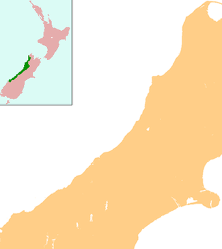
| Country | New Zealand |
| Region | West Coast |
| District | Westland District |
| Electorates | West Coast-Tasman Te Tai Tonga |
| Population (2013) | |
| • Total | 288 |
| Local iwi | Ngāi Tahu |
The population of Whataroa and its surrounding area was 288 in the 2013 census, a decrease of 117 from 2006.[3]
Whataroa is located in an agricultural area where dairying is the primary activity. The town contains establishments such as a school, two churches, and a Māori craft gallery. It is also a staging base for trips to a white heron sanctuary that is the only breeding location of white heron in New Zealand.[4]
Te Taho, a small farming community, is located north of Whataroa on State Highway 6. It once included a maternity hospital and a number of schools.[5]
Attractions
Whataroa hosts the South Westland A&P Show annually in February. Founded in 1951, events include equestrian competitions, dairy cattle judging, dog trials, trade displays and various family entertainment.
The Woodham Shield is an annual rugby competition in which Whataroa and neighboring towns, Franz- Fox- Haast, Hari Hari and Ross, compete against each other for possession of the shield.[6]
History
Whataroa was the site of cattle sales twice a year from 1875, serving farmers from around South Westland.[7] The last mob of cattle was driven to Whataroa in 1961.[8]
A dairy factory was established at Whataroa before World War I.[9]
Education
Whataroa School is a coeducational full primary school (years 1-8), with a decile rating of 7[10] and a roll of 30[11](as at March 2020). The school was established in 1879[12] and celebrated its 125th reunion in 2004.[13]
Hydrothermal activity
Whataroa sits on the Alpine Fault, a seismically active area. In 2017 scientists reported they had discovered beneath Whataroa "extreme" hydrothermal activity which "could be commercially very significant".[14][15]
References
- Peter Dowling (editor) (2004). Reed New Zealand Atlas. Reed Books. map 74. ISBN 978-0-7900-0952-0.CS1 maint: extra text: authors list (link)
- Roger Smith, GeographX (2005). The Geographic Atlas of New Zealand. Robbie Burton. map 173. ISBN 978-1-877333-20-0.
- 2013 Census QuickStats about a place : Whataroa
- "Whataroa - Westland District Council". Archived from the original on October 14, 2008. Retrieved 2008-08-10.
- McCormack, Trish. "Gunn, Mabel Winifred". Te Ara: The Encyclopedia of New Zealand. Ministry for Culture and Heritage.
- Shield stays in Whataroa Archived 2013-11-06 at the Wayback Machine. Greymouth Star
- Rogers, Anna (2005). Illustrated History of the West Coast. Auckland: Reed Books. p. 66. ISBN 978-0-7900-1022-9.
- "Historic Haast to Paringa Cattle Track". Department of Conservation. Retrieved 2008-08-10.
- Rogers, p. 100.
- Education Counts: Whataroa School
- "New Zealand Schools Directory". New Zealand Ministry of Education. Retrieved 26 April 2020.
- "About our school". Whataroa School. Archived from the original on 2011-07-24. Retrieved 2008-08-10.
- "Whataroa District Schools 125th Reunion". Education Gazette New Zealand. 83 (3). 23 February 2004.
- Sutherland, R., Townend, J., Toy, V., Upton, P., Coussens, J., and 61 other (2017) "Extreme hydrothermal conditions at an active plate-bounding fault". Letter to Nature. doi:10.1038/nature22355
- Geothermal discovery on West Coast Otago Daily Times, 18 May 2017.