West Point, California
West Point (formerly, Indian Gulch and Westpoint) is a census-designated place (CDP) in Calaveras County, California, in the United States. At the 2010 census, West Point's population was 674, down from 746 as of the 2000 census. The town is registered as California Historical Landmark #268.[2] There is an annual West Point Lumberjack Days festival in the community. Walton's Mountain Winery & Vineyard is West Point's First Winery that opened in 2006.
West Point | |
|---|---|
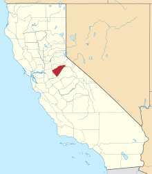
 Location in Calaveras County and the state of California | |
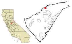
 West Point Location in the United States | |
| Coordinates: 38°23′57″N 120°31′39″W | |
| Country | |
| State | |
| County | Calaveras |
| Area | |
| • Total | 3.719 sq mi (9.632 km2) |
| • Land | 3.719 sq mi (9.632 km2) |
| • Water | 0 sq mi (0 km2) 0% |
| Elevation | 2,769 ft (844 m) |
| Population (2010) | |
| • Total | 674 |
| • Density | 180/sq mi (70/km2) |
| Time zone | UTC-8 (Pacific (PST)) |
| • Summer (DST) | UTC-7 (PDT) |
| ZIP code | 95255 |
| Area code(s) | 209 |
| FIPS code | 06-84732 |
| GNIS feature IDs | 255226, 2409563 |
| Reference no. | 268 |
History
West Point was originally the name of a camp established here by scout Kit Carson, who was searching for a pass over the Sierra Nevada.[3] The town was originally named Indian Gulch when founded in 1852; the name was changed to West Point in 1854.[3] The first post office was opened in 1856, the name changed to Westpoint in 1895 and changed back to West Point in 1947.[3]
One emigrant road forked by Big Meadow — its north branch came directly to West Point, which was a thriving trading post prior to the gold discovery. Author Bret Harte lived there for a time.
Geography
According to the United States Census Bureau, the CDP has a total area of 3.7 square miles (9.6 km2), all land.
Climate
According to the Köppen Climate Classification system, West Point has a warm-summer Mediterranean climate, abbreviated "Csa" on climate maps.[4]
Demographics
2010
At the 2010 census West Point had a population of 674. The population density was 181.2 people per square mile (70.0/km²). The racial makeup of West Point was 563 (83.5%) White, 0 (0.0%) African American, 43 (6.4%) Native American, 2 (0.3%) Asian, 7 (1.0%) Pacific Islander, 29 (4.3%) from other races, and 30 (4.5%) from two or more races. Hispanic or Latino of any race were 67 people (9.9%).[5]
The census reported that 673 people (99.9% of the population) lived in households, 1 (0.1%) lived in non-institutionalized group quarters, and no one was institutionalized.
There were 308 households, 70 (22.7%) had children under the age of 18 living in them, 125 (40.6%) were opposite-sex married couples living together, 39 (12.7%) had a female householder with no husband present, 18 (5.8%) had a male householder with no wife present. There were 18 (5.8%) unmarried opposite-sex partnerships, and 0 (0%) same-sex married couples or partnerships. 109 households (35.4%) were one person and 48 (15.6%) had someone living alone who was 65 or older. The average household size was 2.19. There were 182 families (59.1% of households); the average family size was 2.81.
The age distribution was 133 people (19.7%) under the age of 18, 36 people (5.3%) aged 18 to 24, 119 people (17.7%) aged 25 to 44, 223 people (33.1%) aged 45 to 64, and 163 people (24.2%) who were 65 or older. The median age was 50.0 years. For every 100 females, there were 94.2 males. For every 100 females age 18 and over, there were 93.9 males.
There were 378 housing units at an average density of 101.6 per square mile (39.2/km²),of which 308 were occupied, 213 (69.2%) by the owners and 95 (30.8%) by renters. The homeowner vacancy rate was 2.3%; the rental vacancy rate was 6.9%. 434 people (64.4% of the population) lived in owner-occupied housing units and 239 people (35.5%) lived in rental housing units.
2000
At the 2000 census there were 746 people, 305 households, and 203 families in the CDP. The population density was 199.4 people per square mile (77.0/km²). There were 345 housing units at an average density of 92.2 per square mile (35.6/km²). The racial makeup of the CDP was 82.04% White, 1.21% Black or African American, 8.18% Native American, 0.67% Asian, 2.82% from other races, and 5.09% from two or more races. 8.04% of the population were Hispanic or Latino of any race.[6] Of the 305 households 25.9% had children under the age of 18 living with them, 46.6% were married couples living together, 14.4% had a female householder with no husband present, and 33.4% were non-families. 26.6% of households were one person and 13.1% were one person aged 65 or older. The average household size was 2.43 and the average family size was 2.86.
The age distribution was 24.4% under the age of 18, 5.9% from 18 to 24, 20.0% from 25 to 44, 30.0% from 45 to 64, and 19.7% 65 or older. The median age was 45 years. For every 100 females, there were 84.7 males. For every 100 over, there are 85.5 males.
The median household income was $25,417 and the median family income was $27,794. Males had a median income of $24,028 versus $22,500 for females. The per capita income for the CDP was $11,439. About 28.2% of families and 33.9% of the population were below the poverty line, including 45.3% of those under age 18 and 15.7% of those age 65 or over.
Politics
In the state legislature, West Point is in the 8th Senate District, represented by Republican Andreas Borgeas,[7] and the 5th Assembly District, represented by Republican Frank Bigelow.[8] Federally, West Point is in California's 4th congressional district, represented by Republican Tom McClintock.[9]
References
- "E-1 Current Population Estimates for Cities, Counties, and the State: January 1, 2013 and 2014". California Department of Finance. May 1, 2014. Retrieved September 29, 2014.
- "West Point". Office of Historic Preservation, California State Parks. Retrieved 2012-10-06.
- Durham, David L. (1998). California's Geographic Names: A Gazetteer of Historic and Modern Names of the State. Clovis, Calif.: Word Dancer Press. p. 845. ISBN 1-884995-14-4.
- Climate Summary for West Point, California
- "2010 Census Interactive Population Search: CA - West Point CDP". U.S. Census Bureau. Archived from the original on July 15, 2014. Retrieved July 12, 2014.
- "U.S. Census website". United States Census Bureau. Retrieved 2008-01-31.
- "Senators". State of California. Retrieved March 21, 2013.
- "Members Assembly". State of California. Retrieved March 21, 2013.
- "California's 4th Congressional District - Representatives & District Map". Civic Impulse, LLC. Retrieved March 2, 2013.