Forest Meadows, California
Forest Meadows is a census-designated place (CDP) in Calaveras County, California, United States. The population was 1,249 at the 2010 census, up from 1,197 at the 2000 census.
Forest Meadows | |
|---|---|
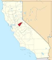
 Location in Calaveras County and the state of California | |
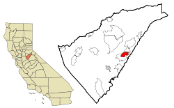
 Forest Meadows Location in the United States | |
| Coordinates: 38°10′05″N 120°24′20″W | |
| Country | |
| State | |
| County | Calaveras |
| Area | |
| • Total | 5.655 sq mi (14.647 km2) |
| • Land | 5.655 sq mi (14.647 km2) |
| • Water | 0 sq mi (0 km2) 0% |
| Elevation | 3,376 ft (1,029 m) |
| Population (2010) | |
| • Total | 1,249 |
| • Density | 220/sq mi (85/km2) |
| Time zone | UTC-8 (Pacific (PST)) |
| • Summer (DST) | UTC-7 (PDT) |
| ZIP code[3] | 95247 |
| Area code(s) | 209 |
| FIPS code | 06-24897 |
| GNIS feature IDs | 1804875, 2408228 |
Geography
According to the United States Census Bureau, the CDP has a total area of 5.7 square miles (15 km2), all of it land.
Demographics
| Historical population | |||
|---|---|---|---|
| Census | Pop. | %± | |
| U.S. Decennial Census[4] | |||
2010
At the 2010 census Forest Meadows had a population of 1,249. The population density was 220.9 people per square mile (85.3/km²). The racial makeup of Forest Meadows was 1,198 (95.9%) White, 0 (0.0%) African American, 4 (0.3%) Native American, 14 (1.1%) Asian, 0 (0.0%) Pacific Islander, 7 (0.6%) from other races, and 26 (2.1%) from two or more races. Hispanic or Latino of any race were 60 people (4.8%).[5]
The whole population lived in households, no one lived in non-institutionalized group quarters and no one was institutionalized.
There were 586 households, 81 (13.8%) had children under the age of 18 living in them, 367 (62.6%) were opposite-sex married couples living together, 39 (6.7%) had a female householder with no husband present, 11 (1.9%) had a male householder with no wife present. There were 23 (3.9%) unmarried opposite-sex partnerships, and 7 (1.2%) same-sex married couples or partnerships. 138 households (23.5%) were one person and 74 (12.6%) had someone living alone who was 65 or older. The average household size was 2.13. There were 417 families (71.2% of households); the average family size was 2.46.
The age distribution was 153 people (12.2%) under the age of 18, 72 people (5.8%) aged 18 to 24, 139 people (11.1%) aged 25 to 44, 466 people (37.3%) aged 45 to 64, and 419 people (33.5%) who were 65 or older. The median age was 58.0 years. For every 100 females, there were 99.5 males. For every 100 females age 18 and over, there were 95.0 males.
There were 845 housing units at an average density of 149.4 per square mile (57.7/km²),of which 586 were occupied, 488 (83.3%) by the owners and 98 (16.7%) by renters. The homeowner vacancy rate was 5.4%; the rental vacancy rate was 7.4%. 1,030 people (82.5% of the population) lived in owner-occupied housing units and 219 people (17.5%) lived in rental housing units.
2000
At the 2000 census there were 1,197 people, 531 households, and 398 families in the CDP. The population density was 211.6 people per square mile (81.7/km²). There were 660 housing units at an average density of 116.7 per square mile (45.0/km²). The racial makeup of the CDP was 95.66% White, 1.75% Native American, 0.67% Asian, 0.25% from other races, and 1.67% from two or more races. 3.59% of the population were Hispanic or Latino of any race.[6] Of the 531 households 21.1% had children under the age of 18 living with them, 68.9% were married couples living together, 4.9% had a female householder with no husband present, and 24.9% were non-families. 21.5% of households were one person and 9.8% were one person aged 65 or older. The average household size was 2.25 and the average family size was 2.58.
The age distribution was 18.1% under the age of 18, 2.8% from 18 to 24, 15.8% from 25 to 44, 36.4% from 45 to 64, and 26.8% 65 or older. The median age was 54 years. For every 100 females, there were 93.1 males. For every 100 females age 18 and over, there were 90.3 males.
The median household income was $51,318 and the median family income was $72,083. Males had a median income of $47,500 versus $31,406 for females. The per capita income for the CDP was $26,929. About 7.0% of families and 7.9% of the population were below the poverty line, including 14.2% of those under age 18 and none of those age 65 or over.
Politics
In the state legislature, Forest Meadows is in the 8th Senate District, represented by Republican Andreas Borgeas,[7] and the 5th Assembly District, represented by Republican Frank Bigelow.[8] Federally, Forest Meadows is in California's 4th congressional district, represented by Republican Tom McClintock.[9]
References
- "2010 Census U.S. Gazetteer Files – Places – California". United States Census Bureau.
- "Forest Meadows". Geographic Names Information System. United States Geological Survey. Retrieved January 8, 2015.
- "Forest Meadows, California Zip Code Boundary Map (CA)". Retrieved April 8, 2015.
- "Census of Population and Housing". Census.gov. Retrieved June 4, 2016.
- "2010 Census Interactive Population Search: CA - Forest Meadows CDP". U.S. Census Bureau. Archived from the original on July 15, 2014. Retrieved July 12, 2014.
- "U.S. Census website". United States Census Bureau. Retrieved 2008-01-31.
- "Senators". State of California. Retrieved March 21, 2013.
- "Members Assembly". State of California. Retrieved March 21, 2013.
- "California's 4th Congressional District - Representatives & District Map". Civic Impulse, LLC. Retrieved March 2, 2013.