West Attica
West Attica (Greek: Δυτική Αττική) is one of the regional units of Greece. It is part of the region of Attica. The regional unit covers the western part of the agglomeration of Athens, and the area to its west.
West Attica Περιφερειακή ενότητα Δυτικής Αττικής | |
|---|---|
 Municipalities of West Attica | |
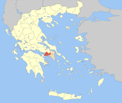 Location of West Attica within Greece | |
| Coordinates: 38°2′N 23°32′E | |
| Country | Greece |
| Region | Attica |
| Area | |
| • Total | 1,004.007 km2 (387.649 sq mi) |
| Population (2011) | |
| • Total | 160,927 |
| • Density | 160/km2 (420/sq mi) |
| Time zone | UTC+2 |
| • Summer (DST) | UTC+3 (EEST) |
| Postal codes | 1xx xx |
| Area codes | 210, 22960 |
| ISO 3166 code | GR-A3 |
| Car plates | ΥΡ |
| Website | www |
Administration
The regional unit West Attica is subdivided into 5 municipalities. These are (number as in the map in the infobox):[1]
- Aspropyrgos (2)
- Eleusis (1)
- Fyli (5)
- Mandra-Eidyllia (3)
- Megara (4)
With respect to parliamentary elections West Attica belongs to the electoral district of Attica.
Prefecture
As a part of the 2011 Kallikratis government reform, the regional unit West Attica was created out of the former prefecture West Attica (Greek: νομαρχία Δυτικής Αττικής). The prefecture had the same territory as the present regional unit. At the same time, the municipalities were reorganised, according to the table below.[1]
| New municipality | Old municipalities | Seat |
|---|---|---|
| Aspropyrgos | Aspropyrgos | Aspropyrgos |
| Eleusis | Eleusis | Eleusis |
| Magoula | ||
| Fyli | Fyli | Ano Liosia |
| Ano Liosia | ||
| Zefyri | ||
| Mandra-Eidyllia | Mandra | Mandra |
| Erythres | ||
| Oinoi | ||
| Vilia | ||
| Megara | Megara | Megara |
| Nea Peramos |
Provinces
There were two provinces in the prefecture of West Attica: Megarida, and the Attica Province (most of which was part of East Attica).[2] They were abolished in 2006.
References
- "Kallikratis reform law text" (PDF).
- "Detailed census results 1991" (PDF). (39 MB) (in Greek and French)
External links
Administrative division of the Attica Region | ||
|---|---|---|
| Regional unit of Central Athens |  | |
| Regional unit of North Athens | ||
| Regional unit of West Athens | ||
| Regional unit of South Athens | ||
| Regional unit of Piraeus | ||
| Regional unit of East Attica | ||
| Regional unit of West Attica | ||
| Regional unit of Islands | ||
| ||