Waihola
The township of Waihola lies between Dunedin and Milton, New Zealand in Otago, in New Zealand's South Island.[4] It lies close to the southeast shore of the shallow tidal lake which shares its name.
Waihola Waihora | |
|---|---|
Town | |
 Main street of Waihola | |
 Waihola Location of Waihola | |
| Coordinates: 46°2′0″S 170°6′0″E | |
| Country | New Zealand |
| Region | Otago |
| District | Clutha |
| Government | |
| • Type | District Council |
| • Body | Clutha District Council[1] |
| • Mayor | Bryan Cadogan |
| • Bruce Ward Councillor (Chair, Corporate Services Committee) | Gaynor Finch |
| • Bruce Ward Councillor | Joanna Lowrey |
| • Bruce Ward Councillor (Chair, Regulatory Services Committee) | Bruce Vollweiler |
| Area | |
| • Total | 1.63 km2 (0.63 sq mi) |
| Population | |
| • Total | 370 |
| • Density | 230/km2 (590/sq mi) |
| PO Box Lobby Postcode (Waihola, Waihola) | 9243 |
| Rural Delivery Postcode (RD 1, Outram) | 9073 |
| International telephone access and area code | 03 |
| ISO 3166 code | 554 |
| Local iwi | Ngāi Tahu |
| [4][5][6] | |
Etymology
The name Waihola is accepted to be analogous with the word wai-hora, meaning "spreading waters". The place name for the location of Waihola is assigned as an official place name by the New Zealand Geographic Board.[7] The place name also creates some interest as the Māori alphabet doesn't normally contain the letter 'L'. This is most likely an example of an earlier Southern Māori dialect.[8]
Location
The town is located on State Highway 1, and the South Island Main Trunk rail line runs through it, though trains no longer stop. The township is within the boundaries of Clutha District.
Tourism
Waihola is a popular destination for day-trips from Dunedin, 35 kilometres to the north, and the lake is a venue for many water sports, including waterskiing, rowing, and yachting.
Wetlands
"The 2175-hectare Waihola Waipori wetland system is one of the largest and most significant remaining lowland wetland systems in New Zealand. It is a diverse and highly productive ecosystem that supports threatened species such as the giant kokopu and the South Island Fernbird. The wetland is of great significance to Kai Tahu and an important recreational hunting and fishing area." (Lake Waihola Waipori Wetlands Society) There are also the Sinclair Wetlands.
Gallery
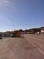 Main road of Waihola looking north
- Houses and a petrol station in Waihola
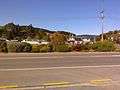 Houses in Waihola
References
- "Councillors". cluthadc.govt.nz. Retrieved 14 June 2016.
- "Population Statistics, Charts, Map, Location, Weather and Web Information". Waihola (Otago, South Island, New Zealand). 30 June 2018. Retrieved 28 June 2020.
- "New Zealand Gazetteer: Search for Place Names | Land Information New Zealand (LINZ)". linz.govt.nz. Retrieved 14 June 2016.
- mao(B)/mri(T) native language
- "New Zealand Post". nzpost.co.nz. Retrieved 14 June 2016.
- "New Zealand Gazetteer". LINZ. Retrieved 28 June 2020.
- Macalister, John (2004). "Listening to Proper Nouns: Social Change and Maori Proper Noun Use in New Zealand English" (PDF). New Zealand English Journal. 18: 28. Retrieved 24 June 2018.
External links
| Wikimedia Commons has media related to Waihola. |