Vyartsilya
Vyartsilya (Russian: Вя́ртсиля; Finnish: Värtsilä) is an urban locality (an urban-type settlement) under the administrative jurisdiction of the town of republic significance of Sortavala in the Republic of Karelia, Russia, located near the border with Finland, 256 kilometers (159 mi) west of Petrozavodsk, the capital of the republic. As of the 2010 Census, its population was 3,080.[2]
Vyartsilya Вяртсиля | |
|---|---|
Urban-type settlement[1] | |
 Coat of arms | |
Location of Vyartsilya 
| |
 Vyartsilya Location of Vyartsilya 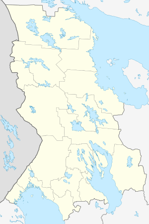 Vyartsilya Vyartsilya (Karelia) | |
| Coordinates: 62°11′N 30°42′E | |
| Country | Russia |
| Federal subject | Republic of Karelia[1] |
| Founded | 1499 |
| Urban-type settlement status since | 1946 |
| Population | |
| • Total | 3,080 |
| • Estimate (2018)[3] | 2,941 (-4.5%) |
| • Subordinated to | town of republic significance of Sortavala[1] |
| • Municipal district | Sortavalsky Municipal District[4] |
| • Urban settlement | Vyartsilskoye Urban Settlement[5] |
| • Capital of | Vyartsilskoye Urban Settlement[5] |
| Time zone | UTC+3 (MSK |
| Postal code(s)[7] | 186757 |
| OKTMO ID | 86610160051 |
| 2010 Census | 3,080[2] |
|---|---|
| 2002 Census | 3,230[8] |
| 1989 Census | 2,915[9] |
| 1979 Census | 2,935[10] |
History
Before World War II, Värtsilä belonged to Finland. Urban-type settlement status was granted to it in 1946.
Administrative and municipal status
Within the framework of administrative divisions, the urban-type settlement of Vyartsilya is subordinated to the town of republic significance of Sortavala.[1] As a municipal division, Vyartsilya is incorporated within Sortavalsky Municipal District[4] as Vyartsilskoye Urban Settlement.[5]
Border crossing
Vyartsilya is a major border checkpoint on the Finnish–Russian border, with about one million people crossing the border annually. It is said that during the Cold War, from time to time, exchanges of captured spies occurred there.
Tourism
An international tourist route, Blue Highway, goes through Vyartsilya. The Blue Highway goes through four countries from Mo i Rana, Norway, via Sweden and Finland to Pudozh in Russia.
References
Notes
- Государственный комитет Российской Федерации по статистике. Комитет Российской Федерации по стандартизации, метрологии и сертификации. №ОК 019-95 1 января 1997 г. «Общероссийский классификатор объектов административно-территориального деления. Код 86 410 560», в ред. изменения №278/2015 от 1 января 2016 г.. (State Statistics Committee of the Russian Federation. Committee of the Russian Federation on Standardization, Metrology, and Certification. #OK 019-95 January 1, 1997 Russian Classification of Objects of Administrative Division (OKATO). Code 86 410 560, as amended by the Amendment #278/2015 of January 1, 2016. ).
- Russian Federal State Statistics Service (2011). "Всероссийская перепись населения 2010 года. Том 1" [2010 All-Russian Population Census, vol. 1]. Всероссийская перепись населения 2010 года [2010 All-Russia Population Census] (in Russian). Federal State Statistics Service.
- "26. Численность постоянного населения Российской Федерации по муниципальным образованиям на 1 января 2018 года". Federal State Statistics Service. Retrieved January 23, 2019.
- Федеральная служба государственной статистики. Федеральное агентство по технологическому регулированию и метрологии. №ОК 033-2013 1 января 2014 г. «Общероссийский классификатор территорий муниципальных образований. Код 86 610». (Federal State Statistics Service. Federal Agency on Technological Regulation and Metrology. #OK 033-2013 January 1, 2014 Russian Classification of Territories of Municipal Formations. Code 86 610. ).
- Law #813-ZRK
- "Об исчислении времени". Официальный интернет-портал правовой информации (in Russian). June 3, 2011. Retrieved January 19, 2019.
- Почта России. Информационно-вычислительный центр ОАСУ РПО. (Russian Post). Поиск объектов почтовой связи (Postal Objects Search) (in Russian)
- Russian Federal State Statistics Service (May 21, 2004). "Численность населения России, субъектов Российской Федерации в составе федеральных округов, районов, городских поселений, сельских населённых пунктов – районных центров и сельских населённых пунктов с населением 3 тысячи и более человек" [Population of Russia, Its Federal Districts, Federal Subjects, Districts, Urban Localities, Rural Localities—Administrative Centers, and Rural Localities with Population of Over 3,000] (XLS). Всероссийская перепись населения 2002 года [All-Russia Population Census of 2002] (in Russian).
- "Всесоюзная перепись населения 1989 г. Численность наличного населения союзных и автономных республик, автономных областей и округов, краёв, областей, районов, городских поселений и сёл-райцентров" [All Union Population Census of 1989: Present Population of Union and Autonomous Republics, Autonomous Oblasts and Okrugs, Krais, Oblasts, Districts, Urban Settlements, and Villages Serving as District Administrative Centers]. Всесоюзная перепись населения 1989 года [All-Union Population Census of 1989] (in Russian). Институт демографии Национального исследовательского университета: Высшая школа экономики [Institute of Demography at the National Research University: Higher School of Economics]. 1989 – via Demoscope Weekly.
- "Всесоюзная перепись населения 1979 г. Национальный состав населения по регионам России" [All Union Population Census of 1979. Ethnic composition of the population by regions of Russia] (XLS). Всесоюзная перепись населения 1979 года [All-Union Population Census of 1979] (in Russian). 1979 – via Demoscope Weekly (website of the Institute of Demographics of the State University—Higher School of Economics.
Sources
- Законодательное Собрание Республики Карелия. Закон №813-ЗРК от 1 ноября 2004 г. «О городских, сельских поселениях в Республике Карелия», в ред. Закона №1694-ЗРK от 2 апреля 2013 г. «О преобразовании муниципальных образований "Нюхчинское сельское поселение" и "Сумпосадское сельское поселение" Беломорского муниципального района и внесении изменений в некоторые законодательные акты Республики Карелия». Вступил в силу по истечении десяти дней со дня официального опубликования. Опубликован: газета "Карелия", №124, 126, 129, 132, 135, 136, 139, 4 ноября — 9 декабря 2004 г. (Legislative Assembly of the Republic of Karelia. Law #813-ZRK of November 1, 2004 On the Urban, Rural Settlements in the Republic of Karelia, as amended by the Law #1694-ZRK of April 2, 2013 On the Transformation of the Municipal Formations of "Nyukhchinskoye Rural Settlement" and "Sumposadskoye Rural Settlement" of Belomorsky Municipal District of the Republic of Karelia and on Amending Various Legislative Acts of the Republic of Karelia. Effective as of the day which is ten days after the day of the official publication.).
| Administrative districts | ||
|---|---|---|
| Cities and towns | ||
| Urban-type settlements | ||