Victoria Park Avenue
Victoria Park Avenue is a major north-south route in eastern Toronto, Ontario, Canada. It is the western border of Scarborough, separating it from Old Toronto, East York, and North York. The common nickname for it is VP or Vic Park.
| Victoria Park Avenue | |
|---|---|
 Victoria Park Avenue within Toronto | |
| Route information | |
| Maintained by City of Toronto government, York Region | |
| Major junctions | |
| South end | Queen Street East |
| |
| North end | Denison St |
| Highway system | |
Roads in Toronto
| |
History

Victoria Park Avenue was originally a pioneer road for settlement of Scarborough. Except for its very southernmost section (south of Bracken Avenue), the road once formed the boundary for the former township, borough, and city of Scarborough with the former municipalities of East York, North York, and the former city of Toronto.
Route description
Victoria Park Avenue begins as a two-lane residential street near Lake Ontario at Queen Street at the east end of The Beaches community. It takes a sharp jog west just before Bracken Avenue, and then continues in a straight line northward.
It is still a two-lane residential street from Bracken Avenue north to Gerrard Street, albeit one with a heavy traffic load; at Gerrard Street it becomes a four-lane major arterial road. It reduces to two lanes again from a point north of Danforth Avenue to Dawes Road, then resumes its role as a four-lane arterial road for the rest of its length. North of Dawes it shifts from being a residential street to being a suburban arterial, with mostly stores and low rise apartment buildings along the rest of its length.
Victoria Park Avenue ends a short distance north of Steeles Avenue at Denison Street in Markham, Ontario.
Transportation
Victoria Park remains one of the busiest north-south streets on Toronto's east side, along with Markham Road and Kennedy Road. It is served by the Toronto subway at Victoria Park station. Historically the first bus to service the street were private routes that operated along Dawes Road, and then north along Victoria Park. This route was taken over by the TTC in 1954, and offered service as far north as Victoria Park and Lawrence.[1] The opening of Victoria Park subway station in 1968 led to the creation of the 24 Victoria Park, replacing the Dawes Road bus on Victoria Park. It first ran to Victoria Park and Old Sheppard Avenue, but has steadily been extended northwards. Also beginning in 1968, the portion of Victoria Park south of the subway station began to be served by the 12 Kingston Road bus. This bus travels south until Kingston Road and then turns east into Scarborough. It stops at the Bingham Loop to meet up with the termini of the 502 Downtowner and 503 Kingston Rd.[2]
Landmarks
| Landmark | Cross street | Notes | Image |
|---|---|---|---|
| R. C. Harris Water Treatment Plant | Queen St |  | |
| Neil McNeil Catholic Secondary School | Bracken Ave |  | |
| Shoppers World Danforth | Danforth Ave | Former auto plant |  |
| Victoria Park subway station | Denton Ave |  | |
| Dentonia Park | Denton Ave | Also has a golf course |  |
| Eglinton Square Shopping Centre | Eglinton Ave |  | |
| Church of St. Jude (Wexford) | Sloane Ave | 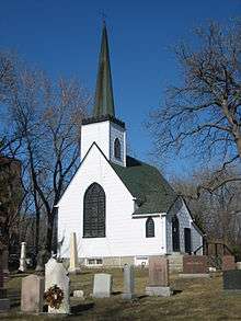 | |
| Senator O'Connor College School | Rowena Dr |  | |
| Victoria Park Collegiate Institute | Cassandra Blvd |  | |
| Annunciation of the Blessed Virgin Mary Roman Catholic Church | Combermere Dr |  | |
| Parkway Mall | Ellesmere Rd | 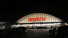 | |
| St. Andrew Anglican Church | Terraview Blvd | 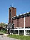 | |
| Johnny's Charcoal Broiled Hamburgers | Sheppard Ave | 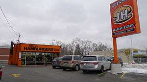 |
See also
External links
References
- Peter Coulman "23 Dawes" Transit Toronto.
- Peter Coulman "12 Kingston Road" Transit Toronto.
Major roads, highways and streets in Toronto | |||||||||
|---|---|---|---|---|---|---|---|---|---|
| North–south |
| ||||||||
| East–west |
| ||||||||
| |||||||||
| |||||||||
| East-West Municipal Roads: |
| Road signs in Markham |
|---|---|---|
| North-South Municipal Roads: | ||
| Regional Roads: |
| |
| Highways and Expressways: | ||
| See also |
| |