Kingston Road (Toronto)
Kingston Road is the southernmost major road along the eastern portion of Toronto, specifically in the district of Scarborough. Until 1998, it formed a portion of Highway 2. The name of the street is derived from Kingston, Ontario as the road was the primary route used to travel from Toronto to the settlements east of it situated along the shores of Lake Ontario; in the west end of Kingston, the road was referred to as the York Road (referring to Toronto) until at least 1908, and is today named Princess Street.
| |
|---|---|
| Durham Regional Highway 2 | |
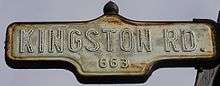
 Kingston Rd. within Toronto | |
| Route information | |
| Maintained by City of Toronto government Region of Durham | |
| Length | 36.3 km[1] (22.6 mi) |
| Major junctions | |
| West end | Queen Street (Continues as Eastern Avenue. |
| Woodbine Avenue Danforth Avenue St. Clair Avenue Markham Road Eglinton Avenue Lawrence Avenue Morningside Avenue Highway 2A Sheppard Avenue/Port Union Road | |
| East end | |
| Location | |
| Major cities | Toronto Pickering |
| Towns | Ajax |
| Highway system | |
| Roads in Ontario | |
Due to its diagonal course near the shore of Lake Ontario, the street is the terminus of many arterial roads in eastern Toronto, both east-west and north-south, with a few continuing for a short distance after as minor residential streets. However Lawrence Avenue continues as a major arterial for a considerable distance beyond it.
Because the road no longer bears the name "Kingston Road" anywhere east of the Toronto area, the street has been dramatically shortened from its original length. This is in contrast to other long-distance historic "streets" such as Dundas Street, which runs from Toronto to London and still carries that name in the latter city and in many points in between.
History
American engineer Asa Danforth Jr. was contracted to build a road as a route to connect Toronto (then called York) with the mouth of the Trent River in 1799 at a cost of $90.00 per mile. The road, known as The Scarborough Front Road, was completed by December 18, 1800, but was poorly maintained thereafter. In 1815 the Kingston Road was surveyed and it followed the line, in many cases, of the former road laid out by Asa Danforth as far as the Trent River. Beyond that point, the two historic roads diverge. The Kingston Road was completed in 1817, serving as a post road for stagecoaches delivering mail on a rigid schedule.
Route description

The Toronto section runs from Queen Street East, as a continuation of Eastern Avenue, just west of Woodbine Avenue (route to Lake Shore Boulevard, the westerly continuation of former Highway 2), through Scarborough to Toronto's eastern city limits with Durham Region, where it continues into Pickering and Ajax (as Durham Regional Highway 2), and officially ends where its name changes to Dundas Street in Whitby, at Lake Ridge Road (Durham Regional Road 23), just west of Highway 412.
A small portion of road parallel to Kingston Road is called Old Kingston Road running near the Highland Creek, east of Morningside Avenue. There is a discontinuity and a large reduction in capacity as the road reverts to the original route at an interchange with Military Trail, where traffic is defaulted onto Highway 2A, which was constructed in 1947 as a precursor to Highway 401, and later became a spur when that highway was extended westwards along a more northerly alignment. To facilitate traffic to and from Highway 401, and to preserve the historic village of West Hill, the spur was retained and Kingston Road was never widened and reconnected as a through street, despite having six lanes on either side of West Hill.[2] Other former, parallel sections also called Old Kingston Road, exist in Ajax and Courtice, although Kingston Road proper does not reach Courtice today. There is also an old section of the old Danforth Road in Grafton.
The southwestern-most section in the Beaches area is a traditional urban street with storefronts, high pedestrian traffic, and streetcars. The speed limit in that section is 50 km/h (31 mph).
Until Highway 401 was constructed, Kingston Road was the principal route from Toronto to points east. Accordingly, it became the site of numerous inns and motels, many of which still dot the road, particularly in Scarborough. Now some of these inns are being demolished to make way for townhouse developments. Kingston Road is a six-lane principal arterial road through most of Scarborough, narrowing to four lanes in Durham, with a 60 km/h (37 mph) speed limit for the most part.
Public Transit
Kingston Road Tramway
From 1875 to 1887 Kingston Road Tramway ran horsecars from Don Rver (Don Bridge - now Old Eastern Avenue Bridge) to Main Street (moved further east to Blantyre Avenue in 1878 to serve Scarboro Heights Hotel[3]).[4] The single track route had three major stops (Don Bridge, Woodbine, Ben Lamond Hotel at Main Street and Scarboro Heights Hotel at Blantyre Avenue) running 12 times daily and 13 on Saturday in summer. The route ceased operation in 1887.
Streetcar
In Toronto, the street is served by the Toronto Transit Commission (TTC), which operates a streetcar service (with one running only 503 Kingston Rd) route during weekday daytime and streetcars being replaced by buses during evenings, weekends and holidays) west of Victoria Park Avenue and three bus routes further east in Scarborough. In Durham, Kingston Road is served by Durham Region Transit's (DRT) Pulse bus rapid transit and GO Transit, which both operate routes, originating in Toronto, with duplicate routing (although routing and termini are separate within Toronto) along it.
The regular routes (showing branches with maximum coverage) primarily serving the street are:
Toronto (TTC):
| Route | Direction and Termini | ||||
|---|---|---|---|---|---|
503 |
Kingston Rd[5] | WB | To Spadina Avenue via King Street |
EB | To Victoria Park Avenue (Bingham Loop) |
12+ |
Kingston Rd[6] | WB | To Victoria Park Subway Station via Victoria Park Avenue |
EB | To U of T Scarborough (D branch) |
102+ |
Markham Rd[7] | WB | To Warden Subway Station via St. Clair Avenue |
EB | To (All branches serve Kingston Rd. as far east as Markham Road before turning off) |
86+ |
Scarborough[8] | WB | To Kennedy Subway/RT Station via Eglinton Avenue |
EB | To (Branches A,C, and E serve Kingston Rd. as far east as Meadowvale Road before turning off) |
Durham Region (DRT) and GO Transit:
| Route | Direction and Termini | ||||
|---|---|---|---|---|---|
900 |
Highway 2[9] | WB | To University of Toronto Scarborough Campus via Ellesmere Road |
EB | To Mary Street in Oshawa via Dundas and King/Bond Streets |
| Route | Direction and Termini | ||||
|---|---|---|---|---|---|
92+ |
Yorkdale/Oshawa[10] | WB | To Yorkdale Bus Terminal (main route) Finch Bus Terminal (A branch) via Highway 401 |
EB | To Oshawa Bus Terminal via Dundas and King/Bond Streets (main route) |
See also
References
- "Kingston Road route". Google Maps. Retrieved March 27, 2017.
- Brown p. 105
- https://static.torontopubliclibrary.ca/da/images/LC/1879-scarboro-sb.jpg
- http://www.beachesliving.ca/pages/index.php?act=landmark&id=130
- "TTC Description of 503 Kingston Rd". Toronto Transit Commission. Retrieved 23 June 2020.
- "TTC Description of 12 Kingston Rd". Toronto Transit Commission. Retrieved 10 January 2016.
- "TTC Description of 102 Markham Rd". Toronto Transit Commission. Retrieved 16 January 2016.
- "TTC Description of 86 Scarborough". Toronto Transit Commission. Retrieved 10 January 2016.
- "DRT Pulse Map" (PDF). Durham Region Transit. Region of Durham. Archived from the original (PDF) on 23 September 2015. Retrieved 15 June 2015.
- Yorkdale/Oshawa GO Bus Map
- Bibliography
- Brown, Ron (1997). Toronto's Lost Villages. Polar Bear Press. ISBN 1-896757-02-2.
Major roads, highways and streets in Toronto | |||||||||
|---|---|---|---|---|---|---|---|---|---|
| North–south |
| ||||||||
| East–west |
| ||||||||
| |||||||||
| |||||||||