Vanderkloof Dam
The Vanderkloof Dam (originally the P. K. Le Roux Dam) is situated approximately 130 km (81 mi) downstream from Gariep Dam and is fed by the Orange River, South Africa's largest river. Vanderkloof Dam is the second-largest dam in South Africa (in volume), having the highest dam wall in the country at 108 metres (354 ft). The dam was commissioned in 1977; it has a capacity of 3,187.557 million cubic metres (2,584,195 acre⋅ft) and a surface area of 133.43 square kilometres (51.52 sq mi) when full. Other rivers flowing into this dam are the Berg River, two unnamed streams coming in from the direction of Reebokrand, the Knapsak River, Paaiskloofspruit, Seekoei River, Kattegatspruit and the Hondeblaf River, in a clockwise direction.
| Vanderkloof Dam | |
|---|---|
 An aerial view of Vanderkloof Dam. | |
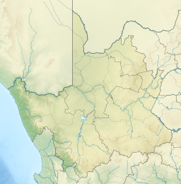 Location of Vanderkloof Dam in Northern Cape 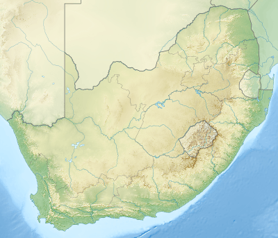 Vanderkloof Dam (South Africa) | |
| Official name | Vanderkloof Dam |
| Country | South Africa |
| Location | Between Northern Cape and Free State |
| Coordinates | 29.99222°S 24.73167°E |
| Construction began | 1973 |
| Opening date | 1977 |
| Owner(s) | Department of Water Affairs |
| Dam and spillways | |
| Type of dam | Arch dam |
| Impounds | Orange River |
| Height | 108 m (354 ft)[1] |
| Length | 756 m (2,480 ft)[2] |
| Reservoir | |
| Creates | Vanderkloof Dam Reservoir |
| Total capacity | 3,236 million cubic metres (114.3×10⁹ cu ft)[2] |
| Surface area | 133.402 km2 (51.507 sq mi) |
| Power Station | |
| Operator(s) | Eskom |
| Turbines | 2 |
| Installed capacity | 240 MW (320,000 hp) 360 MW (480,000 hp) (max) |
| Annual generation | 932 GWh (3,360 TJ)[3] |
See also
- List of reservoirs and dams in South Africa
References
- "Vanderkloof Dam". Retrieved 2009-05-27.
- "Vanderkloof Dam". Department of Water Affairs and Forestry (South Africa). Retrieved 2009-05-27.
- Eskom website
External links
| Wikimedia Commons has media related to Vanderkloof Dam. |
- Vanderkloof Dam
- Vanderkloof Power Station on the Eskom-Website
Power in South Africa | |||||
|---|---|---|---|---|---|
| Sectors | |||||
| Companies and organisations |
| ||||
| Active power stations | |||||
| Decommissioned power stations |
| ||||
| Other | |||||
| |||||
This article is issued from Wikipedia. The text is licensed under Creative Commons - Attribution - Sharealike. Additional terms may apply for the media files.