Gariep Dam
Gariep Dam located in South Africa, near the town of Norvalspont, bordering the Free State and Eastern Cape provinces. Its primary purpose is for irrigation, domestic and industrial use as well as for power generation.
| Gariep Dam | |
|---|---|
 Gariep Dam | |
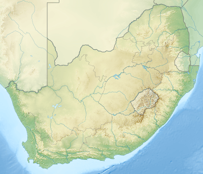 Location of Gariep Dam in South Africa | |
| Official name | Gariep Dam |
| Location | Border of Eastern Cape and Free State, South Africa |
| Coordinates | 30°37′25.43″S 25°30′23.81″E |
| Construction began | 1965 |
| Opening date | 1971 |
| Owner(s) | Department of Water Affairs |
| Dam and spillways | |
| Type of dam | Arch-gravity dam |
| Impounds | Orange River |
| Height | 88 m (289 ft) |
| Length | 914 m (2,999 ft) |
| Reservoir | |
| Creates | Gariep Dam Reservoir |
| Total capacity | 5,340,000 megalitres (5,340 hm3)[1] |
| Surface area | 374 km2 (144 sq mi) |
| Power Station | |
| Operator(s) | Eskom |
| Turbines | 4 x 90 MW (120,000 hp) |
| Installed capacity | 360 MW (480,000 hp) (max) |
| Annual generation | 889 GWh (3,200 TJ)[2] |
Name
The Gariep Dam, on its commission in 1971, was originally named the Hendrik Verwoerd Dam after Hendrik Verwoerd, the Prime Minister before and after 31 May 1961, when the country changed from the Union of South Africa to the Republic of South Africa. However, after the end of apartheid, the Verwoerd name was considered unsuitable. The name was officially changed to Gariep Dam on 4 October 1996. Gariep is Khoekhoe for "river", the original name of the Orange River.[3]
Location
The dam is on the Orange River about 48 kilometres (30 mi) north-east of Colesberg and 208 kilometres (129 mi) south of Bloemfontein. It is in a gorge at the entrance to the Ruigte Valley some 5 kilometres (3.1 mi) east of Norvalspont. The dam crest is some 1300m (4250ft) above sea level.
Dimensions
The wall is 88 m high and has a crest length of 914 m and contains approximately 1.73 million m³ of concrete. The Gariep Dam is the largest storage reservoir in South Africa. In South African English, 'dam' refers both to the structure and the water volume it retains. Gariep Dam has a total storage capacity of approximately 5,340,000 megalitres (5,340 hm3) and a surface area of more than 370 square kilometres (140 sq mi) when full. The hydro-electrical power station houses four 90 MW generators, giving a maximum output of 360 MW of electricity at a water flow rate of 800 m³/s.
Design type and contractors
The structure is a concrete gravity-arch hybrid dam. This design was chosen as the gorge is too wide for a complete arch so flanking walls form gravity abutments to the central arch.
It was built by Dumez, a French construction company.
Gariep Dam Bridge
Gariep Dam bridge | |
|---|---|
| Coordinates | 30°37′22″S 25°30′23″E |
| Carries | 14300 tons |
| Characteristics | |
| Width | Doubleway |
| Statistics | |
| Toll | None |

| |
Rivers and spruits flowing into the dam
Orange-Fish River Project
At Oviston, on the south bank of the reservoir, is the inlet of the Orange-Fish River Tunnel, allowing water to be diverted to the Great Fish River and most of the Eastern Cape's western parts.
Gallery
 Gariep Dam overflowing in January 2011
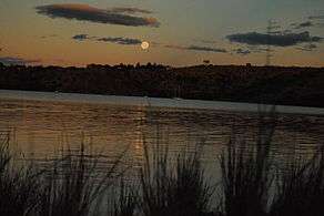 Sunset at Oviston Nature Reserve on the dam's southern shores
.JPG) Road sign heading for the dam wall
Road sign heading for the dam wall.JPG) View over the lake
View over the lake.JPG) Forever Holiday Resort at Gariep Dam
Forever Holiday Resort at Gariep Dam
References
- "State of Dams in Provinces as on 20080901". Department of Water Affairs and Forestry. Archived from the original on 2008-04-21. Retrieved 2008-09-07.
- Eskom website
- "Dictionary of Southern African Place Names (Public Domain)". Human Science Research Council. p. 171.
- Dept of Water Affairs website
External links
- Gariep Hydroelectric Power Station on the Eskom-Website

Places adjacent to Gariep Dam | ||||||||||
|---|---|---|---|---|---|---|---|---|---|---|
| ||||||||||
Power in South Africa | |||||
|---|---|---|---|---|---|
| Sectors | |||||
| Companies and organisations |
| ||||
| Active power stations | |||||
| Decommissioned power stations |
| ||||
| Other | |||||
| |||||