Usellus
Usellus (Sardinian: Usèddus; Latin: Uselis or Usellis[3]) is a town, comune (municipality) and former bishopric in the Province of Oristano in the Italian region Sardinia.
Usellus Usèddus | |
|---|---|
| Comune di Usellus | |
 Coat of arms | |
Location of Usellus 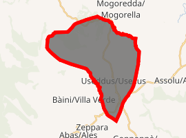
| |
 Usellus Location of Usellus in Sardinia 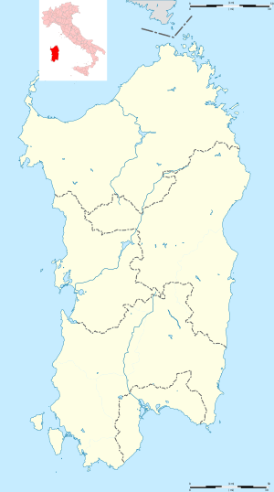 Usellus Usellus (Sardinia) | |
| Coordinates: 39°48′N 8°51′E | |
| Country | Italy |
| Region | Sardinia |
| Province | Oristano (OR) |
| Frazioni | Escovedu |
| Government | |
| • Mayor | Felice Atzori |
| Area | |
| • Total | 35.10 km2 (13.55 sq mi) |
| Elevation | 289 m (948 ft) |
| Population (31 December 2016)[2] | |
| • Total | 773 |
| • Density | 22/km2 (57/sq mi) |
| Demonym(s) | Usellesi Useddesus |
| Time zone | UTC+1 (CET) |
| • Summer (DST) | UTC+2 (CEST) |
| Postal code | 09090 |
| Dialing code | 0783 |
| Website | Official website |
Usellus borders the following comuni: Albagiara, Ales, Gonnosnò, Mogorella, Villa Verde, Villaurbana.
History
Usellus is in the interior of Sardinia, about 25 kilometres (16 mi) from the Gulf of Oristano on the west coast, and the same distance south of Forum Trajani (modern Fordongianus). Its name is not found in the Itineraries, and the only ancient author who mentions it is Ptolemy, with the name Οὔσελλις,[4] who erroneously places it on the west coast of the island: but the existing ruins, together with the continuity of the name, leave no doubt of its true situation. It is about 5 kilometres (3 mi) northeast of the modern town of Ales.
Ptolemy styles it a colonia, and this is confirmed by an inscription on a bronze tablet of AD 158 (a tabula patronatus, setting forth that M. Aristius Balbinus had accepted the position of patron of the town for himself and his heirs) that speaks of the place as Colonia Julia Augusta Uselis. It would hence appear probable that the colony must have been founded under Augustus, though Pliny[5] asserts that Turris Libisonis (modern Porto Torres) was the only colony in Sardinia at his time (79 CE, hence after Augustus' reign)[6] It may be that civic rights were obtained from Augustus.[7][8]
Main sights
References
- "Superficie di Comuni Province e Regioni italiane al 9 ottobre 2011". Istat. Retrieved 16 March 2019.
- All demographics and other statistics: Italian statistical institute Istat.
- Richard Talbert, Barrington Atlas of the Greek and Roman World, (ISBN 0-691-03169-X), Map 48.
- Ptolemy, iii. 3. § 2
- Pliny the Elder, H.N. iii.85
- De la Marmora, Voy. en Sardaigne, vol. ii. pp. 367, 466.
- Mommsen, Corp. Inscr. Lat. x. p. 816
-

- "IterrCost - Church of Santa Reparata". Retrieved April 2014. Check date values in:
|accessdate=(help)
External links
| Wikimedia Commons has media related to Usellus. |
- GCatholic - Diocese with incumbent bio links