United Shire of Beechworth
The United Shire of Beechworth was a local government area located about 270 kilometres (168 mi) northeast of Melbourne, the state capital of Victoria, Australia. The shire covered an area of 771.57 square kilometres (297.9 sq mi), and existed from 1856 until 1994.
| United Shire of Beechworth Victoria | |||||||||||||||
|---|---|---|---|---|---|---|---|---|---|---|---|---|---|---|---|
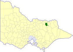 Location in Victoria | |||||||||||||||
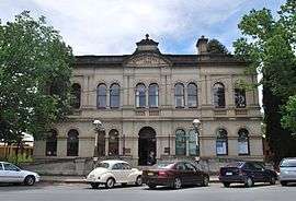 Shire Hall | |||||||||||||||
| Population | 5,210 (1992)[1] | ||||||||||||||
| • Density | 6.752/km2 (17.489/sq mi) | ||||||||||||||
| Established | 1856 | ||||||||||||||
| Area | 771.57 km2 (297.9 sq mi) | ||||||||||||||
| Council seat | Beechworth | ||||||||||||||
| County | Bogong | ||||||||||||||
| |||||||||||||||
History
Beechworth originated as two separate entities; the Borough of Beechworth, first created as a municipal district on 23 August 1856, becoming a borough on 11 September 1863, and the Shire of Beechworth, created on 27 December 1865 as a union of the Stanley (10 December 1862) and Wooragee (30 March 1863) Road Districts. The two entities merged on 29 December 1871, to form the United Shire of Beechworth. At dissolution, it was the only United Shire of its kind remaining in Victoria.[2]
On 18 November 1994, the United Shire of Beechworth was abolished, and, along with parts of the Shires of Chiltern, Rutherglen and Yackandandah, was merged into the newly created Shire of Indigo. The area around Mudgegonga, in the southeast of the former United Shire, was transferred to the newly created Alpine Shire.[3]
Wards
The United Shire of Beechworth was divided into four ridings, each of which elected three councillors:
- East Central Riding
- West Central Riding
- North Riding
- South Riding
Towns and localities
Population
| Year | Population |
|---|---|
| 1954 | 4,417 |
| 1958 | 4,580* |
| 1961 | 4,845 |
| 1966 | 4,804 |
| 1971 | 4,506 |
| 1976 | 4,618 |
| 1981 | 4,673 |
| 1986 | 4,883 |
| 1991 | 4,966 |
* Estimate in the 1958 Victorian Year Book.
References
- Australian Bureau of Statistics, Victoria Office (1994). Victorian Year Book. pp. 49–52. ISSN 0067-1223.
- Victorian Municipal Directory. Brunswick: Arnall & Jackson. 1992. pp. 595–596. Accessed at State Library of Victoria, La Trobe Reading Room.
- Australian Bureau of Statistics (1 August 1995). Victorian local government amalgamations 1994-1995: Changes to the Australian Standard Geographical Classification (PDF). Commonwealth of Australia. p. 4,8,9. ISBN 0-642-23117-6. Retrieved 5 January 2008.