Shire of Kerang
The Shire of Kerang was a local government area located in northwestern Victoria, Australia, along the Murray River. The shire covered an area of 3,254.45 square kilometres (1,256.6 sq mi), and existed from 1862 until 1995. From 1966 onwards, Kerang itself was managed by a separate entity; the Borough of Kerang.
| Shire of Kerang Victoria | |||||||||||||||
|---|---|---|---|---|---|---|---|---|---|---|---|---|---|---|---|
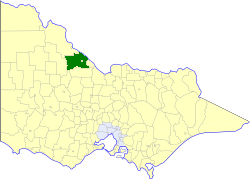 Location in Victoria | |||||||||||||||
| Population | 4,380 (1992)[1] | ||||||||||||||
| • Density | 1.3458/km2 (3.486/sq mi) | ||||||||||||||
| Established | 1862 | ||||||||||||||
| Area | 3,254.45 km2 (1,256.6 sq mi) | ||||||||||||||
| Council seat | Kerang | ||||||||||||||
| County | Gunbower, Tatchera | ||||||||||||||
_Council_1994.jpg) | |||||||||||||||
| |||||||||||||||
History
The Swan Hill Road District, which initially covered most of northwestern Victoria, was incorporated on 8 July 1862, and became a shire on 14 August 1871. The Shire of Gordon was severed and incorporated on 26 May 1885, from parts of the East and West Loddon Ridings, with the Shire of Mildura following suit on 10 January 1890, from the Lower Murray Riding. The Shire of Castle Donnington was severed on 30 May 1893, from the remainder of those three ridings. The remainder of the shire was renamed the Shire of Kerang on 31 December 1898.[2]
On 8 March 1922, parts of the North East and South East Ridings severed and was incorporated as the Shire of Cohuna, while the area around Kerang itself was incorporated as the Borough of Kerang on 1 April 1966. On 5 July 1977, the Shire of Gordon annexed parts of the South West Riding.
On 20 January 1995, the Shire of Kerang was abolished, and, along with the Borough of Kerang, and the Shire of Cohuna, was merged into the newly created Shire of Gannawarra. The Tresco township was transferred to the newly created Rural City of Swan Hill.[3]
Wards
The Shire of Kerang was divided into three ridings on 1 April 1990, each of which elected three councillors:
- Central Riding
- East Riding
- West Riding
Towns and localities
Population
| Year | Population |
|---|---|
| 1954 | 8,483 |
| 1958 | 9,020* |
| 1961 | 9,095 |
| 1966 | 5,261 |
| 1971 | 4,930 |
| 1976 | 4,447 |
| 1981 | 4,366 |
| 1986 | 4,316 |
| 1991 | 4,222 |
* Estimate in the 1958 Victorian Year Book.
References
- Australian Bureau of Statistics, Victoria Office (1994). Victorian Year Book. pp. 49–52. ISSN 0067-1223.
- Victorian Municipal Directory. Brunswick: Arnall & Jackson. 1992. pp. 718–720. Accessed at State Library of Victoria, La Trobe Reading Room.
- Australian Bureau of Statistics (1 August 1995). Victorian local government amalgamations 1994-1995: Changes to the Australian Standard Geographical Classification (PDF). Commonwealth of Australia. p. 6,11. ISBN 0-642-23117-6. Retrieved 5 January 2008.