Shire of Dundas (Victoria)
The Shire of Dundas was a local government area about 300 kilometres (186 mi) west of Melbourne, the state capital of Victoria, Australia. The shire covered an area of 3,464.39 square kilometres (1,337.6 sq mi), and existed from 1857 until 1994.
| Shire of Dundas Victoria | |||||||||||||||
|---|---|---|---|---|---|---|---|---|---|---|---|---|---|---|---|
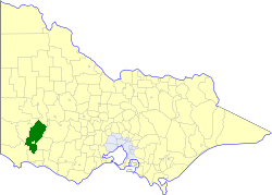 Location in Victoria | |||||||||||||||
| Population | 3,500 (1992)[1] | ||||||||||||||
| • Density | 1.010/km2 (2.62/sq mi) | ||||||||||||||
| Established | 1857 | ||||||||||||||
| Area | 3,464.39 km2 (1,337.6 sq mi) | ||||||||||||||
| Council seat | Hamilton | ||||||||||||||
| County | Dundas, Normanby, Villiers | ||||||||||||||
| |||||||||||||||
History
Dundas was first incorporated as a road district on 4 August 1857, and became a shire on 8 December 1863.[2]
On 23 September 1994, the Shire of Dundas was abolished, and, along with the City of Hamilton, the Shire of Wannon, and parts of the Shire of Mount Rouse, was merged into the newly created Shire of Southern Grampians. The Macarthur hinterland area was transferred into the newly created Shire of Moyne, administered from Port Fairy.[3]
Wards
The Shire of Dundas was divided into three ridings, each of which elected three councillors:
- South Riding
- East Riding
- West Riding
Towns and localities
|
|
Population
| Year | Population |
|---|---|
| 1954 | 3,903 |
| 1958 | 4,100* |
| 1961 | 4,072 |
| 1966 | 3,913 |
| 1971 | 3,667 |
| 1976 | 3,420 |
| 1981 | 3,478 |
| 1986 | 3,469 |
| 1991 | 3,402 |
* Estimate in the 1958 Victorian Year Book.
References
- Australian Bureau of Statistics, Victoria Office (1994). Victorian Year Book. pp. 49–52. ISSN 0067-1223.
- Victorian Municipal Directory. Brunswick: Arnall & Jackson. 1992. pp. 659–660. Accessed at State Library of Victoria, La Trobe Reading Room.
- Australian Bureau of Statistics (1 August 1995). Victorian local government amalgamations 1994-1995: Changes to the Australian Standard Geographical Classification (PDF). Commonwealth of Australia. p. 10,11. ISBN 0-642-23117-6. Retrieved 5 January 2008.