Umiat, Alaska
Umiat (OO-mee-yat) is an unincorporated community in North Slope Borough, Alaska, United States.[1] It is located on the Colville River, 140 miles southwest of Deadhorse in the Arctic Circle. The town is not accessible by road or rail, only by air or river. In 1944, the Naval Oil Reserve was set up and it later became an air force base, which is now closed. It is known as one of the coldest places in the US with its inland tundra climate, a rarity for North America. Yearly low temperatures run even colder than Utqiagvik, Alaska on average.
Umiat | |
|---|---|
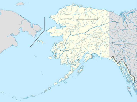 Umiat Location within the state of Alaska | |
| Coordinates: 69°22′01″N 152°08′39″W | |
| Country | United States |
| State | Alaska |
| Borough | North Slope |
| Government | |
| • Borough mayor | Harry K. Brower, Jr. |
| • State senator | Donny Olson (D) |
| • State rep. | Dean Westlake (D) |
| Elevation | 259 ft (79 m) |
| Time zone | UTC-9 (Alaska (AKST)) |
| • Summer (DST) | UTC-8 (AKDT) |
| FIPS code[1] | 02-80250 |
| GNIS ID[1] | 1411508 |
In 2009 Governor Parnell budgeted for a proposed road to Umiat branching off of the Dalton Highway.[2]
Umiat has become a center in the summer for research by the BLM and USGS concerning climate change. Research also goes on in the impact that development has on the Arctic tundra. As the NPRA is managed by BLM, they watch the impact that the ice roads and ice-drilling pads have on plant and animal life in the area.
Umiat has no permanent residents, being a camp and fuel stop for aircraft and helicopters operating in the area. The camp is run by a locally owned company that provides oilfield services in the area, their crew consists in the summer of approximately 10 people who work on a two weeks on two weeks off schedule. At any given time, there are between 20 and 30 people lodged and fed there.
The camp operates from the middle of May to the middle of September. The camp has access to the internet, news and entertainment by satellite.
Accommodations are "ATCO" units that are permanently placed, a cafeteria style kitchen is in one of the units.
Climate
Umiat has a subarctic climate with long winters. February is the coldest month, a common trait on the North Slope, and average temperatures remain below 0°F until mid-April. Severe cold can persist well into spring; on April 5, 1995, the temperature fell to −50°F. Precipitation is irregular and snow has occurred in every month but July.
| Climate data for Umiat | |||||||||||||
|---|---|---|---|---|---|---|---|---|---|---|---|---|---|
| Month | Jan | Feb | Mar | Apr | May | Jun | Jul | Aug | Sep | Oct | Nov | Dec | Year |
| Record high °F (°C) | 37 (3) |
37 (3) |
40 (4) |
51 (11) |
73 (23) |
88 (31) |
92 (33) |
90 (32) |
75 (24) |
52 (11) |
43 (6) |
37 (3) |
92 (33) |
| Average high °F (°C) | −13 (−25) |
−14 (−26) |
−7 (−22) |
11 (−12) |
32 (0) |
58 (14) |
66 (19) |
58 (14) |
41 (5) |
18 (−8) |
−1 (−18) |
−12 (−24) |
20 (−7) |
| Average low °F (°C) | −29 (−34) |
−31 (−35) |
−27 (−33) |
−11 (−24) |
16 (−9) |
37 (3) |
43 (6) |
37 (3) |
26 (−3) |
2 (−17) |
−17 (−27) |
−28 (−33) |
2 (−17) |
| Record low °F (°C) | −62 (−52) |
−66 (−54) |
−63 (−53) |
−50 (−46) |
−22 (−30) |
9 (−13) |
24 (−4) |
5 (−15) |
4 (−16) |
−38 (−39) |
−56 (−49) |
−58 (−50) |
−66 (−54) |
| Average precipitation inches (mm) | 0.38 (9.7) |
0.26 (6.6) |
0.16 (4.1) |
0.21 (5.3) |
0.07 (1.8) |
0.68 (17) |
0.79 (20) |
1.06 (27) |
0.47 (12) |
0.68 (17) |
0.38 (9.7) |
0.33 (8.4) |
5.46 (139) |
| Average snowfall inches (cm) | 4.5 (11) |
2.4 (6.1) |
2.3 (5.8) |
1.9 (4.8) |
1.2 (3.0) |
0.2 (0.51) |
0 (0) |
0.2 (0.51) |
2.6 (6.6) |
8.5 (22) |
5.2 (13) |
4.2 (11) |
33.2 (84) |
| Source: [3] | |||||||||||||
Transportation
Umiat Airport is a state owned, public use airport located in Umiat.[4]
References
- "Feature Detail Report for: Umiat (populated place)". Geographic Names Information System. United States Geological Survey. March 31, 1981.
- "Foothills West Transportation Access Project", State of Alaska, Retrieved June 19, 2010
- {{cite web |url=https://wrcc.dri.edu/cgi-bin/cliMAIN.pl?ak9539
- FAA Airport Master Record for UMT (Form 5010 PDF). Federal Aviation Administration. Effective November 15, 2012.
- "Umiat, Alaska 99790". Prudhoe Bay.com.
- "Umiat Air Field: Current Conditions". Colville-Watershed.org. GWScientific, LLC. EEInternet, LLC. February 6, 2008. Archived from the original on February 6, 2008.
Municipalities and communities of North Slope Borough, Alaska, United States | ||
|---|---|---|
Borough seat: Utqiagvik | ||
| Cities | 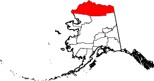 North Slope Borough map | |
| CDPs | ||
| Unincorporated communities | ||
| Ghost towns | ||
| Authority control |
|
|---|