Uitgeest
Uitgeest [œy̯tˈxeːst] (![]()
Uitgeest | |
|---|---|
 Windmill Tweede Broekermolen in Uitgeest | |
 Flag  Coat of arms | |
.svg.png) Location in North Holland | |
| Coordinates: 52°32′N 4°43′E | |
| Country | Netherlands |
| Province | North Holland |
| Government | |
| • Body | Municipal council |
| • Mayor | Wendy Verkleij-Eimers (VVD) |
| Area | |
| • Total | 22.29 km2 (8.61 sq mi) |
| • Land | 19.19 km2 (7.41 sq mi) |
| • Water | 3.10 km2 (1.20 sq mi) |
| Elevation | 1 m (3 ft) |
| Population (January 2019)[4] | |
| • Total | 13,528 |
| • Density | 705/km2 (1,830/sq mi) |
| Time zone | UTC+1 (CET) |
| • Summer (DST) | UTC+2 (CEST) |
| Postcode | 1910–1911 |
| Area code | 0251 |
| Website | www |

Population centres
The municipality of Uitgeest consists of the following cities, towns, villages and/or districts:
- Assum
- Busch en Dam
- Groot Dorregeest
- Uitgeest
Topography
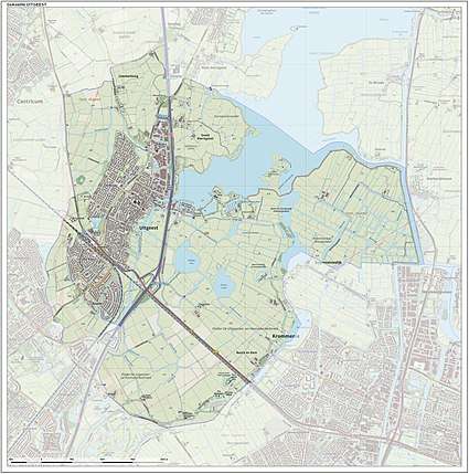
Dutch topographic map of the municipality of Uitgeest, June 2015
Local government
The municipal council of Uitgeest consists of 15 seats, which are divided as follows:
Tourist information
No less than five windmills can be seen in the polder landscape surrounding the village. Uitgeest was the birthplace (in 1550) of Cornelis Corneliszoon, inventor of the wind-powered sawmill. An industrial heritage park, centered on sawmill De Hoop,[5] is under construction.
The village has a Reformed church dating back to the early 14th Century and lakeside marina. The outdoor kart-racing track of 670m had to make room for development of houses, so one tourist attraction has been lost. Fort along Den Ham (between Uitgeest and Krommenie) was one of the 42 forts of the Stelling van Amsterdam, a 19th-century ring of fortifications around Amsterdam which has been designated as a UNESCO World Heritage Site. The fort is now a museum open to the public on Sundays.
Transportation
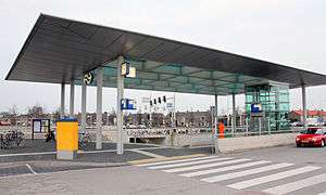
- Railway station: Uitgeest
Uitgeest is served by 4 trains per hour (Monday - Saturday), journey time to Amsterdam is around 20 minutes. It is recommended not to travel on the Stoptrein via Beverwijk and Haarlem as this journey is slower, and the journey via Zaandam passes through beautiful countryside.
- Highway
Uitgeest is very close to the highways N8/A8 and A9. This will take you to Amsterdam in around 15 minutes. Recently (December 2010) the A9 highway has been improved by adding two lanes ('spitsstroken'), improving the traffic to and from the Amsterdam region.
Notable residents

- Cornelis Corneliszoon van Uitgeest (ca.1550-ca.1600) a Dutch windmill owner who invented the wind-powered sawmill
- Willem Blaeu (1571–1638) a Dutch cartographer, atlas maker and publisher
- Hessel Gerritsz (ca.1581–1632) a Dutch engraver, cartographer and publisher
- Jaap Knol (1896–1975) a Dutch javelin thrower, competed at the 1928 Summer Olympics
- Peter Smit (born 1952) children's writer
- Niels Kokmeijer (born 1977) a former Dutch footballer with almost 100 club caps, now manager of the Netherlands national beach soccer team
- Thijs Sluijter (born 1980) a retired Dutch footballer with over 300 club caps
Gallery
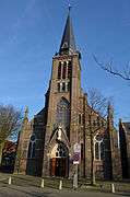 Neo-Gothische kruiskerk, Uitgeest
 Uitgeesterweg, De Bisschop Stolpboerderij
 Artsenwoning, Middelweg, Uitgeest
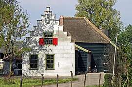 Provincialeweg 3 Het Kooghuis Boerderij
 Uitgeest - panoramio
References
- "Burgemeester & Wethouders" [Mayor and aldermen] (in Dutch). Gemeente Uitgeest. Retrieved 22 March 2014.
- "Kerncijfers wijken en buurten" [Key figures for neighbourhoods]. CBS Statline (in Dutch). CBS. 2 July 2013. Retrieved 12 March 2014.
- "Postcodetool for 1911EG". Actueel Hoogtebestand Nederland (in Dutch). Het Waterschapshuis. Retrieved 22 March 2014.
- "Bevolkingsontwikkeling; regio per maand" [Population growth; regions per month]. CBS Statline (in Dutch). CBS. 1 January 2019. Retrieved 1 January 2019.
- www.dehoopuitgeest.nl
External links

- Official website

| Authority control |
|
|---|