Transport in Suriname
The Republic of Suriname (Dutch: Republiek Suriname) has a number of forms of transport. Transportation emissions are an increasing part of Suriname's contributions to climate change, as part of the Nationally Determined Contributions for the Paris Agreement, Suriname has committed to emissions controls for vehicles and increased public transit investment.[1]

Railways
- Railways, total: 166 km single track.[2]
- standard gauge: 80 km 1,435 mm (4 ft 8 1⁄2 in) gauge in West-Suriname, but not in use. This stretch was constructed as part of the West Suriname Plan.
- narrow gauge: 86 km 1,000 mm (3 ft 3 3⁄8 in) gauge Lawa Railway from Onverwacht to Sarakreek,[3] currently not in use. In 2014, a plan had been announced to reopen the line between Onverwacht and Paramaribo Central Station. The intention was for the line to be extended onto Paramaribo Adolf Pengel Airport,[4] but as of May 2020, the project has not started.
Rail links with adjacent countries
- None
Highways
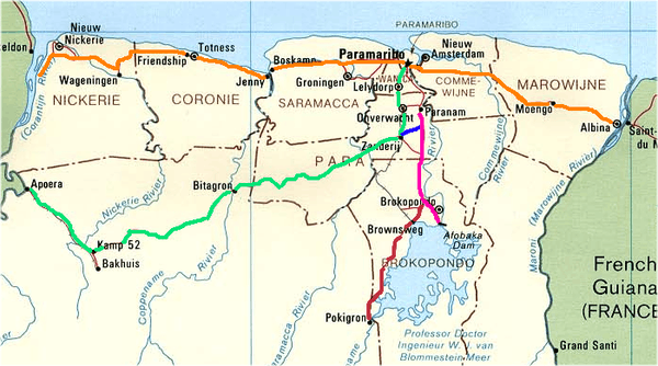
East-West Link
|
Southern East-West Link
|
Desiré Delano Bouterse Highway
|
Afobakaweg
|
Road to Pokigron
|
Afobakaweg
The Afobakaweg is a paved 2-lane road connecting Paranam with Afobaka, the location of the Afobaka Dam. The road connects northwards to Paramaribo and the East-West Link.[5] The Afobakaweg has two major branches: One paved branch leads to Brokopondo,[6] and another paved[7] branch leads to Pokigron via Brownsweg.[8] A further extension of the Pokigron branch to Brazil via Vier Gebroeders is as of May 2020 still in the planning phase.[9]
Desiré Delano Bouterse Highway
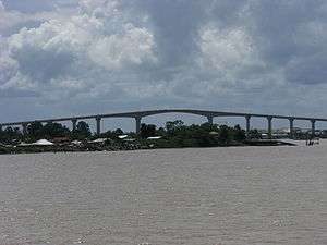
On 15 May 2020, the Desiré Delano Bouterse Highway opened, and is the first motorway of Suriname, providing a faster connection between Paramaribo and the Johan Adolf Pengel International Airport.[10][11]
East-West Link
A major road is the 2-lane East-West Link connecting Albina to Nieuw Nickerie. The road was fully paved on 17 December 2009.[12]. There is a Southern East-West Link connecting Paramaribo with Apoera via Bitagron, however it is mainly unpaved.[13]
Statistics
- total: 4,304 km (2003)[14]
- paved: 1,130 km (2003)[14]
- highway: 9.6 km (2020)[15]
- unpaved: 3,174 km (2003)[14]
NOTE: Driving is on the left.[16] Suriname and its neighbour Guyana are the only two countries on the (in-land) American continent which still drive on the left.
Road links with adjacent countries

Waterways
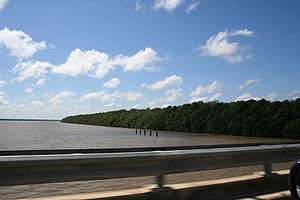
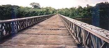
1,200 km; most important means of transport; oceangoing vessels with drafts ranging up to 7 m can navigate many of the principal waterways.[2]
Ports and harbours
- Albina
- Moengo
- Nieuw-Nickerie
- Paramaribo
- Paranam
- Wageningen
Merchant marine
- total: 10 ships.[18]
- ships by type: (2018)
- cargo ship 5
- petroleum tanker 3
- other 2
Airports
- 55 (2013)[2]
- List of airports in Suriname
Paved runways
- total: 6[19]
- over 3,047 m: 1
- under 914 m: 5 (2013)
Unpaved runways
- total: 49[20]
- 914 to 1,523 m: 4
- under 914 m: 45 (2013)
See also
References
- "Suriname's climate promise, for a sustainable future". UN News. 2020-01-31. Retrieved 2020-06-07.
- "Suriname Transport". Nation Master. Retrieved 13 May 2020.
- "De Vraagbaak. Almanak voor Suriname 1913". Digital Library for Dutch Literature (in Dutch). 1912. Retrieved 13 May 2020.
- "Suriname railway plan announced". Railway Gazette. Railway Gazette Group. 7 November 2014. Retrieved 13 May 2020..
- "REGIONAAL PLAN BROKOPONDO" (PDF). Planning Office Suriname (in Dutch). Retrieved 13 May 2020.
- "Omgeving Brownsberg". Vakantie Arena (in Dutch). Retrieved 13 May 2020.
- "Suriname ontvangt geld van China om financiering project". Indian Feelings (in Dutch). Retrieved 14 May 2020.
- "District Brokopondo". Suriname.nu. Retrieved 13 May 2020.
- "Een weg komt nooit alleen" (PDF). University of Amsterdam (in Dutch). Retrieved 13 May 2020.
- "OFFICIELE OPENING HIGHWAY ZANDERIJ-AFOBAKAWEG OP 15 MEI". United News.sr (in Dutch). Retrieved 12 May 2020.
- "Ingebruikname Nieuwe Highway straks een feit". De Boodschap.today. Retrieved 15 May 2020.
- "Weg South Drain na 29 maanden klaar". De Ware Tijd via Nickerie.net (in Dutch). Retrieved 13 May 2020.
- "De natuurlijke omgeving van de zuidelijke Oost-west verbinding". Planning Office Suriname (in Dutch). Retrieved 13 May 2020.
- "CIA Factbook 2003". Central Intelligence Agency". Retrieved 13 May 2020.
- "Werkzaamheden nieuwe Highway vorderen". De Boodschap (Official Press Office of the Government of Suriname) (in Dutch). Retrieved 12 May 2020.
- "Links of Rechts?". De West via Delpher (in Dutch). 4 January 1910. Retrieved 13 May 2020.
- "Transport". Ministry of Transport, Communication and Tourism (in Dutch). Retrieved 4 May 2020.
- "Suriname Merchant Marine". Index Mundi. Retrieved 13 May 2020.
- "Suriname Airports with paved runways". Index Mundi. Retrieved 13 May 2020.
- "Suriname Airports - with unpaved runways". Index Mundi. Retrieved 13 May 2020.
External links
![]()
Transport in the Americas | ||
|---|---|---|
| ||
| Sovereign states |
| .svg.png) |
| ||
| History |  | ||||
|---|---|---|---|---|---|
| Geography |
| ||||
| Politics |
| ||||
| Economy |
| ||||
| Society |
| ||||