Toguéré Coumbé
Toguéré Coumbé is a village and commune of the Cercle of Ténenkou in the Mopti Region of Mali. The commune contains 32 villages[3] and in 2009 had a population of 27,057.[2]
Toguéré Coumbé | |
|---|---|
Commune and village | |
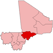
 Toguéré Coumbé Location in Mali | |
| Coordinates: 14°55′5″N 4°35′36″W | |
| Country | |
| Region | Mopti Region |
| Cercle | Ténenkou Cercle |
| Area | |
| • Total | 1,448 km2 (559 sq mi) |
| Population (2009 census)[2] | |
| • Total | 27,057 |
| • Density | 19/km2 (48/sq mi) |
| Time zone | UTC+0 (GMT) |
The village is 75 km northeast of Ténenkou and 80 km northwest of Mopti, near the right bank of the Diaka Channel, a distributary of the Niger River that only fills when the Niger is in flood. The commune occupies part of the Inner Niger Delta and from July to December much of the commune is under water and many villages are only accessible by boat.
The market that is held in the village on Saturdays serves many settlements in the surrounding region.[4]
References
- Plan de Sécurité Alimentaire Commune Rurale de Toguéré Combé 2006-2010 (PDF) (in French), Commissariat à la Sécurité Alimentaire, République du Mali, USAID-Mali, 2006, archived from the original (PDF) on 2012-09-13.
- Resultats Provisoires RGPH 2009 (Région de Mopti) (PDF) (in French), République de Mali: Institut National de la Statistique.
- Communes de la Région de Mopti (PDF) (in French), Ministère de l’administration territoriale et des collectivités locales, République du Mali, archived from the original (PDF) on 2012-09-19.
- Quensière, Jacques, ed. (1994), La pêche dans le delta central du Niger: approche pluridisciplinaire d'un système de production halieutique (PDF) (in French), Paris: ORSTOM, Karthala, p. 539 Carte VI, ISBN 2709912023.
This article is issued from Wikipedia. The text is licensed under Creative Commons - Attribution - Sharealike. Additional terms may apply for the media files.