Togoro Kotia
Togoro Kotia is a commune of the Cercle of Ténenkou in the Mopti Region of Mali. The principal village lies at Sossobé. The commune contains 13 villages and in 2009 had a population of 13,687.
Togoro Kotia | |
|---|---|
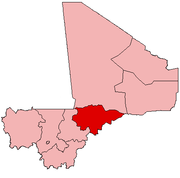
 Togoro Kotia Location in Mali | |
| Coordinates: 14°33′39″N 4°40′29″W | |
| Country | |
| Region | Mopti Region |
| Cercle | Ténenkou Cercle |
| Area | |
| • Total | 1,000 km2 (400 sq mi) |
| Population (2009 census)[2] | |
| • Total | 13,687 |
| • Density | 14/km2 (35/sq mi) |
| Time zone | UTC+0 (GMT) |
The commune lies in the Inner Niger Delta and each year between July and December the area is flooded. During this period most villages can only be accessed by boat.
References
- Plan de Sécurité Alimentaire Commune Rurale de Togoro-Kotia 2006-2010 (PDF) (in French), Commissariat à la Sécurité Alimentaire, République du Mali, USAID-Mali, 2006, archived from the original (PDF) on 2012-09-15.
- Resultats Provisoires RGPH 2009 (Région de Mopti) (PDF) (in French), République de Mali: Institut National de la Statistique.
This article is issued from Wikipedia. The text is licensed under Creative Commons - Attribution - Sharealike. Additional terms may apply for the media files.