Dougoutene II
Dougoutene II is a rural commune of the Cercle of Koro in the Mopti Region of Mali. The commune contains 20 villages[4] and in the 2009 census had a population of 20,115. The commune is administered from Andiagana-Na.
Dougoutene II | |
|---|---|
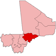
 Dougoutene II Location in Mali | |
| Coordinates: 13°56′3″N 2°59′50″W[1] | |
| Country | |
| Region | Mopti Region |
| Cercle | Koro Cercle |
| Area | |
| • Total | 265 km2 (102 sq mi) |
| Population (2009 census)[3] | |
| • Total | 20,115 |
| • Density | 76/km2 (200/sq mi) |
| Time zone | UTC+0 (GMT) |
References
- Common and Fundamental Operational Datasets Registry: Mali, United Nations Office for the Coordination of Humanitarian Affairs, archived from the original on 2012-01-06. See cheflieu_mali.zip
- Common and Fundamental Operational Datasets Registry: Mali, United Nations Office for the Coordination of Humanitarian Affairs, archived from the original on 2012-01-06. commune_mali.zip (Originally from the Direction Nationale des Collectivités Territoriales, République du Mali)
- Resultats Provisoires RGPH 2009 (Région de Mopti) (PDF) (in French), République de Mali: Institut National de la Statistique, archived from the original (PDF) on 2012-09-19.
- Communes de la Région de Mopti (PDF) (in French), Ministère de l’administration territoriale et des collectivités locales, République du Mali, archived from the original (PDF) on 2012-09-19.
External links
- Plan de Sécurité Alimentaire Commune Rurale de Dougoutenen II 2007-2011 (PDF) (in French), Commissariat à la Sécurité Alimentaire, République du Mali, USAID-Mali, 2006, archived from the original (PDF) on 2012-09-20, retrieved 2012-05-12.
This article is issued from Wikipedia. The text is licensed under Creative Commons - Attribution - Sharealike. Additional terms may apply for the media files.