Tintic School District
Tintic School District is a school district located in western Juab County, Utah, United States.[2]
| Tintic School District | |
|---|---|
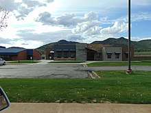 The school district office building in Eureka, May 2016 | |
| Address | |
| 545 East Main Street PO Box 210[1](p120)[2] , Utah, 84628 United States | |
| District information | |
| Type | Public |
| Grades | PK to 12 |
| Established | 1914[3] |
| Superintendent | Kodey Hughes[4][1](p120) |
| Governing agency | Utah Department of Education |
| Schools |
|
| NCES District ID | 4901020[5] |
| Students and staff | |
| Students | 228[1](p120) |
| Teachers | 18[1](p120) |
| Other information | |
| Schedule | M-F except state holidays |
| Website | www |
Description
The district serves the western part of Juab County, while the Juab School District serves the very eastern portion (along the Interstate 15 corridor). In addition to the residents of the more than 2,100 square miles (5,400 km2) of western Juab County, the district also serves several out of state students (from White Pine County, Nevada).[1](pp120–21) [Note 1] The district is the second smallest of the 41 school districts within the state.[1](pp56–133)
History
The Tintic School District was established in 1914 when the existing school districts in Eureka, Knightsville, Mammoth, Silver City, and the West Desert (the area near the Nevada border on the far west end of the county, including communities of Callao, Partoun, and Trout Creek) were consolidated. It originally served the children of the many mining workers of the Tintic Mining District, but as the mining industry in the area declined, so has the number of students.[3]
Communities served
The Tintic School District serves the following communities:[2]
Schools

The following are schools within the Tintic School District:[1](pp68–69)
Elementary schools
- Eureka Elementary School - Eureka
- West Desert Elementary School - Trout Creek
High schools
- Tintic High School - Eureka
- West Desert High School - Trout Creek
Notes
- The main population areas served by the district are the West Desert area (the area near the Nevada border on the far west end of the county, including communities of Callao, Partoun, and Trout Creek) and the Eureka area (the U.S. Route 6 corridor near the eastern end of the county). Even though the driving distance between the two areas is considerable (136 miles [219 km]), accessibility between the two areas is substantially greater since 50 miles (80 km) of the normal travel route is on gravel road.[3] Occasionally, due to weather conditions, the only reasonably access to the western area is by way of Wendover, Utah, a 248 miles (399 km) drive.[6]
References
- "Utah's 2015-16 Educational Directory". schools.utah.gov. Utah State Office of Education. 2015. Archived from the original (PDF) on 18 February 2017. Retrieved 25 Mar 2018 – via Wayback Machine.
- "Tintic School District". tintic.org. Tintic School District. Retrieved 7 Sep 2016.
- "Welcome to the Tintic School District's Website". tintic.org. Tintic School District. Retrieved 25 Mar 2018.
- "District Office". tintic.org. Tintic School District. Retrieved 25 Mar 2018.
- "Search for Public School Districts – District Detail for Tintic District". National Center for Education Statistics. Institute of Education Sciences. Retrieved 7 Sep 2016.
- Google (25 Mar 2018). "Untitled map showing the driving route between the West Desert High School and the district offices, via Wendover" (Map). Google Maps. Google. Retrieved 25 Mar 2018.