Tiaong
Tiaong, officially the Municipality of Tiaong, (Tagalog: Bayan ng Tiaong), is a 1st class municipality in the province of Quezon, Philippines. According to the 2015 census, it has a population of 99,712 people.[3]
Tiaong | |
|---|---|
| Municipality of Tiaong | |
     Quezon-Laguna Boundary Arch, Saint John the Baptist Parish Church, Municipal Hall, Claro M. Recto Memorial Shrine, Villa Escudero | |
 Seal | |
Nickname(s):
| |
 Map of Quezon with Tiaong highlighted | |
| |
.svg.png) Tiaong Location within the Philippines | |
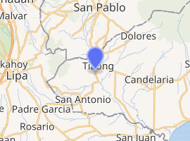
| Coordinates: 13°57′N 121°19′E | |
| Country | |
| Region | Calabarzon (Region IV-A) |
| Province | Quezon |
| District | 2nd District |
| Founded | May 12, 1691 |
| Barangays | 31 (see Barangays) |
| Government | |
| • Type | Sangguniang Bayan |
| • Mayor | Ramon A. Preza |
| • Vice Mayor | William A. Razon |
| • Congressman | David C. Suarez |
| • Electorate | 57,355 voters (2019) |
| Area | |
| • Total | 168.38 km2 (65.01 sq mi) |
| Elevation | 55.0 m (180.4 ft) |
| Population (2015 census)[3] | |
| • Total | 99,712 |
| • Density | 590/km2 (1,500/sq mi) |
| • Households | 22,287 |
| Economy | |
| • Income class | 1st municipal income class |
| • Poverty incidence | 8.59% (2015)[4] |
| • Revenue (₱) | 199,834,328.54 (2016) |
| Time zone | UTC+8 (PST) |
| ZIP code | 4325 |
| PSGC | |
| IDD : area code | +63 (0)42 |
| Climate type | tropical rainforest climate |
| Native languages | Tagalog |
| Website | tiaongquezon |
It lies in the deep coconut region of Quezon, some 96 kilometres (60 mi) southeast of Manila.
Barangays
Tiaong is politically subdivided into 31 barangays.
- Anastacia
- Aquino
- Ayusan I
- Ayusan II
- Behia
- Bukal
- Bula
- Bulakin
- Cabatang
- Cabay
- Del Rosario
- Lagalag
- Lalig
- Lumingon
- Lusacan
- Paiisa
- Palagaran
- Poblacion I
- Poblacion II
- Poblacion III
- Poblacion IV
- Quipot
- San Agustin
- San Isidro
- San Jose
- San Juan
- San Pedro
- Tagbakin
- Talisay
- Tamisian
- San Francisco
Demographics
| Population census of Tiaong | ||
|---|---|---|
| Year | Pop. | ±% p.a. |
| 1903 | 9,527 | — |
| 1918 | 14,211 | +2.70% |
| 1939 | 27,179 | +3.14% |
| 1948 | 26,454 | −0.30% |
| 1960 | 26,084 | −0.12% |
| 1970 | 38,725 | +4.03% |
| 1975 | 43,245 | +2.24% |
| 1980 | 48,606 | +2.36% |
| 1990 | 60,662 | +2.24% |
| 1995 | 67,403 | +1.99% |
| 2000 | 75,498 | +2.46% |
| 2007 | 87,707 | +2.09% |
| 2010 | 91,599 | +1.59% |
| 2015 | 99,712 | +1.63% |
| Source: Philippine Statistics Authority[3][5][6][7] | ||
Climate
| Climate data for Tiaong, Quezon | |||||||||||||
|---|---|---|---|---|---|---|---|---|---|---|---|---|---|
| Month | Jan | Feb | Mar | Apr | May | Jun | Jul | Aug | Sep | Oct | Nov | Dec | Year |
| Average high °C (°F) | 27 (81) |
28 (82) |
30 (86) |
32 (90) |
31 (88) |
30 (86) |
29 (84) |
29 (84) |
29 (84) |
29 (84) |
28 (82) |
27 (81) |
29 (84) |
| Average low °C (°F) | 20 (68) |
20 (68) |
21 (70) |
22 (72) |
24 (75) |
24 (75) |
24 (75) |
24 (75) |
24 (75) |
23 (73) |
22 (72) |
21 (70) |
22 (72) |
| Average precipitation mm (inches) | 52 (2.0) |
35 (1.4) |
27 (1.1) |
27 (1.1) |
82 (3.2) |
124 (4.9) |
163 (6.4) |
144 (5.7) |
145 (5.7) |
141 (5.6) |
100 (3.9) |
102 (4.0) |
1,142 (45) |
| Average rainy days | 12.0 | 8.1 | 8.8 | 9.7 | 17.9 | 22.6 | 26.2 | 24.5 | 24.6 | 22.0 | 16.7 | 14.9 | 208 |
| Source: Meteoblue [8] | |||||||||||||
History
In 1957, the following barrios were created:
Local government
Elected officials 2019-2022:
- Mayor: Ramon Preza
- Vice Mayor: William Razon
- Councilors:
- Maria Maja Escueta Landicho
- Tom Ilao
- JP Preza
- Jessa Preza
- Gemson Boongaling
- Eugene Lopez
- Odek Convento
- Rec Baldeo
Landmarks
Education

Tiaong Elementary School

Saint John Parochial School
Elementary Level:
- Private school
- Kiddie Corner School Inc.
- Saint John Parochial School
- Gaudete Study Center Inc
- Tiaong Christian Academy
- Maranatha Christian Academy
- Public School
- Lusacan Central Elementary School
- Del Rosario Elementary School
- Lagalag Elementary School
- Hilirang Buli Elementary School
- Tiaong East Elementary School
- Claro M. Recto Memorial Central School
High Schools:
- Private School
- St. John Parochial School
- Don Ysidro Memorial School
- Gaudete Study Center Inc.
- Public High School
- Recto Memorial National High School
- Recto Memorial National High School Annex
- Lusacan National High School
- Cabay National High School
- Gloria Umali National High School
- Paiisa National High School
- Talisay National High School
College Level:
- Public Schools
- College
- SLSU
- Private Schools:
- Asian Institute of Technology and Education
Image gallery
 Boundary Arch of Quezon
 Saint John the Baptist Parish Church of Tiaong
 Town hall
 Moises Amat Escueta Ala-ala Park
 Tiaong Lying-In Hospital
References
- "Municipality". Quezon City, Philippines: Department of the Interior and Local Government. Retrieved 31 May 2013.
- "Province: Quezon". PSGC Interactive. Quezon City, Philippines: Philippine Statistics Authority. Retrieved 12 November 2016.
- Census of Population (2015). "Region IV-A (Calabarzon)". Total Population by Province, City, Municipality and Barangay. PSA. Retrieved 20 June 2016.
- "PSA releases the 2015 Municipal and City Level Poverty Estimates". Quezon City, Philippines. Retrieved 1 January 2020.
- Census of Population and Housing (2010). "Region IV-A (Calabarzon)". Total Population by Province, City, Municipality and Barangay. NSO. Retrieved 29 June 2016.
- Censuses of Population (1903–2007). "Region IV-A (Calabarzon)". Table 1. Population Enumerated in Various Censuses by Province/Highly Urbanized City: 1903 to 2007. NSO.
- "Province of Quezon". Municipality Population Data. Local Water Utilities Administration Research Division. Retrieved 17 December 2016.
- "Tiaong: Average Temperatures and Rainfall". Meteoblue. Retrieved 27 January 2020.
- "An Act Creating the Barrio of Matipunso in the Municipality of Tiaong, Province of Quezon". LawPH.com. Retrieved 2011-04-12.
- "An Act Creating the Barrio of Behia in the Municipality of Tiaong, Province of Quezon". LawPH.com. Retrieved 2011-04-12.
- "An Act Creating the Barrio of Bucal in the Municipality of Tiaong, Province of Quezon". LawPH.com. Retrieved 2011-04-12.
External links
| Wikimedia Commons has media related to Tiaong, Quezon. |
- Tiaong Profile at PhilAtlas.com
- Philippine Standard Geographic Code
- Philippine Census Information
- Local Governance Performance Management System
- Quezon Province Business Directory and Travel Guide
Places adjacent to Tiaong | |
|---|---|
Lucena (capital) | |
| Municipalities |
|
| Component city | |
| Highly urbanized city |
|
| Authority control |
|---|
This article is issued from Wikipedia. The text is licensed under Creative Commons - Attribution - Sharealike. Additional terms may apply for the media files.