Thanyaburi District
Thanyaburi (Thai: ธัญบุรี, pronounced [tʰān.já(ʔ).bū.rīː]) is a district (amphoe) in Pathum Thani Province.
Thanyaburi ธัญบุรี | |
|---|---|
.jpg) Tambon Rangsit, Thanyaburi District (in front of Thanyaburi Hospital). | |
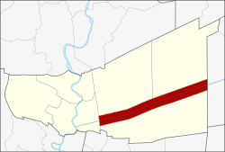 District location in Pathum Thani Province | |
| Coordinates: 14°1′16″N 100°44′4″E | |
| Country | Thailand |
| Province | Pathum Thani |
| Seat | Rangsit |
| Area | |
| • Total | 112.124 km2 (43.291 sq mi) |
| Population (2017) | |
| • Total | 206,582 |
| • Density | 1,842.44/km2 (4,771.9/sq mi) |
| Time zone | UTC+7 (ICT) |
| Postal code | 12110 |
| Geocode | 1303 |
History
Mueang Thanyaburi was built by order of King Rama V in 1901. The city name translates to 'rice city'. At the same time, King Rama V ordered Min Buri (มีนบุรี, 'fish city') to be built as its twin. The province was abolished and incorporated into Pathum Thani in 1932.[1]
The district's name was changed from Mueang to Rangsit in 1917.[2] In 1938 it was renamed "Thanyaburi".[3]
Geography
Mueang Thanyaburi is in the eastern part of the Chao Phraya valley that is called Thung Luang. It is easily accessible from Bangkok via the Eastern Outer Ring Road (9) or from Rangsit centre on Highway 305 (Rangsit-Nakhon Nayok)
The main water resource of Thanyaburi is Khlong Rangsit. It was the first canal (Khlong) for irrigation purposes of Siam.
Neighboring districts are (from the north clockwise): Khlong Luang and Nong Suea of Pathum Thani; Ongkharak of Nakhon Nayok Province; Lam Luk Ka and Mueang Pathum Thani of Pathum Thani Province.
Economy
Thanyaburi District is the site of the Government Pharmaceutical Organization's "second factory". This facility, among other pursuits, houses the firm's medical marijuana farm and production line for cannabinoid medicines.[4][5]
Administration
The district is divided into six sub-districts (tambons), which are further subdivided into 12 villages (mubans). There is one city (thesaban nakhon), two towns (thesaban mueangs), and one sub-district municipality (thesaban tambon) in the district. Rangsit city covers tambon Prachathipat. Sanan Rak town covers tambons Bueng Sanan and Bueng Nam Rak and the town Bueng Yitho covers tambon Bueng Yitho. The subdistrict municipality Thanyaburi covers tambons Rangsit and Lam Phak Kut.
| No. | Name | Thai | Villages | Pop.[6] |
|---|---|---|---|---|
| 1. | Prachathipat | ประชาธิปัตย์ | - | 82,483 |
| 2. | Bueng Yitho | บึงยี่โถ | 4 | 31,891 |
| 3. | Rangsit | รังสิต | 4 | 24,735 |
| 4. | Lam Phak Kut | ลำผักกูด | 4 | 37,185 |
| 5. | Bueng Sanan | บึงสนั่น | - | 12,260 |
| 6. | Bueng Nam Rak | บึงน้ำรักษ์ | - | 18,028 |
Notable people
- Saen Sor Ploenchit – former WBA Flyweight World Champion
- Sirimongkol Singwangcha – former WBC Bantamweight and Super-featherweight World Champion
References
- พระบรมราชโองการ ประกาศ ยุบรวมท้องที่บางมณฑลและบางจังหวัด (PDF). Royal Gazette (in Thai). 48 (0 ก): 576–578. 1932-02-21.
- ประกาศกระทรวงมหาดไทย เรื่อง เปลี่ยนชื่ออำเภอ (PDF). Royal Gazette (in Thai). 34 (0 ก): 40–68. 1917-04-29.
- พระราชกฤษฎีกาเปลี่ยนนามจังหวัด และอำเภอบางแห่ง พุทธศักราช ๒๔๘๑ (PDF). Royal Gazette (in Thai). 55 (0 ก): 658–666. 1938-11-14.
- "GPO Profile; Contact Us". Government Pharmaceutical Organization (GPO). Retrieved 19 August 2019.
- "Thailand to start testing medical marijuana on patients". The Nation. Agence France-Presse. 8 March 2019. Retrieved 19 August 2019.
- "Population statistics 2009". Department of Provincial Administration.
External links
- amphoe.com (Thai)
|  | |