Tenth Street Freedman's Town
The Tenth Street Freedman's Town is a historic African American community in the Oak Cliff section of Dallas, Texas. A freedmen's town is a community settled by former slaves who were emancipated during and after the American Civil War. The freedmen's town that became known as Tenth Street began near the confluence of Cedar Creek and Cedar Creek Branch, at the foot of an African American burial ground dating back to 1846.[1] The name "Tenth Street" became associated with the community in 1887, when John Armstrong and Thomas Marsalis platted the town of Oak Cliff.
Tenth Street Historic District | |
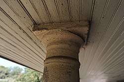 Porches define the character of historic Tenth Street. | |
 Tenth Street Historic District  Tenth Street Historic District | |
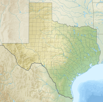
| Location | Western edge of William S. Beatty Survey, Northeast corner William H. Hord Survey, Southeast corner Elizabeth Robertson Survey, Dallas, Texas |
|---|---|
| Coordinates | 32°44′56″N 96°48′24″W |
| Area | Approximately 84 acres (34 ha) |
| Built | 1888-1947 |
| Architect | African American carpenters including Noah Penn, Richard J. Moore, and John Siler, among many others. |
| Architectural style | Folk Victorian, Late 19th and 20th Century Revivals, American Craftsman Shotgun House, Bungalow |
| NRHP reference No. | 94000604 |
| Significant dates | |
| Added to NRHP | June 17, 1994 |
| Designated DLMK | 1993 |
| Designated EMEHP | May 30, 2019 |
Heritage designations

Tenth Street Historic District may identify either a Dallas Landmark District or a National Register Historic District encompassing parts of the Tenth Street Freedman's Town. Only a portion of the original nucleus and subsequent expansion of the Tenth Street Freedman's Town prior to the Second World War is protected by the local historic overlay district. Recollections of longtime residents suggest that some areas included in both the local and national designations, while appropriate to the period of historic significance, were off limits to African Americans during the period of significance and even up until the final years of Jim Crow.
Although the local and national districts were created to recognize the same historic community, the boundaries of the two designations differ slightly from each other. When Dallas adopted the city's twelfth historic district in 1993, the historic overlay was bounded by East Clarendon Drive on the south and southeast, South Fleming Avenue on the southwest, Interstate-35E on the west, East 8th Street on the north from the intersection with I-35E east to the intersection with Denley Drive, thence north along Denley Drive to the north property line of those lots facing south on East 8th Street, thence east along said property line to its intersection with Hutchins Road, thence south along the former Corsicana Interurban right of way to East Clarendon Drive, thence west a short distance along East Clarendon Drive, from which point the boundary jogged south, then west, then north to include the former site of Cuney Street before returning to East Clarendon Drive.[2] The National Register of Historic Places defines the district as roughly bounded by East Clarendon Drive on the south and southeast, South Fleming Avenue on the southwest, Interstate-35E on the west, East 8th Street on the north and the eastern ends of Church Street, East 9th Street and Plum Street on the east, where they dead-end into the old Corsicana Interurban right of way.[3]
References
- "History | Oak Cliff Cemetery". www.oakcliffcemetery.org. Retrieved 2020-01-22.
- "Tenth Street". dallascityhall.com. Retrieved 2020-01-22.
- Tenth Street Historic District, National Register Information System ID: 94000604, National Register of Historic Places Registration Form. Certified by Curtis Tunnell, State Historic Preservation Officer, Texas Historical Commission, May, 1994.