Tenabo
Tenabo is a city in the Mexican state of Campeche. It is located in the north of the state, 35 km from the state capital Campeche, Camp., and 110 km from Mérida, Yucatán, along Federal Highway 180. It serves as the municipal seat for the municipality of the same name.
Tenabo | |
|---|---|
 Coat of arms | |
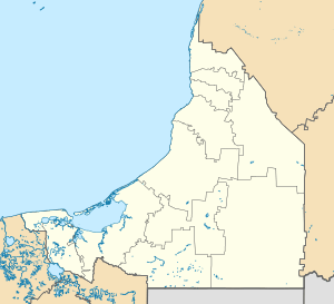 Tenabo Tenabo | |
| Coordinates: 20°02′N 90°13′W | |
| Country | |
| State | Campeche |
| Municipality | Tenabo |
| Founded | 1450 |
| Encomienda | 1544 |
| Elevation | 10 m (30 ft) |
| Population (2010) | |
| • Total | 7,543 |
| Time zone | UTC−6 (Central (US Central)) |
| • Summer (DST) | UTC−5 (Central) |
| Postal code | 24700 |
| Area code(s) | 996 |
| Demonym | Tenabeño |
| Website | www.tenabo.gob.mx |
As of 2010, the city of Tenabo had a population of 7,543.[1]
Climate
| Climate data for Tenabo (1951–2010) | |||||||||||||
|---|---|---|---|---|---|---|---|---|---|---|---|---|---|
| Month | Jan | Feb | Mar | Apr | May | Jun | Jul | Aug | Sep | Oct | Nov | Dec | Year |
| Record high °C (°F) | 38.2 (100.8) |
39.0 (102.2) |
41.9 (107.4) |
44.0 (111.2) |
46.2 (115.2) |
42.5 (108.5) |
39.5 (103.1) |
39.5 (103.1) |
38.5 (101.3) |
37.3 (99.1) |
39.3 (102.7) |
38.8 (101.8) |
46.2 (115.2) |
| Average high °C (°F) | 30.3 (86.5) |
32.0 (89.6) |
34.6 (94.3) |
36.9 (98.4) |
36.9 (98.4) |
35.4 (95.7) |
34.5 (94.1) |
34.5 (94.1) |
33.6 (92.5) |
32.4 (90.3) |
31.3 (88.3) |
30.1 (86.2) |
33.5 (92.3) |
| Daily mean °C (°F) | 24.0 (75.2) |
25.0 (77.0) |
27.5 (81.5) |
29.7 (85.5) |
30.0 (86.0) |
29.4 (84.9) |
28.6 (83.5) |
28.6 (83.5) |
28.2 (82.8) |
26.8 (80.2) |
25.2 (77.4) |
23.9 (75.0) |
27.2 (81.0) |
| Average low °C (°F) | 17.7 (63.9) |
18.1 (64.6) |
20.5 (68.9) |
22.5 (72.5) |
23.1 (73.6) |
23.5 (74.3) |
22.8 (73.0) |
22.7 (72.9) |
22.8 (73.0) |
21.1 (70.0) |
19.1 (66.4) |
17.7 (63.9) |
21.0 (69.8) |
| Record low °C (°F) | 9.5 (49.1) |
8.5 (47.3) |
8.5 (47.3) |
10.5 (50.9) |
16.1 (61.0) |
15.6 (60.1) |
19.0 (66.2) |
19.1 (66.4) |
19.1 (66.4) |
10.5 (50.9) |
10.0 (50.0) |
8.3 (46.9) |
8.3 (46.9) |
| Average precipitation mm (inches) | 21.7 (0.85) |
8.9 (0.35) |
13.4 (0.53) |
20.7 (0.81) |
88.3 (3.48) |
161.0 (6.34) |
145.0 (5.71) |
174.6 (6.87) |
219.9 (8.66) |
102.9 (4.05) |
41.5 (1.63) |
29.4 (1.16) |
1,027.3 (40.44) |
| Average precipitation days (≥ 0.1 mm) | 2.7 | 1.2 | 1.1 | 1.4 | 4.7 | 9.9 | 11.5 | 11.8 | 12.8 | 8.0 | 3.5 | 2.1 | 70.7 |
| Source: Servicio Meteorológico National[2][3] | |||||||||||||
References
- Link to tables of population data from Census of 2005 Instituto Nacional de Estadística, Geografía e Informática (INEGI)
- Tenabo Enciclopedia de los Municipios de México (INAFED)
- Ayuntamiento de Tenabo Official website (in Spanish)
- "Tenabo". Catálogo de Localidades. Secretaría de Desarrollo Social (SEDESOL). Retrieved 23 April 2014.
- "Estado de Campeche–Estacion: Tenabo (SMN)". NORMALES CLIMATOLÓGICAS 1951–2010 (in Spanish). Servicio Meteorológico National. Archived from the original on 18 May 2015. Retrieved 12 May 2015.
- "Extreme Temperatures and Precipitation for Tenabo (SMN) 1952–1974" (in Spanish). Servicio Meteorológico Nacional. Archived from the original on 18 May 2015. Retrieved 12 May 2015.
Campeche (capital) | ||
| Municipalities and (municipal seats) |  | |
This article is issued from Wikipedia. The text is licensed under Creative Commons - Attribution - Sharealike. Additional terms may apply for the media files.