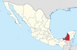
Municipalities of Campeche
Campeche is a state in Southeast Mexico that is divided into eleven municipalities.[1] According to the 2015 Mexican Intercensal Survey, Campeche is the third least populous state with 899,931 inhabitants and the 17th largest by land area spanning 57,693.59 square kilometres (22,275.62 sq mi).[1][2]
Municipalities in Campeche are administratively autonomous of the state according to the 115th article of the 1917 Constitution of Mexico.[3] Every three years, citizens elect a municipal president (Spanish: presidente municipal) by a plurality voting system who heads a concurrently elected municipal council (ayuntamiento) responsible for providing all the public services for their constituents. The municipal council consists of a variable number of trustees and councillors (regidores y síndicos).[4] Municipalities are responsible for public services (such as water and sewerage), street lighting, public safety, traffic, supervision of slaughterhouses and the maintenance of public parks, gardens and cemeteries.[5] They may also assist the state and federal governments in education, emergency fire and medical services, environmental protection and maintenance of monuments and historical landmarks. Since 1984, they have had the power to collect property taxes and user fees, although more funds are obtained from the state and federal governments than from their own income.[5]
The largest municipality by population in Campeche is the state capital Campeche, with 283,025 residents, while the smallest municipality by population is Palizada with 8,971 residents.[1] The largest municipality by area is Calakmul, which spans 14,031.51 km2 (5,417.60 sq mi), while Tenabo is the smallest at 1,061.63 km2 (409.90 sq mi).[2] The first municipalities to incorporate were Campeche, Carmen, and Hecelchakán on April 6, 1825, and the newest municipality is Candelaria, which incorporated July 1, 1998.[6][7]
Municipalities
- Largest municipalities in Campeche by population
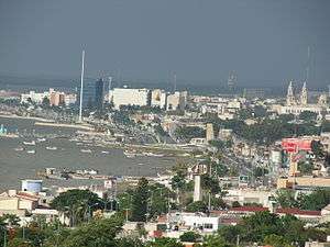
 Skyline of Carmen, Campeche's second largest municipality by population
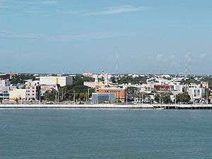
 Coast of Champotón, the third largest municipality by population in Campeche
![]()
| Name | Municipal seat | Population (2015)[1][8] |
Population (2010)[9] |
Change | Land area[2] | Population density (2015) |
Incorporation date[6] | |
|---|---|---|---|---|---|---|---|---|
| km2 | sq mi | |||||||
| Calakmul | Xpujil | 28,424 | 26,882 | +5.7% | 14,031.51 | 5,417.60 | 2.0/km2 (5.2/sq mi) | December 31, 1996[10] |
| Calkiní | Calkiní | 56,537 | 52,890 | +6.9% | 2,108.70 | 814.17 | 26.8/km2 (69.4/sq mi) | July 4, 1862 |
| Campeche |
Campeche | 283,025 | 259,005 | +9.3% | 3,253.63 | 1,256.23 | 87.0/km2 (225.3/sq mi) | April 6, 1825 |
| Candelaria | Candelaria | 43,879 | 41,194 | +6.5% | 5,687.63 | 2,196.01 | 7.7/km2 (20.0/sq mi) | July 1, 1998[7] |
| Carmen | Ciudad del Carmen | 248,303 | 221,094 | +12.3% | 8,644.17 | 3,337.53 | 28.7/km2 (74.4/sq mi) | April 6, 1825 |
| Champotón | Champotón | 90,244 | 83,021 | +8.7% | 6,876.26 | 2,654.94 | 13.1/km2 (34.0/sq mi) | November 30, 1840 |
| Escárcega | Escárcega | 58,553 | 54,184 | +8.1% | 4,798.22 | 1,852.60 | 12.2/km2 (31.6/sq mi) | July 19, 1990 |
| Hecelchakán | Hecelchakán | 31,230 | 28,306 | +10.3% | 1,278.67 | 493.70 | 24.4/km2 (63.3/sq mi) | April 6, 1825 |
| Hopelchén | Hopelchén | 40,100 | 37,777 | +6.1% | 7,803.22 | 3,012.84 | 5.1/km2 (13.3/sq mi) | May 24, 1837 |
| Palizada | Palizada | 8,971 | 8,352 | +7.4% | 2,149.95 | 830.10 | 4.2/km2 (10.8/sq mi) | July 4, 1862 |
| Tenabo | Tenabo | 10,665 | 9,736 | +9.5% | 1,061.63 | 409.90 | 10.0/km2 (26.0/sq mi) | July 4, 1862 |
| Campeche | — | 899,931 | 822,441 | +9.4% | 57,693.59 | 22,275.62 | 15.6/km2 (40.4/sq mi) | — |
| Mexico[11] | — | 119,938,473 | 112,336,538 | +6.8% | 1,972,550 | 761,606 | 60.8/km2 (157.5/sq mi) | — |
References
- "Número de habitantes". INEGI (National Institute of Statistics and Geography). Retrieved July 15, 2017.
- "Unidad de Microrregiones Cédulas de Información Municipal (SCIM)" (in Spanish). Secretaría de Desarrollo Social. Retrieved November 18, 2017.
- Article 115, Political Constitution of the United Mexican States of 1917 (in Spanish). Retrieved September 27, 2017.
- OECD (November 12, 2004). New Forms of Governance for Economic Development. OECD Publishing. p. 121. ISBN 978-9264015326.
- International Business Publications (2009). Mexico Company Laws and Regulations Handbook. p. 42. ISBN 978-1-4330-7030-3.
- Estado de Baja California Sur. División Territorial de 1810 a 1995 (PDF) (in Spanish). Mexico: INEGI. 1996. p. 81. ISBN 978-970-13-1491-3.
- "Enciclopedia de Los Municipios y Delegaciones de México Estado de Campeche" (in Spanish). H. Ayuntamiento de Escobedo. Retrieved May 26, 2018.
- "Tabulados de la Encuesta Intercensal 2015" (xls) (in Spanish). INEGI. Retrieved July 15, 2017.
- "Localidades y su población por municipio según tamaño de localidad" (PDF) (in Spanish). INEGI. Archived from the original (PDF) on July 20, 2018. Retrieved July 15, 2017.
- "Historia de Calakmul el Municipio Mas Joven del Estado de Campeche" (in Spanish). Gobierno Municipal del Honorable Ayuntamiento de Calakmul. Retrieved May 26, 2018.
- "Población" (in Spanish). INEGI. Retrieved January 20, 2018.