Tang, County Westmeath
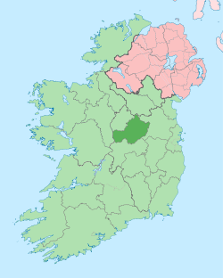
Tang (Irish: An Teanga, meaning "The tongue") is a village and a half-parish in County Westmeath, on the N55 national secondary road between Athlone and Ballymahon, County Longford. Tang is in the parish of Drumraney. It is in County Westmeath but on the border with County Longford from which it is separated by the River Tang which flows into Lough Ree 3 km downstream via the River Inny.
Tang An Teanga | |
|---|---|
Village | |
 Tang Community Centre | |
 Tang Location in Ireland | |
| Coordinates: 53°32′06″N 7°47′13″W | |
| Country | Ireland |
| Province | Leinster |
| County | County Westmeath |
| Elevation | 66 m (217 ft) |
| Time zone | UTC+0 (WET) |
| • Summer (DST) | UTC-1 (IST (WEST)) |
| Irish Grid Reference | N133541 |
External links
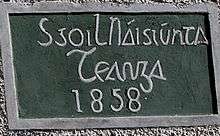
Old national school sign
This article is issued from Wikipedia. The text is licensed under Creative Commons - Attribution - Sharealike. Additional terms may apply for the media files.