Sverdrup Mountains
The Sverdrup Mountains (Norwegian: Sverdrupfjella) are a group of mountains about 80 km (50 mi) long, standing just west of the Gjelsvik Mountains in Queen Maud Land, East Antarctica. With its summit at 2,655 metres (8,711 ft), the massive Mount Krüger forms the highest point in the Sverdrup Mountains.
| Sverdrup Mountains | |
|---|---|
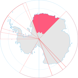 Map depicting the territorial extent of Queen Maud Land
| |
| Highest point | |
| Peak | Mount Krüger |
| Elevation | 8,711 ft (2,655 m) |
| Coordinates | 72°20′S 01°00′E |
| Naming | |
| Native name | Sverdrupfjella |
| Geography | |
| Continent | Antarctica |
| State/Province | Queen Maud Land, East Antarctica |
| Parent range | Fimbulheimen |
Discovery and naming
First photographed from the air and roughly plotted by the Third German Antarctic Expedition (3rd GAE), 1938–1939. Mapped in detail by Norwegian cartographers from surveys and aerial photographs taken by the Norwegian–British–Swedish Antarctic Expedition (NBSAE), and again by a later Norwegian expedition. Named for Harald Sverdrup, Chairman of the Norwegian Committee for the NBSAE.[1]
Norwegian–British–Swedish Antarctic Expedition
Norwegian–British–Swedish Antarctic Expedition (NBSAE), 1949–1952
Norwegian Expedition
Luncke Expedition, 1958–1959
List of important geographical features of the Sverdrup Mountains

| Name of feature | Coordinates | Altitude | Discovery | Notes |
|---|---|---|---|---|
| Alan Peak | 72°39′S 00°11′E | 3rd GAE | A peak at the west side of the mouth of Reece Valley, in the southern part of the Sverdrup Mountains. Remapped by Norwegian cartographers from surveys and aerial photographs taken by the NBSAE and later by the NE. Named for Alan Reece, geologist of the NBSAE, and earlier with the Falkland Islands Dependencies Survey (FIDS). | |
| Barkley Mountains | 72°22′S 01°00′E | 3rd GAE | Remapped by Norwegian cartographers from surveys and aerial photographs taken by the NBSAE and later by the NE. Named for Erich Barkley, biologist of the 3rd GAE. | |
| Brattskarvet Mountain | 72°06′S 01°27′E | 2100 meters | 3rd GAE | Remapped by Norwegian cartographers from surveys and aerial photographs taken by the NBSAE and later by the NE. Named Brattskarvet (the steep mountain). |
| Fuglefjellet | 72°17′S 00°46′E | 3rd GAE | 7 nautical miles (13 km) east of Mount Roer. Remapped by Norwegian cartographers from surveys and aerial photographs taken by the NBSAE and later by the NE. Named Fuglefjellet (the bird mountain). | |
| Gburek Peaks | 72°11′S 00°15′W | 3rd GAE | A group of rocky elevations including Straumsvola Mountain and Jutulrora Mountain, forming the western end of the Sverdrup Mountains. Remapped by Norwegian cartographers from surveys and aerial photographs taken by the NBSAE and later by the NE. Named for Leo Gburek, geophysicist of the 3rd GAE. | |
| Hamartind Peak | 72°33′S 00°39′E | |||
| Isingen Mountain | 72°23′S 01°04′E | |||
| Joungane Peaks | 72°04′S 00°17′W | |||
| Jutulrora Mountain | 72°15′S 00°27′W | |||
| Kvitho Peak | 72°29′S 01°13′E | |||
| Kvithovden Peak | 72°22′S 00°45′E | |||
| Kvitkjolen Ridge | ||||
| Kvitsvodene Valley | ||||
| Mount Brandt | 72°10′S 01°07′E | |||
| Mount Krüger | 72°36′S 00°57′E | 2655 meters | 3rd GAE | The summit of Krügerfjellet, 8 miles (13 km) southwest of Kvitho Peak, is the highest point in the Sverdrup Mountains.[2][3] Named for Walter Krüger, meteorological assistant on the 3rd GAE. |
| Mount Roer | 72°18′S 00°21′E | |||
| Nupskapa Peak | 72°43′S 00°16′E | |||
| Oppkuven Peak | 72°37′S 00°24′E | |||
| Paulsen Mountains | 72°10′S 01°21′E | 3rd GAE | A group of mountains including Brattskarvet Mountain, Vendeholten Mountain and Tverrveggen Ridge, located in the northern part of the Sverdrup Mountains. Named for Karl-Heinz Paulsen, oceanographer on the expedition. | |
| Rogstad Glacier | ||||
| Romlingane Peaks | 72°11′S 01°08′E | |||
| Salknappen Peak | 72°19′S 01°02′E | |||
| Snarby Peak | 72°02′S 01°37′E | |||
| Sorhausane Peaks | 72°47′S 00°15′E | |||
| Storjoen Peak | 72°07′S 00°12′W | |||
| Straumsvola Mountain | 72°07′S 00°20′W | |||
| Tverrveggen Ridge | 72°17′S 01°20′E | 3rd GAE | Remapped by Norwegian cartographers from surveys and aerial photographs taken by the NBSAE and later by the NE. Named Tverrveggen (the transverse wall). | |
| Tvora | 72°10′S 00°05′W | |||
| Vendeholten Mountain | 72°12′S 01°20′E |
See also
References
- "Sverdrup Mountains". Geographic Names Information System. United States Geological Survey. Retrieved 5 July 2010.
- "Mount Krüger". Geographic Names Information System. United States Geological Survey. Retrieved 5 July 2010.
- "Mount Krüger, Antarctica". Peakbagger.com. Retrieved 5 July 2010.
External links
![]()
![]()
| General |
| .svg.png) |
|---|---|---|
| Geographic regions | ||
| Waterways | ||
| Famous explorers | ||