Sung Men District
Sung Men (Thai: สูงเม่น, pronounced [sǔːŋ mên]) is a district (amphoe) of Phrae Province, northern Thailand.
Sung Men สูงเม่น | |
|---|---|
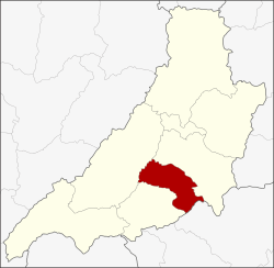 District location in Phrae Province | |
| Coordinates: 18°3′7″N 100°6′42″E | |
| Country | Thailand |
| Province | Phrae |
| Seat | Sung Men |
| Area | |
| • Total | 375.0 km2 (144.8 sq mi) |
| Population (2005) | |
| • Total | 80,129 |
| • Density | 213.7/km2 (553/sq mi) |
| Time zone | UTC+7 (ICT) |
| Postal code | 54130 |
| Geocode | 5404 |
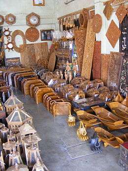
Community store, Sung Men District
History
In 1903 the district name was Mae Phuak (แม่พวก) and was centered in Ban Sung Men.[1] The government changed the district name to Sung Men in 1917.[2]
Geography
Neighboring districts are (from the southwest clockwise) Den Chai, Long, and Mueang Phrae of Phrae Province; Tha Pla and Mueang Uttaradit of Uttaradit Province.
The important water resource is the Yom River.
Administration
The district is divided into 12 sub-districts (tambons), which are further subdivided into 109 villages (mubans). The townships (thesaban tambons) Sung Men covers parts of tambon Sung Men. There are a further 12 tambon administrative organizations (TAO).
| No. | Name | Thai name | Villages | Pop. | |
|---|---|---|---|---|---|
| 1. | Sung Men | สูงเม่น | 9 | 7,711 | |
| 2. | Nam Cham | น้ำชำ | 15 | 10,094 | |
| 3. | Hua Fai | หัวฝาย | 13 | 10,610 | |
| 4. | Don Mun | ดอนมูล | 10 | 7,701 | |
| 5. | Ban Lao | บ้านเหล่า | 9 | 5,885 | |
| 6. | Ban Kwang | บ้านกวาง | 6 | 3,496 | |
| 7. | Ban Pong | บ้านปง | 6 | 5,151 | |
| 8. | Ban Kat | บ้านกาศ | 7 | 3,427 | |
| 9. | Rong Kat | ร่องกาศ | 11 | 7,641 | |
| 10. | Sop Sai | สบสาย | 6 | 3,891 | |
| 11. | Wiang Thong | เวียงทอง | 12 | 10,485 | |
| 12. | Phra Luang | พระหลวง | 5 | 4,037 |
References
- แจ้งความกระทรวงมหาดไทย (PDF). Royal Gazette (in Thai). 19 (53): 1024. March 22, 1903.
- ประกาศกระทรวงมหาดไทย เรื่อง เปลี่ยนชื่ออำเภอ (PDF). Royal Gazette (in Thai). 34 (0 ก): 40–68. April 29, 1917.
This article is issued from Wikipedia. The text is licensed under Creative Commons - Attribution - Sharealike. Additional terms may apply for the media files.