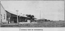
Stonehenge, Queensland (Barcoo Shire)
Stonehenge is an outback town and locality in the Shire of Barcoo, Queensland, Australia.[2][3] In the 2016 census, Stonehenge had a population of 44 people.[1]
| Stonehenge Queensland | |||||||||||||||
|---|---|---|---|---|---|---|---|---|---|---|---|---|---|---|---|
 Stonehenge | |||||||||||||||
| Coordinates | 24.3525°S 143.2875°E | ||||||||||||||
| Population | 44 (2016 census)[1] | ||||||||||||||
| • Density | 0.00285/km2 (0.00738/sq mi) | ||||||||||||||
| Postcode(s) | 4730 | ||||||||||||||
| Area | 15,432.8 km2 (5,958.6 sq mi) | ||||||||||||||
| Time zone | AEST (UTC+10:00) | ||||||||||||||
| Location | |||||||||||||||
| LGA(s) | Shire of Barcoo | ||||||||||||||
| State electorate(s) | Gregory | ||||||||||||||
| Federal Division(s) | Maranoa | ||||||||||||||
| |||||||||||||||
Geography
Stonehenge is in the Channel Country.
Nearby is one of three areas used to base the Australian Department of Defence's over-the-horizon radar system.
History
Its name originates from when the area was a stopping point for bullock teams. A stone hut used by the bullock drivers to overnight in eventually fell into disuse, and the stone remains became known as 'Stonehenge'.[4]
The Stonehenge State School opened on 3 September 1900. The school closed in 1947 but subsequently reopened. It closed again on 1 February 1977 but reopened again on 27 January 1981.[5]
At the 2006 census, Stonehenge and the surrounding area had a population of 106.[6]
The Stonehenge Library opened in 2009.[7]
Facilities
Stonehenge has a sports centre and community centre.[8]
The Barcoo Shire Council operates a public library at 9 Stratford Street.[9]
Education
Stonehenge State School is a government primary (Early Childhood-6) school for boys and girls at 27 Bulford Street (24.3507°S 143.2874°E).[10][11] In 2017, the school had an enrolment of 7 students with 2 teachers and 4 non-teaching staff (1 full-time equivalent).[12] The school motto is 'Strong and Proud'.[11]
There is no secondary school in Stonehenge. The nearest one is in Longreach 155 kilometres (96 mi); other options are boarding schools and distance education.[13]
References
- Australian Bureau of Statistics (27 June 2017). "Stonehenge (SSC)". 2016 Census QuickStats. Retrieved 20 October 2018.

- "Stonehenge - town in Shire of Barcoo (entry 32495)". Queensland Place Names. Queensland Government. Retrieved 10 June 2019.
- "Stonehenge - locality in Shire of Barcoo (entry 49112)". Queensland Place Names. Queensland Government. Retrieved 10 June 2019.
- Action Graphics A Stonehenge without stones
- "Opening and closing dates of Queensland Schools". Queensland Government. Retrieved 9 July 2015.
- Australian Bureau of Statistics (25 October 2007). "Stonehenge (Barcoo Shire) (State Suburb)". 2006 Census QuickStats. Retrieved 25 January 2008.
- "Public Libraries Statistical Bulletin 2016-17" (PDF). Public Libraries Connect. State Library of Queensland. November 2017. p. 11. Archived (PDF) from the original on 30 January 2018. Retrieved 30 January 2018.
- "Stonehenge". Barcoo Shire Council. Retrieved 12 November 2013.
- "Stonehenge Library". Public Libraries Connect. State Library of Queensland. 30 August 2017. Retrieved 31 January 2017.
- "State and non-state school details". Queensland Government. 9 July 2018. Archived from the original on 21 November 2018. Retrieved 21 November 2018.
- "Stonehenge State School". Retrieved 21 November 2018.
- "ACARA School Profile 2017". Archived from the original on 22 November 2018. Retrieved 22 November 2018.
- "Queensland Globe". State of Queensland. Retrieved 10 August 2019.
Further reading
| Wikimedia Commons has media related to Stonehenge, Queensland (Barcoo Shire). |
- McIvor, Roy (2010). Cockatoo: My Life in Cape York. Stories and Art. Roy McIvor. Magabala Books. Broome, Western Australia. ISBN 978-1-921248-22-1.