Staphorst
Staphorst (![]()
Staphorst | |
|---|---|
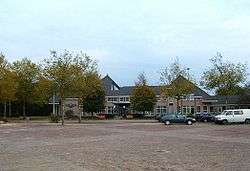 Staphorst city hall | |
 Flag  Coat of arms | |
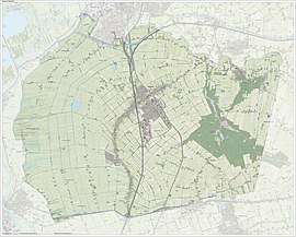
.svg.png) Location in Overijssel | |
| Coordinates: 52°39′N 6°13′E | |
| Country | Netherlands |
| Province | Overijssel |
| Government | |
| • Body | Municipal council |
| • Mayor | Theo Segers (CU) |
| Area | |
| • Total | 135.69 km2 (52.39 sq mi) |
| • Land | 134.22 km2 (51.82 sq mi) |
| • Water | 1.47 km2 (0.57 sq mi) |
| Elevation | 1 m (3 ft) |
| Population (January 2019)[4] | |
| • Total | 17,003 |
| • Density | 127/km2 (330/sq mi) |
| Demonym(s) | Staphorstenaar, Staphorster |
| Time zone | UTC+1 (CET) |
| • Summer (DST) | UTC+2 (CEST) |
| Postcode | 7715, 7950–7955 |
| Area code | 0522 |
| Website | www |
History
The villages of Staphorst and its southern neighbour Rouveen came into existence as in the 13th century monks started to bring the bogs and swamps into culture.
All the farms were built along the long road through the bog area. Thus a lengthy row of farms was built, becoming the 11 km (7 mi) long village of Staphorst-Rouveen. This phenomenon is called in Dutch: lintbebouwing (ribbon urbanization). In many parts of the Netherlands this type of village is quite common, e.g. Vriezenveen, the villages along river dykes in the Netherlands, the so-called moor-colonies in the provinces Drenthe and Groningen, as well as the German regions opposite the border.
According to the website goDutch.com in the section of "Excerpts from the Windmill" in the entry for "Staphorst reunion organizers eager to welcome former residents for April 2011 municipal bicentennial", Staphorst was a Dutch municipality, created through a decree by French emperor Napoleon who merged four smaller entities into a much larger one. The 1811 decree merged the villages of Rouveen, Staphorst and IJhorst along with nearby sparsely populated Hasselter schoutambt (a judicial entity) into a municipality, known since 1818 as Staphorst. Except for a few minor changes, Staphorst's borders have remained unchanged, making it an anomaly in Dutch municipal history.
A specialty for Staphorst is, that after a farmer's death, his land was often divided between his sons. The son who didn't inherit his father's farm built a farm-house for his own behind the other. Therefore, many pieces of farmland are very lengthy, yet narrow (e.g. 1500 x 40 metres). Originally, each piece of land was 125 metres wide.[5]
The farms are of the traditional Low Saxon type. They have green doors and window shutters. Most farms existing now were built between 1850 and 1910.
Society
Staphorst is still a largely orthodox Calvinist village and has one of the highest church attendancy rates of the Netherlands. In 1971, Staphorst became world news due to an outbreak of polio. 39 people (mostly children) became infected with polio.[6] Of these, five died and a number of others became disabled. 20% of residents remain unvaccinated[6] for religious reasons. As a result, Staphorst and other similar areas in the Netherlands are classified as risk areas by the WHO[6] – the only such area in Europe.

The Total Fertility Rate (TFR) in Staphorst at 2.76 was 4th highest in all of Netherlands in 2003.[7] That makes Staphorst a place with one of the highest birth rates in all of Europe.
Population centres
Demographics
Staphorst had a sustainable birth rate until the beginning of 21st century. But during the 2000–2007 period, the birth rate dropped considerably.
- Birth Rate: 15.79 per 1000 (down from 18.96 in 2000).
- Death Rate: 6.98 per 1000.
- NGR: +0.88%[8]
The birth rate of Staphorst declined further to 14,9‰ in 2016, while the total fertility rate declined to 2,65 children per woman.
Notable people

- Lambertus Johannes Hansen (1803 in Staphorst – 1859) Dutch painter
- Tjerk Vermaning (1929 in Staphorst – 1986) a controversial Dutch amateur archaeologist
- Roelof Bisschop (born 1956 in Staphorst) a Dutch historian and politician
Sport
- Marc Houtzager (born 1971 in Rouveen) a Dutch show jumping equestrian, silver medallist at the 2012 Summer Olympics
- Bert Konterman (born 1971 in Rouveen) former professional footballer with 470 club caps
- Gretha Smit (born 1976 in Rouveen) a Dutch former speed skater, silver medallist in the 2002 Winter Olympics
Gallery
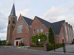
 Rouveen - Oud Gereformeerde Kerk
 Rouveen, hotel
 Forest Service Staphorst, Recreational pond 'de Zwarte Dennen'
.jpg) Molen De Leijen, Staphorst
Molen De Leijen, Staphorst
References
- "College van B&W" [Board of mayor and aldermen] (in Dutch). Gemeente Staphorst. Archived from the original on 16 April 2014. Retrieved 1 April 2014.
- "Kerncijfers wijken en buurten" [Key figures for neighbourhoods]. CBS Statline (in Dutch). CBS. 2 July 2013. Retrieved 12 March 2014.
- "Postcodetool for 7951DE". Actueel Hoogtebestand Nederland (in Dutch). Het Waterschapshuis. Retrieved 1 April 2014.
- "Bevolkingsontwikkeling; regio per maand" [Population growth; regions per month]. CBS Statline (in Dutch). CBS. 1 January 2019. Retrieved 1 January 2019.
- (in Dutch) Over Staphorst, "Staphorst vroeger," Archived 28 July 2012 at the Wayback Machine Gemeente Staphorst.
- (in Dutch) "Polio in Staphorst," Andere Tijden, VPRO (1 Nov 2007).
- "Largest families in Urk," CBS (Statistics Netherlands), Web magazine (1 September 2003 10:00).
- CBS/nl
External links
| Wikimedia Commons has media related to Staphorst. |
Places adjacent to Staphorst | ||||||||||
|---|---|---|---|---|---|---|---|---|---|---|
| ||||||||||
Municipalities of Overijssel | ||
|---|---|---|
 | ||
| ||
| Authority control |
|
|---|