Sri City
Sri City or Satyavedu Reserve Infracity Pvt. Ltd.[3] is an integrated business city (township) located on NH 16 in the state of Andhra Pradesh, India. Much of the Sri City area is in Chittoor District and a smaller area along the NH16[4] is in Nellore District of Andhra Pradesh, India.
Sri City | |
|---|---|
town | |
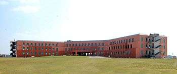
.svg.png) Sri City | |
| Coordinates: 13.557673°N 80.029489°E | |
| Country | India |
| State | Andhra Pradesh |
| District | Chittoor District |
| Area | |
| • Total | 69.88697 km2 (26.98351 sq mi) |
| Area rank | 24 |
| • Rank | 414 |
| Languages | |
| • Official | Telugu |
| Time zone | UTC+5:30 (IST) |
| Website | SriCity |
Geography
It is situated between north latitudes of 13°29’50" & 13°34’40" and east longitudes of 79°57’30" & 80°02’50",[5] at an average elevation of about 20 metres above MSL (66 ft) covering parts of Chittoor district and Nellore district of Andhra Pradesh. It is alongside NH 5 which forms part of the Golden Quadrilateral.[6] A creek (Karipeti Kalava) flows through Sri City passing through a number of lakes on the way to joining Pulicat Lake north of Tada. There is a state forest on the western boundary. The Telugu Ganga project carrying Krishna River water to Chennai passes along the western boundary of Sri City.
Languages
Telugu is the official and spoken language.[7] Most of the educated populace speak English and are bi-lingual.[8]
Demographics
Sri City forms part of Satyavedu and Varadaiahpalem mandals of Chittoor District. It is part of the Satyavedu constituency and Tirupati MP constituency. As per 2011 census the total population of the satyavedu constituency is 2,77,010,[9] with a literacy rate of 78.98, well over national rate of Literacy in India which stand at 74.04%.[10]
Social organizations
Special Economic Zone
The integrated township includes various zones: Industrial, Residential, Educational, Commercial and Recreational.
The Industrial Zone includes a Special Economic Zone (SEZ) for Export Oriented Industry and Domestic Tariff Zone (DTZ) for Domestic Industry. It is a business destination for global companies to establish Manufacturing, Services and Trading operations in India.[12]
The SEZ is administered by Andhra Pradesh Industrial Infrastructure Corporation (APIIC)[13] & Industrial Area Local Authority (IALA). The Government appointed officer controls the planning and building approval processes. A Commissioner appointed by the Government of India, Ministry of Commerce, administers the (SEZ) area.
The SEZ was designed by Jurong Consultants, Singapore,[14] taking into account future dimensions of expansion.[15]
Transport

Sricity is located in close proximity to Asian Highway 45. The Tirupati Airport is the nearest domestic airport (82 km) and Chennai International Airport is the nearest international airport (86 km).[16] Tada and Arambakkam railways stations are nearest railway stations to Sricity.[17][18] Chennai Port and Ennore Ports are the nearest port to the town.[19] While, Krishnapatnam Port is located 100 km (62 mi) to the north of Sri City.[19]
See also
External links
| Wikimedia Commons has media related to Sricity. |
References
- "Sri city".
- "SEZ Benefits in India".
- "SEZs in AndhraPradesh | Andhra Pradesh Industrial Infrastructure Corporation".
- Tirupati MP also pointed out that Sri City was in close proximity to NH16 & 2 International Airports – Chennai and Tirupati.
- Sri City, Andhra Pradesh-Source-Google Maps
- "Archived copy". Archived from the original on 30 March 2012. Retrieved 5 October 2011.CS1 maint: archived copy as title (link) Places to visit near sriharikota (shar) | About Sriharikota-Source-Website on Sriharikota Range (SHAR)
- "Archived copy". Archived from the original on 9 October 2010. Retrieved 5 October 2010.CS1 maint: archived copy as title (link)
- People from different states like Bihar, Jharkhand and Odisha work in Sri City
- "WELCOME TO CENSUS OF INDIA : Census India Library". www.censusindia.gov.in. Retrieved 3 February 2016.
- Demographics of India, 2001 Census
- "SEZ India - Customers, Clients, Special Economic Zone, VRV, Venture, Busanaremaja Agracipta, EURA, BFG, Free Trade Zone, Industrial Park, SEZ". www.sricity.in. Archived from the original on 9 May 2015. Retrieved 25 April 2016.
- Multi-product SEZ at Nellore-Source-Financial Express
- SEZs Assisted by APIIC-Source-Andhra Pradesh Industrial Infrastructure Corporation
- Sri City Master-planned by Jurong Consultants, Singapore – Source – Site Selection Magazine Online
- Sri City SEZ eyes Rs 20,000-cr turnover-Source-The Hindu Business Line
- "Set up Nano car project in Sathyavedu SEZ". The Hindu. 31 August 2008. Retrieved 24 January 2016.
- "TADA/Tada (3 PFs) Railway Station Map/Atlas – India Rail Info". India Rail Info. Retrieved 24 January 2016.
- Train Arrival Timings Sullurupeta/SPE-Source-indiarailinfo.com
- Special Economic Zones in India: Recent Developments and Future Prospects, Sri City distance from Chennai, Ennore and Krishnapattnam Ports, refer Page 8-Source-Indian Institute of South Asian Studies, National University of Singapore Archived 11 October 2010 at the Wayback Machine