Squares in London
Squares have long been a feature of London and come in numerous identifiable forms. The landscaping spectrum of squares stretches from those with more hardscape, constituting town squares (also known as city squares)—to those with communal gardens, for which London is a major international exponent, known as garden squares.

A few in the capital of the United Kingdom, such as Trafalgar Square, began as public open spaces in the same way as other city squares worldwide, typically a plaza, piazza and a platz in Spain, Italy and Germany. Most, however, began as garden squares i.e. private communal gardens for the inhabitants of surrounding houses. All types of the space are more prevalent in parts of London with high (urban) density. Some of these gardens are now open to the public, while others, for example around Notting Hill, are railed (a form of fencing) and private.
The terminology has been loosely applied for over a century. Some "squares" are irregularly shaped—including five triangles, a pentagon, hexagon, octagon, and two ovals among those officially named Square. Approbative and technical studies of garden squares commonly cover equivalent landscaped communal gardens not named as a Square many of which have become small public parks. A diversity of descriptive names features in the list of London's "garden squares".
Name and shape
"Square" is a generic term for neat, planned or set aside urban open spaces larger than a verge or pavement overlooked by buildings. In London, elements of fields were set aside, a fact reflected in the name of the square London Fields and two later examples: Coram's Fields and Lincoln's Inn Fields. Some are not actually square, or even rectangular. One reason for this is the use of a local nickname for the street, park or garden in question. Another is that some older squares were irregularly shaped to begin with, or lost their original layout due to the city's many transformations, not least following the Great Fire of London and The Blitz.
The street naming (or streetnaming) authority of each London Borough and the City of London Corporation by authority of an Act of 1939 imposes rules to authorise appropriate street names for new developments and for owners wishing to rename features.[1] Commercial building and retained historic names apart, new residential squares must in many boroughs be "for a square only" — considered not well elongated but rectangular and to some extent open.[2] Billiter Square, EC3 and Millennium Square, SE1 in districts dominated by retail, commerce and offices are among many modern buildings (not beside a visible rectangular open space) that include alternative, higher built density, square features to their design—such as a courtyard or a square footprint.
Some squares are paved (Granary Square); some grass and trees (Russell Square); many others diverse communal gardens. Most of those that are actually square have the word in their name, and these are listed below. Others more flexibly identified do not. Such notable lists are commonly identified as list of garden squares or estate gardens, communal gardens, formal gardens, about which many books have been written. Increasingly, spaces are being constructed that are legally private, though in practice open to the public (Paternoster Square).
The Royal Borough of Kensington and Chelsea contains over a hundred garden squares whose use is restricted to residents, almost all share a name with their directly adjoining road. Residents may contract with private contractors or with the council, in which case the council charges those residents, typically at the same time as council tax.[3] One instance is a lens (pointed oval), The Boltons.
Toward the public end of the public/private continuum, London's growth has taken in village greens. A minority of these partly or wholly survive such as Newington Green to form council-run open spaces breaking up housing, road networks and/or retail streets. The categories of greens and garden squares become more well-visited where larger than an informal scale. These are mainly government-run, characteristic parks and open spaces in London. By subtle distinction their less urban equivalent amounts to London's 26 commons most of which were diminished in the period of legal inclosure and/or the city/county's 16 country parks.
History
Development of Squares
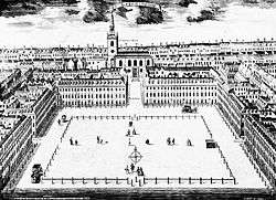
The making of residential squares fell into decline in the early 20th century, one of the last notable such squares having been designed by Edwin Lutyens for Hampstead Garden Suburb. Numerous squares were in danger of filling in for further building. This was banned by the London Squares Act of 1931.[4] In the last quarter of the 20th century a fashion for making office squares developed, a trend led by the Broadgate development. Developers such as London Square, Berkeley Homes and Taylor Wimpey (in the first two instances through their London subsidiaries) have built and set aside land in more than one of their 21st century London developments to create those of the residential type.[5][6][7][8][9][10] More broadly, mixed-use squares to give a focal area have become a resurgent planning design, reflected for instance in Times Square, Sutton and Canada Square, Canary Wharf.
Viewings and events in private communal gardens
Since 1998 many private squares (which term in that context takes in many other shapes of gardens between houses) temporarily open to the paying public: London's "Open Garden Squares Weekend", founded by Caroline Aldiss, takes place on the second weekend in June.[11] The event is organised by the London Parks and Garden Trust. In 2013 over 200 gardens took part, including the garden of the Prime Minister at 10 Downing Street and the Gardens of HM Prison Wormwood Scrubs. Other events in keynote squares coincide such as a World Archaeology Festival, Gordon Square, Bloomsbury run by UCL Institute of Archaeology.[12]
The parks can be categorised as public garden squares, private garden squares or other squares.
Social importance

The local proliferation relative to other UK cities coupled with, since the early 20th century, their widespread opening up has similarly made squares broadly cited in portrayals of London. Initially cultural use was mainly confined to novels and, to a lesser degree, fine art.
"It's a Long Way to Tipperary" is a 1910s song featuring the line "Farewell Leicester Square". "A Nightingale Sang in Berkeley Square" is a romantic hit of 1940 with lyrics by Eric Maschwitz and music by Manning Sherwin, sang that year separately by Ray Noble and Vera Lynn and a theme of a film the next year, by Fritz Lang., Man Hunt. In the 1956 song "Why Can't The English?" from the musical My Fair Lady, Professor Henry Higgins laments, "Hear them down in Soho Square/Dropping H's everywhere."
Drama most notably includes the high-audience soap opera broadcast by the BBC running since 1985, EastEnders based on a semi-permanent set north of London's border, Albert Square. It had pre-release titles Square Dance, Round the Square, Round the Houses, London Pride and East 8.[14]
Soho Square garden contains a bench that commemorates the singer Kirsty MacColl, who wrote the song "Soho Square" for her album Titanic Days. After her death in 2000, fans bought a memorial bench in her honour, inscribing the lyrics: "One day I'll be waiting there / No empty bench in Soho Square".[15] The Lindisfarne album Elvis Lives On the Moon also includes a song named after that square.[16]
Notable communal gardens surrounded by buildings
- Arundel Gardens
- Bedford Square
- Belgrave Square
- Berkeley Square
- Clapton Square
- Egerton Gardens
- Finsbury Circus
- Golden Square
- Grosvenor Square
- Hans Place
- Harrington Gardens
- Kensington Square
- Kensington Park Gardens
- Lennox Gardens, London
- Park Crescent
- Royal Crescent
- Russell Square
- St George's Square
- St. James's Square
- Sloane Square
- Soho Square
- The Boltons
- Wilton Crescent
Most notable town squares
List of Greater London squares
This list comprises places bearing the word Square. The tables state if each has an open-air space exceeding a double-size pavement or the provision of parking spaces. Those marked mainly (due to a building, typically a church, school or community hall in the space) or yes have a clear, open space. Those marked No include streets of any shape including those with vestigial names (throwbacks) to open spaces that lay there (or adjacent) before.
Demolished squares are listed in a table at the end of this section.
Approximate area, in square metres, includes hardscapes and roads.
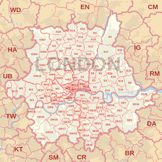
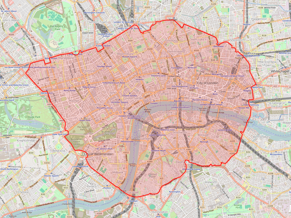
London's squares are arranged by postcode, see the map below of postcodes.
Centremost postcodes
| Name | Post district | Open-to-sky area between buildings | Image | m² |
|---|---|---|---|---|
| King | EC1 | Mainly |  | 16000 |
| Charterhouse | EC1 | Yes |  |
9300 |
| Northampton | EC1 | Yes |  | 6600 |
| Brewery | EC1 | Yes |  | 900 |
| Waterhouse | EC1 | Yes |  | 1500 |
| Coldbath (historically Cold Bath) | EC1 | Yes |  | 320 |
| St John’s | EC1 | Yes |  | 4500[n 3] |
| Myddelton | EC1 | Yes |  |
14000 |
| Rosebery | EC1 | No |  | 600 |
| Bartholomew | EC1 | No |  |
0 |
| Finsbury | EC2 | Mainly |  | 17000 |
| Devonshire | EC2 | Yes |  |
3200[n 6] |
| Reliance | EC2 | No |  | 0 |
| Mark | EC2 | Yes |  |
2400 |
| Finsbury Avenue | EC2 | Mainly |  | 2600 |
| Aldermanbury | EC2 | Yes |  | 1650 |
| Exchange | EC2 | Yes |  |
5900 |
| Monkwell | EC2 | Yes |  | 2280 |
| Bridgewater | EC2 | No | A small pre-school playground | 500 |
| New Inn | EC2 | No |  | 0 |
| Trinity | EC3 | Yes | 8200 | |
| St Helen’s | EC3 | Yes |  | 2700[n 8] |
| America | EC3 | Yes |  | 1000 |
| Paternoster | EC4 | Yes |  | 3200 |
| Salisbury | EC4 | Yes |  | 1280 |
| New Street | EC4 | Yes | 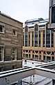 | 1350 |
| Warwick | EC4 | Yes |  |
1150[n 9] |
| Gough | EC4 | Yes | .jpg) | 480 |
| Ludgate | EC4 | No | .jpg) | 0 |
| Queen | WC1 | Yes |  |
8660 |
| Red Lion | WC1 | Mainly |  |
7200 |
| Gray's Inn | WC1 | Yes | .jpg) | 4430 |
| South | WC1 | Yes | 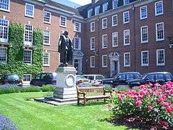 |
2600 |
| Bloomsbury | WC1 | Yes |  |
12000 |
| Regent | WC1 | Yes |  |
7500 |
| Mecklenburgh | WC1 | Mainly |  |
18000 |
| Granville | WC1 | Yes | .jpg) |
5000 |
| Wilmington | WC1 | Yes |  | 7200 |
| Lloyd | WC1 | Yes | .jpg) |
4900 |
| Fleet | WC1 | Yes | [n 11][n 12] | 1850 |
| Wells | WC1 | Mainly | [n 12] | 1400 |
| Argyle | WC1 | Yes |  |
7800 |
| Brunswick | WC1 | Yes | 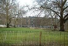 |
18000 |
| Torrington | WC1 | Mainly |  |
8800 |
| Tavistock | WC1 | Yes |  |
18000 |
| Gordon | WC1 | Yes | 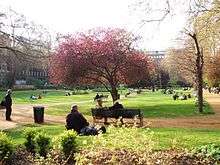 |
16000[n 14] |
| Woburn | WC1 | Yes |  |
6200 |
| Russell | WC1 | Yes |  |
40000 |
| Bedford | WC1 | Yes | 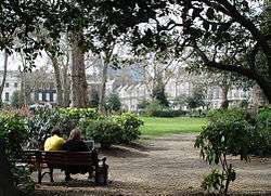 |
17000 |
| New | WC2 | Yes |  | 7000 |
Inner
North and northwest
| Name | Post district | Open-to-sky area between buildings | Image | m² |
|---|---|---|---|---|
| Canonbury | N1 | Yes | .jpg) | 8500 |
| Union | N1 | Yes | .jpg) | 5700 |
| Arlington | N1 | Yes |  | 9200 |
| Claremont | N1 | Yes | _-_geograph.org.uk_-_1523970.jpg) | 12000 |
| King's Cross Square | N1 | Yes | 6900 | |
| Hoxton | N1 | Yes | 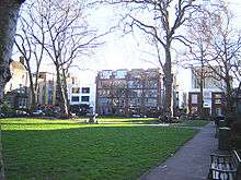 | 6000 |
| Lewis Cubitt Square | N1 | Yes | 5200 | |
| Charles | N1 | Yes | .jpg) | 2700 |
| Highbury | N5 | Yes |  | 9900 |
| Cloudesley | N1 | Mainly | .jpg) | 4800 |
| John Spencer | N1 | Yes | .jpg) | 5200[n 16] |
| De Beauvoir | N1 | Yes |  | 12000 |
| Old Royal Free | N1 | Yes |  | 2800 |
| Lonsdale | N1 | Yes | 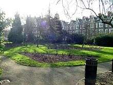 | 5250 |
| Gibson | N1 | Yes |  | 8200 |
| Milner | N1 | Yes |  | 4900 |
| Barnsbury | N1 | Yes | .jpg) | 7750 |
| Edward | N1 | Yes |  | 5900 |
| Alwyne | N1 | Yes |  | 3600 |
| Wellington | N1 | Yes | 3750 | |
| Anderson | N1 | Yes | 1400 | |
| Peabody | N1 | Yes | .jpg) | 1350 |
| Packington | N1 | Yes | 2500 | |
| Canalside | N1 | Yes | 3800 | |
| Red House | N1 | Yes | 3000 | |
| Wilton | N1 | Yes |  | 4200[n 17] |
| Pond | N6 | Mainly |  | 6400 |
| Park | NW1 | Yes |  | 28000 |
| Euston | NW1 | Yes |  | 7000 |
| Munster | NW1 | Yes | .jpg) | 4400 |
| Dorset | NW1 | Yes |  | 8500 |
| Blandford | NW1 | Yes | 1500 each[n 18] | |
| Thornhill | NW1 | Mainly |  | 20000 |
| Chalcot | NW1 | Yes | 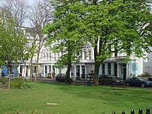 | 3600 |
| Tolmers | NW1 | Yes |  | 2000[n 20] |
| Oakley | NW1 | Yes |  | 13000[n 21] |
| Harrington | NW1 | Yes |  | 8000[n 22] |
| Ampthill | NW1 | Yes |  | 5000[n 23] |
| Elliott | NW1 | No | 0 | |
| St Mark’s | NW1 | Mainly | .jpg) | 3000 |
| Alma | NW8 | Yes | .jpg) | 2800 |
| Camden | NW1 | Yes | .jpg) | 16000 |
| Northpoint and Caledonian | NW1 | No | 0[n 24] | |
| Triton | NW1 | No |  | 0 |
| Rochester | NW1 | No | 0 | |
| Islington | N1 | No | 0 | |
| 1 Hamond | N1 | No | 0[n 25] | |
| Hoffman | N1 | No | 0 | |
| Uhura | N16 | No | 0 |
West and southwest
| Name | Post district | Open-to-sky area between buildings | Image | m² |
|---|---|---|---|---|
| Eaton | SW1 | Yes |  | 51000 |
| Vincent | SW1 | Yes | 47000 | |
| Belgrave | SW1 | Yes |  | 36000 |
| Grosvenor | W1 | Yes | 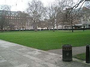 | 30000 |
| St George's | SW1 | Mainly | 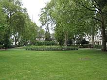 | 22000 |
| Berkeley | W1 | Yes |  | 20000 |
| Portman | W1 | Yes |  | 20000 |
| Eccleston | SW1 | Yes |  | 18000 |
| Onslow | SW7 | Yes |  | 17000[n 16] |
| Warwick | SW1 | Yes |  | 15000 |
| Cavendish | W1 | Yes |  | 14500 |
| Parliament | SW1 | Yes | 14000 | |
| Bryanston | W1 | Yes | 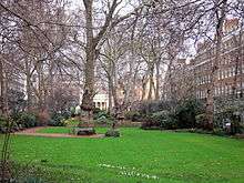 | 14000 |
| Redcliffe | SW10 | Mainly |  | 13500 |
| Dolphin | SW1 | Mainly | .jpg) | 12000[n 26] |
| Thurloe | SW7 | Yes |  | 12000 |
| Montagu | W1 | Yes |  | 11000 |
| Lowndes | SW1 | Yes |  | 11000 |
| Cleveland | W2 | Yes |  | 10000 |
| Kensington Gardens | W8 | Mainly |  | 10000[n 16] |
| Kensington | W8 | Yes | 8400 | |
| Smith | SW1 | Mainly |  | 5900[n 27] |
| Fitzroy | W1 | Yes | 8700 | |
| Nevern | SW5 | Yes |  | 8700 |
| Manchester | W1 | Yes |  | 8000 |
| Hereford | SW7 | Yes | .jpg) | 7400 |
| Chelsea | SW3 | Yes | 10000 | |
| Carlyle | SW3 | Yes |  | 8200 |
| Tedworth | SW3 | Yes | 4800 | |
| Cadogan | SW1 | Yes | .jpg) | 13000 |
| Edwardes | W8 | Yes |  | 16000 |
| Norland | W11 | Yes |  | 12000 |
| Pembridge | W2 | Yes | .jpg) | 10000 |
| Sloane | SW1 | Yes |  | 6000 |
| Duke of York | SW3 | Mainly |  | 5000[n 28] |
| Paultons | SW3 | Yes | .jpg) | 6500 |
| Earl’s Court | SW5 | Yes |  | 6400 |
| Ebury | SW1 | Yes |  | 6000 |
| Brompton | SW3 | Yes | 6200[n 29] | |
| Markham | SW3 | Yes |  | 4500 |
| Montpelier | SW7 | Yes |  | 4300 |
| Alexander | SW3 | Yes |  | 4200[n 30] |
| Ovington | SW3 | Yes | .jpg) | 2600 |
| Trevor | SW7 | Yes | .jpg) | 2800 |
| Lindsay | SW1 | Mainly | .jpg) | 2000 |
| Victoria | SW1 | Yes | 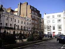 | 1250 |
| Pearson | W1 | Mainly | 1600 | |
| Wellington | SW3 | Yes | 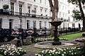 | 1500 |
| Admiral | SW10 | Yes | .jpg) | 1080 |
| Coleridge | SW10 | Yes |  | 1040[n 12] |
| St Mary’s | W2 | Yes |  | 1250 |
| Gloucester | W2 | Yes | 8200 | |
| Hyde Park | W2 | Yes | 8000 | |
| Sussex | W2 | Yes | 7750 | |
| Connaught | W2 | Yes | 6800 | |
| Norfolk | W2 | Yes | 6400 | |
| Sheldon | W2 | Mainly |  | 6000 |
| Cambridge | W2 | Yes |  | 4200 |
| Oxford | W2 | Yes |  | 4200 |
| Talbot | W2 | Yes | 3000 | |
| Lancer | W8 | Yes | 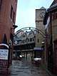 | 3550 |
| Rose | SW3 | Yes | .jpg) | 1200[n 31] |
| Chantry | W8 | Yes | 1200[n 32] | |
| St Andrews | W11 | Yes | 1000 | |
| Wesley | W11 | Yes | .jpg) | 2200 |
| Colville | W11 | Mainly | 3300 | |
| Porchester | W2 | Yes | 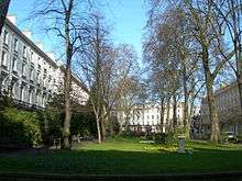 | 5780 |
| Powis | W11 | Yes | .jpg) | 4400 |
| Orme | W11 | Yes | .jpg) | 1980 |
| Prince's | W2 | Yes | .jpg) | 7200 |
| Leinster | W2 | Yes | 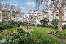 | 7200 |
| Katherine | W11 | Yes | 950 | |
| Campden Hill | W8 | Yes |  | 8500 |
| Wycombe | W8 | Yes | 2000 | |
| Ravenscourt | W6 | Yes | .jpg) | 3200 |
| St Peter's Square | W6 | Yes |  | 13000 |
| Ashcroft | W6 | Yes | .jpg) | 4800[n 33] |
| Westcroft | W6 | Yes | 3200 | |
| Lyric | W6 | Yes |  | 2000 |
| Audley, South Audley Street | W1 | Yes |  | 500 |
| Chesterton | W8 | Yes |  | 2050[n 34] |
| Grafton | SW4 | Yes |  | 7500 |
| Battersea | SW11 | Yes | .jpg) | 1150 |
| Rathbone | W1 | Yes | 800[n 35] | |
| Shuters (Sun Road) | W14 | Yes | 800 | |
| Vine | W14 | Yes | 800 | |
| Orchard | W14 | Yes | 600 | |
| Ivory | SW11 | Yes |  | 500 |
| Nottingdale | W11 | Yes | [n 24] | 450 |
| Macaulay | SW4 | Yes | 1500[n 35] | |
| Imperial | SW6 | Yes | .jpg) | 2700 |
| Hurlingham | SW6 | Yes | 2620 | |
| Marryat | SW6 | Yes | 950 | |
| Queen’s Elm | SW3 | Yes | 900 | |
| Lampeter | W6 | No | [n 36] | 400 |
| Restoration | SW11 | No | 510[n 35] | |
| White's | SW4 | No | 0 | |
| Philpot | SW6 | No | 0 | |
| Mortimer | W11 | No | 0 | |
| St Charles | W10 | No |  | 0 |
| Franklin | W14 | No |  | 0 |
| Fountain | SW1 | No |  | 0 |
| Brassey | SW11 | No | 0 | |
| Cavalry | SW3 | No | 0 |
South
| Name | Postal district | Open to air communal space | Image | m² |
|---|---|---|---|---|
| Surrey | SE1 | Yes | .jpg) | 18000 |
| Dickens | SE1 | Mainly | .jpg) | 12000 |
| Avondale | SE1 | Mainly | .jpg) | 10000 |
| Trinity Church | SE1 | Mainly |  | 7700[n 37] |
| Lorrimore | SE17 | Mainly |  | 7400 |
| Nightingale | SW12 | Yes | .jpg) | 7000 |
| Sutherland | SE17 | Not mainly | .jpg) | 7000 |
| Albert | SW8 | Yes | .jpg) | 6500 |
| West | SE11 | Yes | .jpg) | 6400 |
| Thorburn | SE1 | Mainly |  | 6000 |
| Nelson | SE1 | Yes |  | 6000 |
| Peckham | SE15 | Mainly |  | 5000 |
| Cleaver | SE11 | Yes | .jpg) | 4800 |
| Peabody | SE1 | Yes | 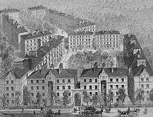 | 4500[n 16] |
| Addington | SE5 | Yes | 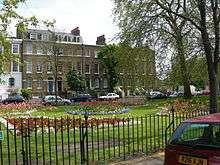 | 4200 |
| St. Philip | Battersea, SW8 | Not mainly |  | 4000[n 38] |
| Providence | SE1 | Yes | .jpg) | 4000 |
| Merrick | SE1 | Yes | _-_geograph.org.uk_-_1765992.jpg) | 3600 |
| Montague | SE15 | Yes | 3200 | |
| Walcot | SE11 | Yes |  | 2700[n 39] |
| Perkins | SE1 | Yes |  | 2600 |
| Bermondsey | SE16 | Yes | .jpg) | 2500 |
| Gatehouse | SE1 | Yes |  | 2100 |
| Helsinki | SE16 | Yes | .jpg) | 2000 |
| Millennium, Shad Thames | SE1 | Yes | 1700 | |
| Greenacre | SE16 | Yes | 1600[n 11] | |
| Reveley | SE16 | Yes | 420[n 11] | |
| Brewery | SE1 | Yes |  | 660 |
| Edward | SE16 | Yes | .jpg) | 900 |
| Elizabeth | SE16 | Yes | .jpg) | 640 |
| Frederick | SE16 | Yes | | 640 |
| Helena | SE16 | Yes | | 640 |
| Sophia | SE16 | Yes | | 640 |
| William | SE16 | Yes | | 640 |
| New Place | SE16 | Yes | 3800 | |
| Lockwood | SE16 | Yes | 4800 | |
| Marden | SE16 | Yes | 5100 | |
| Layard | SE16 | Yes | 6000[n 16] | |
| St Olavs or St Olav's | SE16 | Yes | .jpg) | 2000[18][19][n 16] |
| Great Guildford Business | SE1 | Not mainly | 200 | |
| Oslo | SE16 | Yes | 2300 | |
| Bergen | SE16 | Yes | 1950 | |
| Tillett | SE16 | Yes | 200 | |
| Graphite, Vauxhall Walk | SE11 | Yes | 500 | |
| Cornwall, Kennings Way | SW11 | Yes | 2800[n 40] | |
| John Parker | SW11 | Yes | .jpg) | 1000[n 11] |
| Fenner | SW11 | Yes | .jpg) | 1000[n 11] |
| Holliday | SW11 | Yes | 1000[n 11] | |
| Weekley | SW11 | Yes | 1000[n 11] | |
| Winchester | SE1 | Mainly | 730 | |
| Cobalt | Vauxhall, SW8 | Yes |  | 1500 |
| St Georges or Saint George's | SE8 | Yes | .jpg) | 3000[n 41] |
| Granville | SE15 | Yes | 800 | |
| Yarnfield | SE15 | Yes | 2200 | |
| Vivian | SE15 | Yes | 1000 | |
| Galatea | SE15 | Yes | 2500[n 16] | |
| Huguenot | SE15 | Yes | 1400 | |
| Bonnington | SW8 | Yes |  | 900 |
| Hamilton | SE1 | Yes | 550 | |
| Fountain Green | SE16 | Yes | .jpg) | 970[n 11] |
| Rust | SE5 | No | 0 | |
| Shard's | SE15 | No | 0[n 42] | |
| Choumert | SE15 | No | 0 | |
| Flat Iron | SE1 | No | 0[20] | |
| Gagarin, Southwark Street | SE1 | No | 0[n 39] | |
| Queen Annes | SE1 | No | 0 | |
| Westminster Business | SE11 | No | 0[n 43] |
East
| Name | Post district | Open to air communal space | Image | m² |
|---|---|---|---|---|
| Clapton | E5 | Yes |  | 12000 |
| Canada | E14 | Yes | .jpg) | 12000 |
| Ion | E2 | Yes | .jpg) | 9000 |
| Carlton | E1 | Yes | .jpg) | 9000 |
| Tredegar (/trɪˈdiːɡər/, Welsh: [trɛˈdeːɡar]) | E3 | Yes | .jpg) | 8900 |
| Beaumont | E1 | Yes | 8500 | |
| Cabot | E14 | Yes | .jpg) | 8200 |
| Royal Victoria | E16 | Yes | 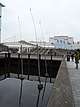 | 5500 |
| St David’s | E14 | Yes | .jpg) | 5500 |
| Harpley | E1 | Yes | 5000 | |
| Bishops, Old Spitalfields Market | E1 | Yes | 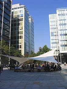 | 5500 |
| Thomas More | E1 | Mainly | 4500 | |
| Ford | E1 | Yes | 4000 | |
| Sidney | E1 | Yes |  | 3950 |
| Avis | E1 | Yes | 3000 | |
| Petticoat | E1 | Mainly |  | 3800 |
| Rectory | E1 | Yes |  | 2800 |
| The Mother's | E5 | Yes | 2500[n 11][n 19] | |
| Wellclose | E1 | Not mainly | .jpg) | 800 |
| Hooper | E1 | Yes | 1600 | |
| Hornbeam | E3 | Yes | 1070 | |
| Jasmine | E3 | Yes | 1070 | |
| Grayling | E2 | Yes | 900 | |
| Times | E1 | Yes | 900[n 44] | |
| Lea | E3 | Yes | 800 | |
| Bartholomew, Cudworth Street | E1 | Yes | .jpg) | 700 |
| Arbour | Stepney, E1 | Yes |  | 6300 |
| Brayford | E1 | Yes | 1100[n 45] | |
| O’Leary | E1 | Yes | 1700 | |
| Douthwaite | E1 | Yes | 840[n 11] | |
| Cork | E1 | Yes | 500[n 11] | |
| The Watergarden, Roy | E14 | Yes | 1100[n 46] | |
| York | E14 | Yes |  | 2800 |
| Cutlers | E14 | Yes | 895[n 11] | |
| Vulcan | E14 | Yes | 900[n 11] | |
| Torres | E14 | Yes | 300[n 11] | |
| Bering | E14 | Yes | 300[n 11] | |
| Shalbourne | E9 | Yes | .jpg) | 1200[n 11] |
| Silk Mills | E9 | Yes | _(cropped).jpg) | 1200[n 11] |
| Leabank | E9 | Yes | 2500 | |
| Alphabet | E3 | Yes | 2000[n 11] | |
| Gerry Raffles and Theatre | E15 | Yes |  | 2500 |
| Heylyn | E3 | Yes | 2300 | |
| Sheffield | E3 | Yes | 1700 | |
| Guerin | E3 | Yes | 1600 | |
| Trellis | E3 | Yes | 1500 | |
| Stonechat | E6 | Yes | 1200[n 11] | |
| Partridge | E6 | Yes | 1200[n 11] | |
| Lampern | E2 | Yes | 1300 | |
| Old Market | E2 | Yes | .jpg) | 1000 |
| Ambassador | E14 | Yes | 1100[n 47] | |
| St George's or Saint George's Square | E14 | Yes | 700 | |
| Aqua Vista | E3 | Yes | 900 | |
| Lanark | E14 | Yes | .jpg) | 1800 |
| Burrells Wharf | E14 | Yes |  | 2500 |
| Capstan | E14 | Yes | 2000 | |
| Botanic | E14 | Yes | .jpg) | 6000 |
| Hopewell | E14 | Yes | 2400 | |
| Carter | E14 | Yes | 1000 | |
| St Thomas’s | E9 | Yes |  | 6000 |
| St Peter’s | E2 | Yes |  | 2000 |
| Pollard | E2 | Yes | 6400 | |
| Market, Chrisp Street | E14 | Yes |  | 3000 |
| Fassett | E9 | Yes | .jpg) | 2200 |
| Shaw | E17 | Yes | 1275 | |
| Sutton (or Urswick Road) | E9 | Yes | 2400[n 11] | |
| The Square, High Road/York Road | E10 | Yes | 2000 | |
| Patriot | E2 | No | 0 | |
| Spital | E1 | No | 0[n 49] | |
| Cumberland Mills | E14 | No | 0[n 43] | |
| Murray | E16 | No | .jpg) | 0 |
| St George's | E7 | No | 0 | |
| Regent | E3 | No | 0 | |
| Old School | E14 | No | 0 | |
| Athol | E14 | No | 0 | |
| Torrens | E15 | No | 0 | |
| Olympus | E5 | No | 0 | |
| Transom | E14 | No | 0 | |
| Forge | E14 | No | 0 | |
| Warrior | E12 | No | 0 | |
| St Luke’s | E16 | No | 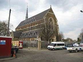 | 0 |
| Goldsmith’s | E2 | No | .jpg) | 0 |
| Education | E1 | No | 0 | |
| Portland | E1 | No | 1180[n 43] | |
| Martineau | E1 | No | 0[n 50] | |
| Chant | E15 | No | 0 | |
| Barnby | E15 | No | 0 | |
| Primrose | E9 | No | 0 | |
| Principal, Chelmer Road | E9 | No | 0 | |
| Albert | E15 | No | .jpg) | 0 |
| Maryland | E15 | No | .jpg) | 0 |
| Tollgate | E6 | No | 0[n 50] | |
| Goose | E6 | No | 0[n 50] | |
| Butterfield | E6 | No | 0[n 50] |
Renamed squares note:
- Albert Gardens
- Trafalgar Gardens
These two 19th century built Squares are officially renamed as shown. This avoids confusion with other squares in London.
Outer
East
| Name | Post town | Post district | Open to air communal space | Image | m² |
|---|---|---|---|---|---|
| Eastbury | Barking | IG11 | Mainly |  | 9000 |
| Brandesbury | Woodford Green | IG8 | Yes | 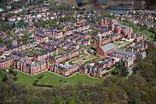 | 3000 |
| Rosebury | Woodford Green | IG8 | Yes | | 3000 |
| Brackley | Woodford Green | IG6 | Yes | 1500[n 51] | |
| Warrington | Dagenham | RM8 | Yes | 2700 | |
| The Square | Ilford | IG1 | Yes | 1850 | |
| Noel | Dagenham | RM8 | Yes | 1400[n 52] | |
| Causton | Dagenham | RM9 | Yes | 2300 | |
| Arnett | London | E4 | Yes | 2700 | |
| Manor | Dagenham | RM8 | No | 0 | |
| Osborne | Dagenham | RM9 | No | 0 | |
| Hunters | Dagenham | RM9 | No | 0 | |
| The Square | Woodford Green | IG8 | No | 0 |
West
(the London Boroughs of Hillingdon, Hounslow and Ealing, exc. Harefield, Isleworth and Feltham)
| Name | Post town | Post district | Open to air communal space | Image | m² |
|---|---|---|---|---|---|
| The Square | Hayes, Uxbridge | UB11 | Yes | 11000 | |
| Sutton | Heston, Hounslow | TW5 | Yes | .jpg) | 7100 |
| Townfield | Hayes | UB3 | Yes | 6500 | |
| Emerald | Southall | UB2 | Yes | 4700 | |
| Halliday | Southall | UB2 | Yes | 1800[n 11] | |
| Cubitt | Southall | UB2 | Yes | 1400[n 11] | |
| Coleridge | London | W13 | Yes | 1200[n 11] | |
| Victoria | London | W5 | Yes | 820 | |
| St Mary’s or Old Ealing | London | W5 | Yes |  | 800 |
| Chiswick | London | W4 | No |  | 0 |
| Essex Place (Market)[n 53] | London | W4 | Yes | 860 | |
| Dolphin | London | W4 | No | 0[n 50] | |
| Epsom | Hounslow | TW6 | No | .jpg) | 0 |
| Cardington | Hounslow | TW4 | No | 0 | |
| Drenon | Hayes | UB3 | No | 0 | |
| Tudor | Hayes | UB3 | No | 0 | |
| Mission | Brentford | TW8 | No | .jpg) | 0 |
| Ferry | Brentford | TW8 | No | 0 |
South West
Royal/London Boroughs of Kingston-upon-Thames, Richmond upon Thames and Wandsworth, excluding Battersea, Norwood, Clapham and Balham.
| Name | Post town | Post district | Open to air communal space | Image | m² |
|---|---|---|---|---|---|
| New | Bedfont, Feltham | TW14 | Yes | 20000[n 11] | |
| St. Andrew’s | Surbiton | KT6 | Yes | 8900 | |
| Toland | London | SW15 | Yes | 6000[n 46][n 16] | |
| Aubyn | London | SW15 | Yes | 3200[n 46] | |
| Chapman | London | SW19 | Yes | .jpg) | 3000 |
| Barringer | London | SW17 | Yes | 1900 | |
| Heathfield | London | SW18 | Mainly not | 13000 | |
| Red Lion | London | SW18 | No | 0 | |
| Hardwicks | London | SW18 | No | 0 | |
| St Edmunds (or Saint Edmunds) | London | SW13 | Yes | 1800 | |
| Emerald | London | SW15 | Yes | 1900 | |
| Radcliffe | London | SW15 | Yes | 1600 | |
| Gillis | London | SW15 | Yes | 1300 | |
| Vanneck | London | SW15 | Yes | 1250 | |
| Bevin | London | SW17 | Yes | 1200 | |
| Chartfield | London | SW15 | Yes | 900 | |
| New Chapel | Feltham | TW13 | Yes | .jpg) | 1400[n 35] |
| Topiary | Richmond | TW9 | Yes | .jpg) | 1400 |
| Heron | Richmond | TW9 | Yes |  | 860[n 46] |
| Charlotte (Pyland Road) | Richmond | TW10 | Yes | 1300[n 46] | |
| Memorial | Kingston upon Thames | KT1 | Yes | 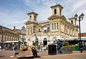 | 1600 |
| Sigrist | Kingston upon Thames | KT1 | Yes | 600 | |
| Noel | Teddington | TW11 | Yes | 500[n 46] | |
| Lower | Isleworth | TW7 | Yes | .jpg) | 730 |
| Upper | Isleworth | TW7 | Yes | .jpg) | 210[n 39] |
| Cheriton | London | SW17 | No | .jpg) | 0 |
| Memorial | Isleworth | TW7 | No | .jpg) | 0 |
| Belvedere | London | SW19 | No | 0 | |
| George | London | SW19 | No | 0 | |
| Magna | London | SW14 | No | 0[n 43] | |
| Pavilion | London | SW17 | No | 0[n 43] | |
| The Square | Richmond | TW9 | No |  | 0 |
| King George | Richmond | TW10 | No | 0 | |
| Fleetwood | Kingston upon Thames | KT1 | No | 0[n 43] | |
| Charter | Kingston upon Thames | KT1 | No | 0 | |
| Ernest | Kingston upon Thames | KT1 | No | 0 | |
| Rosebery | Kingston upon Thames | KT1 | No | 0 | |
| Waters | Kingston upon Thames | KT1 | No | 0 | |
| Ashcombe | New Malden | KT3 | No | 0[n 43] | |
| Idmiston | New Malden | KT3 | No | 0 | |
| St George’s | New Malden | KT3 | No | 0 | |
| St Leonards | Surbiton | KT6 | No | 0 |
.jpg)
South East
Royal/London Boroughs of Greenwich, Lewisham, Bexley and Bromley (plus Norwood and Dulwich)
| Name | Post town | Post district | Open to air communal space | Image | m² |
|---|---|---|---|---|---|
| Ryculff | London | SE3 | Mainly | 5000 | |
| Artillery | London | SE18 | Yes | 3800 | |
| Watermens | London | SE20 | Yes | 3800 | |
| James Clavell | London | SE18 | Yes |  | 3000 |
| Pavilion | London | SE18 | Yes | 1300[n 46] | |
| School | London | SE10 | Yes | 1500[n 46] | |
| Palace | London | SE19 | Yes | 2000 | |
| Talisman | London | SE26 | Yes | 2000 | |
| Chiswell | London | SE3 | Yes | 2100 | |
| Gibbs | London | SE19 | Yes | 2000 | |
| Market | Bromley | BR1 | Yes | 1700 | |
| Robert | London | SE13 | Yes | 2000 | |
| Les Smith or Leslie Smith | London | SE18 | Yes | 880[n 43] | |
| Kingston | London | SE19 | Not mainly | 900 | |
| Tristan | London | SE3 | Yes | 800[n 16] | |
| Old Clem | London | SE18 | Mainly | 850 | |
| St Paul’s | Bromley | BR2 | Not mainly | 580 | |
| Roman | London | SE28 | Yes | 480 | |
| Corvette | London | SE10 | Yes | 380[n 46] | |
| Collins | London | SE3 | Not mainly | 350 | |
| Oregon | Orpington | BR6 | No | 0 | |
| Peppermead | London | SE13 | No | 0[n 24] | |
| Archer | London | SE14 | No | 0 | |
| Beresford | London | SE18 | No | 0 | |
| Reginald | London | SE8 | No | 0 | |
| Ealdham | London | SE9 | No | 0 | |
| Adams | Bexleyheath | DA6 | No | 0 | |
| Brook | London | SE18 | No | 0 | |
| Mortgramit | London | SE18 | No | 0 | |
| Gainsborough | Bexleyheath | DA6 | No | 0 | |
| Regent | Belvedere | DA17 | No | 0 |
North
| Name | Post town | Post district | Open to air communal space | Image | m² |
|---|---|---|---|---|---|
| Arundel | London | N7 | Yes | 12000 | |
| Cornwallis | London | N19 | Mainly | 9500 | |
| Topham | London | N17 | Yes | 1600 | |
| Broadfield | Enfield | EN1 | Yes | 1500 | |
| Westbrook | Cockfosters, Barnet | EN4 | Yes | 1500 | |
| Sambroke | Barnet | EN4 | Yes | 800[n 11] | |
| Albion | London | E8 | Yes | 5800 | |
| Evergreen | London | E8 | Yes | .jpg) | 4600 |
| Chow | London | E8 | Yes | .jpg) | 600 |
| Time | London | E8 | Yes | 300 | |
| Schonfeld | London | N16 | Not mainly | 2000[n 11][n 16] | |
| Christina | London | N4 | No | 0[n 11] | |
| Brunswick | London | N17 | No | 0[n 43] | |
| Chaplin | London | N12 | No | 0 | |
| Hamilton (Sandringham Gardens) | London | N12 | No | 0 | |
| Red (Piano Lane) | London | N16 | No | 0 |
South
| Name | Post town | Post district | Open to air communal space | Image | m² |
|---|---|---|---|---|---|
| Exchange | Croydon | CR0 | Mainly | 4000 | |
| Stanley | Carshalton | SM5 | Yes | 3950 | |
| Alexandra | Morden | SM4 | Yes | 2500 | |
| Glebe | Mitcham | CR4 | Yes | 1350[n 46] | |
| Kennet | Mitcham | CR4 | Yes | 1100[n 11] | |
| Cameron | Mitcham | CR4 | Yes | 900[n 11] | |
| Tyrrell | Mitcham | CR4 | Yes | 650[n 11] | |
| Appleton | Mitcham | CR4 | Yes | 350[n 11] | |
| Torrington | Croydon | CR0 | Yes | 700 | |
| Rathbone (Tanfield Road) | Croydon | CR0 | Yes | 200[n 35] | |
| Times | Sutton | SM1 | No | 0 | |
| Wallington | Wallington | SM6 | No | 0 | |
| Queen's | Croydon | CR0 | No | 0 |
North west
| Name | Post town | Post district | Open to air communal space | Image | m² |
|---|---|---|---|---|---|
| Chelmsford | London | NW4 | Yes | 6300 | |
| South | London | NW11 | Mainly |  | 7600 |
| Central | London | NW11 | Yes | | 10000 |
| North | London | NW11 | Mainly | 7600 | |
| Litchfield | London | NW11 | Yes | 1500 | |
| Lucas | London | NW11 | Yes | .jpg) | 1500 |
| Linden | Harefield, Uxbridge | UB11 | Yes | 1500[n 11] | |
| Seaton | London | NW7 | Yes | 1080 | |
| Sentinel | London | NW4 | Yes | 450 | |
| Hampden | London | N14 | Yes | 5000 | |
| Wembley Central | Wembley | HA9 | Yes | .jpg) | 6400 |
| Belsize | London | NW3 | Not mainly | 10000 | |
| St Leonard’s | London | NW5 | No | 0 | |
| Elliott | London | NW3 | No | 0 | |
| New End | London | NW3 | No | 0 | |
| The Mount | London | NW3 | No |  | 0 |
| Ashbourne | Northwood | HA6 | No | 0 |
Demolished
- Angel Square, EC1
- Billiter Square, EC3
- Holford Square[lower-alpha 1]
- Harewood Square[lower-alpha 2]
- Pancras Square[lower-alpha 3]
- became Bevin Court, north of Percy Circus, Pentonville
- became forecourt zone between overground and underground Marylebone stations
- A very small square.
Notes and References
- Notes
- A pentagon. One actual square is directly north and commonly confused by map makers, the Green. Nine smaller courtyards exist, e.g., Preacher's Court, Pensioners Court, Masters Court: mostly green.
- Within subdivision of a building (into three), a courtyard, linked by public ways to all but north side. Takes up site of Furnival's Inn.
- historic hardscapes north and south of Clerkenwell Road
- a C-shaped building with a raised terrace occupying the void
- Bartholomew Court of the Redbrick Estate could be said to comprise it yet its north side remains: three buildings, today numbered №s 20-28.
- including avenue/plaza East approach in the m² shown.
- Taken as Mark Street Gardens, fronting south-west of this short street
- North-west mini-extension omitted
- A tree on a verge then a side yard with a surface car park in the City of London
- Forms the east of Coram’s Fields
- Car park with a much smaller zone of trees, lawn or shrubs
- Smaller than the large communal courtyard(s) in the same estate
- Forms the west of Coram’s Fields
- Excludes SE greens with table zone used by UCL
- Part of Lincoln's Inn. One side is open (to Lincoln's Inn Fields)
- Set around two greens
- The outer sides form four lines, one very short; the inner sides i.e. the communal gardens are a rounded triangle
- Green, landscaped zones south of four parallel housing blocks; replaced original square and four small streets
- An oval.
- An irregular octagon, with housing facing on seven sides, opened by road eighth side and mini-roundabout; extra courtyards and gated.
- As from Victorian layout, an elongated semi-hexagon, with large green
- A triangle with arterial road
- And extra zones of green and playgrounds
- Recesses in a building’s front (car parks in indents) are marked no for ease of reference.
- Block of flats with smaller garden to rear
- More than 1000 flats occupy the Houses of Dolphin Square, the building sitting in the square is its Sports Centre with café/restaurant. Beatty House, Collingwood House, Drake House, Duncan House, Frobisher House, Grenville House and Hawkins House, Hood House, Howard House, Keyes House, Nelson House, Raleigh House, Rodney House
- Half of Smith Square is a church if excluding the circular road with five exits surrounding
- Retail estate, north of, and café-centrepiece town square
- A long lune shape
- Alexander Square is on one side trees to the back of houses on Egerton Crescent (the only square is conceived taking in Brompton Road), has three minor roads around the other sides of its thin strip of green divided in two by another minor road
- Most of the gardens are to the side at Rose Square, a former hospital, Fulham Road, Chelsea, London
- Chantry Square is set around a small circle with a semi-circular hedge
- Shopping centre
- Chesterton Square is a large courtyard of a large civic/social housing building
- A courtyard
- South part has a courtyard used for parking and small shrubbery
- Half of Trinity Church Square is Henry Wood Hall, an Arts Organisation that replaced the church.
- Half of St Philip Square is the Church of St Philip with St Bartholomew.
- Triangular
- Cornwall Square is divided by fences among the owners.
- Bounded by the Thames, a boat repair marina and the roads named Deptford Wharf and Plough Way, St George’s Square in SE8 has no homes or businesses.
- A narrow asphalted accessway
- A cross- or t-shaped road, without such space or with apartments that have courtyard(s); mainly a parking lot or accessway.
- Mainly water
- T shaped, pedestrian hardscape
- A directly enclosed-by-homes, green courtyard
- A tree set in complex-footprint hardstanding
- Octagon: three sides unfilled
- A short street, leading past Bishops Square, becoming Lamb Street
- Part of a road with a slight kink
- Mostly fenced separate homes and gardens; has a railed verge, with shrubbery, of size stated
- Three triangles (a tree- and shrub-planted verge crossed by two roads and bounded by another)
- Sometimes considered part of Chiswick High Road
- References
- London Buildings Acts (Amendment) Act 1939, Part 2: Naming and Numbering of Streets and Buildings.
- Street Naming application pack Example policy list from Kensington and Chelsea, replacing similar earlier rule. Retrieved 2018-03-12
- "Your garden square and you" Archived 2006-07-11 at the Wayback Machine, Royal Borough of Kensington and Chelsea, London, UK. URL accessed 20 June 2006.
- Camilla Phelps, "London opens its gates". The English Garden, June 2013, 97.
- "Square" Details of 21st century square, at Farm Lane, Fulham, London Square Group, 2018
- "Square"" Details of 21st century square at Waldegrave Road, Teddington, London Square Group, 2018
- "Brunswick Square, Orpington" Berkeley Homes Group, 2018
- "Royal Warwick Square, Kensington", Berkeley Homes Group, 2018
- "St George's Square, Sudbury Hill, Harrow" Taylor Wimpey, 2018
- "Tolworth Square, Surbiton" Taylor Wimpey, 2018
- Phelps, "London opens its gates". The English Garden, June 2013, 95–98.
- "World Archaeology Festival 2013", UCL.
- "Cédric Le Borgne: Was That a Dream?". visitlondon.com.
- Smith, Rupert (2005). EastEnders: 20 Years in Albert Square. BBC Books. p. 15. ISBN 978-0-563-52165-5.
- "Bench in Soho Square". Kirsty MacColl. 2001-08-12. Retrieved 2011-02-03.
- http://www.lindisfarne.co.uk/discography/elvis-lives-on-the-moon.htm
- Historic England. "lamp post in Pensioners Court (1206699)". National Heritage List for England.
- Historic England. "Archway to Rotherhithe Tunnel Approach (1385848)". National Heritage List for England.
- Historic England. "Rotherhithe (Norwegian Seamen) War Memorial (1449959)". National Heritage List for England.
- Flat Iron Square at Google Maps; a street food market that was once a large parking lot, between Southwark St and Union St.
- Has three squares opening out onto the Thames
External links
| Wikimedia Commons has media related to Urban squares in London. |