Route F26 (Iceland)
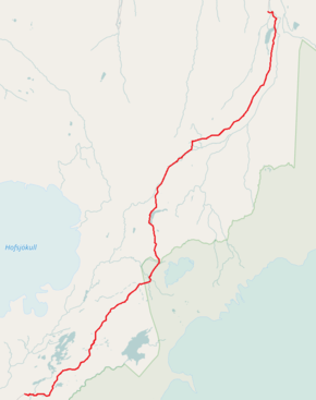
Route F26 or Sprengisandsleið is a highland gravel road in Iceland, running through the Sprengisandur area between the glaciers Hofsjökull and Vatnajökull.
| |
|---|---|
| Sprengisandsleið | |
 | |
| Route information | |
| Length | 154.5 km (96.0 mi) |
| Major junctions | |
| Northern end | |
| Southern end | |
| Highway system | |
| F-tracks in Iceland | |

With its 200 km, it is the longest of the Icelandic highland roads. Its southern end is at the lake Þórisvatn, to the northeast of the volcano Hekla, and its northern end is the south part of Bárðardalur valley, to the southwest of lake Mývatn.
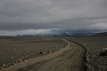
A view of Sprengisandur road with a view of Tungnaárjökull, a tongue of Vatnajökull, in August.
External links
Routes through the interior highlands of Iceland | ||
|---|---|---|
|  | |
This article is issued from Wikipedia. The text is licensed under Creative Commons - Attribution - Sharealike. Additional terms may apply for the media files.