Devica
Devica (Serbian Cyrillic: Девица) is a mountain in eastern Serbia, near the town of Sokobanja. Its highest peak, Čapljinac (also called Manjin Kamen[2]) has an elevation of 1,187 m (3,894 ft) above sea level. It belongs to the boundary of Carpathian and Balkan mountain ranges, which meet in eastern Serbia.[3]
| Devica | |
|---|---|
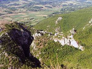 Ruins of Soko Grad | |
| Highest point | |
| Elevation | 1,187 m (3,894 ft) [1] |
| Coordinates | 43°35′38″N 21°56′39″E |
| Geography | |
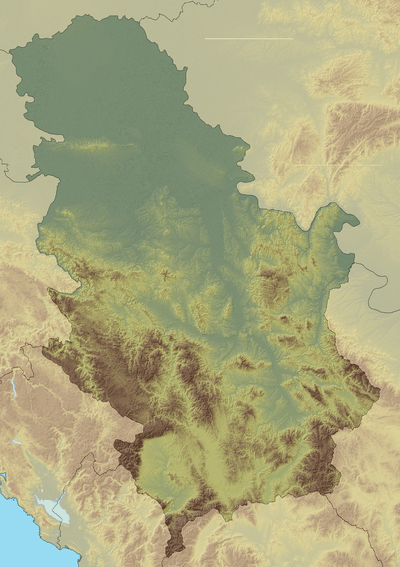 Devica Location in Serbia | |
| Location | Eastern Serbia |
It is bounded by the spa town on Sokobanja and river Moravica on north, Labukovo on south, road Sokobanja-Labukovo on west, and Galibabinac on east. The deep canyon of Moravica is cut into Devica's northern edge, dominated by the old fortress Soko Grad.[3] At the height of around 1100 m there is a large plateau, with several caves and other carst formations. Except for parts near Sokobanja, it has no tourist facilities and is relatively unknown to the wider public.[1]
References
- "Devica" (in Serbian). Sokobanja.org.
- "Ozren i Devica" (in Serbian). PSD Poštar Novi Sad.
- "Devica" (in Serbian). Archived from the original on 2010-09-25. Retrieved 2010-08-11.
Divisions, Groups, and Ranges of the Carpathian Mountains | ||||||
|---|---|---|---|---|---|---|
| Western Carpathians |
| 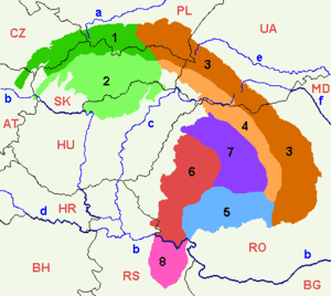 | ||||
| Eastern Carpathians |
| |||||
| Southern Carpathians | ||||||
| Western Romanian Carpathians | ||||||
| Serbian Carpathians |
| |||||
| Adjacent regions |
| |||||
| Grouping by country |
| |||||