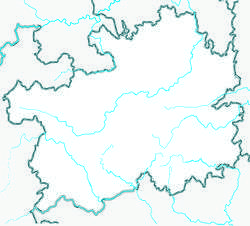
Songtao Miao Autonomous County
Songtao Miao Autonomous County (simplified Chinese: 松桃苗族自治县; traditional Chinese: 松桃苗族自治縣; pinyin: Sōngtáo Miáozú Zìzhìxiàn) is an autonomous county in the northeast of Guizhou province, China, bordering Chongqing to the north and Hunan province to the east. It is under the administration of the prefecture-level city of Tongren.
Songtao County 松桃县 Sungtao, Sung-t'ao | |
|---|---|
County | |
| 松桃苗族自治县 Songtao Miao Autonomous County | |
 Songtao Location of the seat in Guizhou 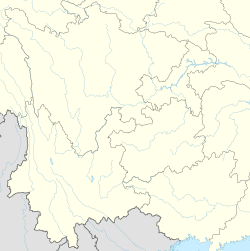 Songtao Songtao (Southwest China) | |
| Coordinates (Songtao County government): 28°09′14″N 109°12′11″E | |
| Country | People's Republic of China |
| Province | Guizhou |
| Prefecture-level city | Tongren |
| Area | |
| • Total | 3,400 km2 (1,300 sq mi) |
| Elevation | 411 m (1,348 ft) |
| Population (2010) | |
| • Total | 486,511 |
| • Density | 140/km2 (370/sq mi) |
| Time zone | UTC+8 (China Standard) |
| Postal code | 558200 |
| Area code(s) | 0856 |
| Website | http://www.songtao.gov.cn/ |
Administrative divisions
Towns (13): Liaogao (蓼皋镇) | Pandan (盘石镇) | Panxin (盘信镇) | Dapingchang (大坪场镇) | Pujiao (普觉镇) | Zhaiying (寨英镇) | Mengqi (孟溪镇) | Wuluo (乌罗镇) | Ganlong (甘龙镇) | Changxingbao (长兴堡镇) | Yajia (迓驾镇) | Daxing (大兴镇) | Niulang (牛郎镇)
Townships (15): Jiujang (九江乡) | Shichang (世昌乡) | Zhengda (正大乡) | Changping (长坪乡) | Taipingying (太平营乡) | Pingtou (平头乡) | Dalu (大路乡) | Miao'ai (妙隘乡) | Lengshuiqi (冷水溪乡) | Danliang (石梁乡) | Waqi (瓦溪乡) | Yong'an (永安乡) | Mushu (木树乡) | Huangban (黄板乡) | Shabahe (沙坝河乡)
Climate
| Climate data for Songtao (1981−2010) | |||||||||||||
|---|---|---|---|---|---|---|---|---|---|---|---|---|---|
| Month | Jan | Feb | Mar | Apr | May | Jun | Jul | Aug | Sep | Oct | Nov | Dec | Year |
| Record high °C (°F) | 24.6 (76.3) |
30.4 (86.7) |
33.1 (91.6) |
34.8 (94.6) |
35.9 (96.6) |
36.8 (98.2) |
39.6 (103.3) |
39.3 (102.7) |
38.2 (100.8) |
34.8 (94.6) |
30.1 (86.2) |
23.6 (74.5) |
39.6 (103.3) |
| Average high °C (°F) | 8.7 (47.7) |
10.7 (51.3) |
15.1 (59.2) |
21.5 (70.7) |
26.1 (79.0) |
28.8 (83.8) |
31.9 (89.4) |
32.0 (89.6) |
28.1 (82.6) |
21.8 (71.2) |
16.9 (62.4) |
11.5 (52.7) |
21.1 (70.0) |
| Daily mean °C (°F) | 4.9 (40.8) |
6.8 (44.2) |
10.6 (51.1) |
16.3 (61.3) |
20.8 (69.4) |
24.1 (75.4) |
26.9 (80.4) |
26.4 (79.5) |
22.6 (72.7) |
17.0 (62.6) |
12.0 (53.6) |
7.0 (44.6) |
16.3 (61.3) |
| Average low °C (°F) | 2.3 (36.1) |
4.1 (39.4) |
7.4 (45.3) |
12.7 (54.9) |
16.9 (62.4) |
20.6 (69.1) |
23.0 (73.4) |
22.4 (72.3) |
18.8 (65.8) |
13.9 (57.0) |
8.9 (48.0) |
3.9 (39.0) |
12.9 (55.2) |
| Record low °C (°F) | −5.5 (22.1) |
−5.3 (22.5) |
−2.6 (27.3) |
2.3 (36.1) |
8.0 (46.4) |
12.6 (54.7) |
16.3 (61.3) |
15.5 (59.9) |
11.3 (52.3) |
4.2 (39.6) |
−1.9 (28.6) |
−5.1 (22.8) |
−5.5 (22.1) |
| Average precipitation mm (inches) | 37.9 (1.49) |
43.7 (1.72) |
64.7 (2.55) |
128.4 (5.06) |
182.7 (7.19) |
203.7 (8.02) |
183.3 (7.22) |
139.4 (5.49) |
91.6 (3.61) |
104.9 (4.13) |
58.6 (2.31) |
30.0 (1.18) |
1,268.9 (49.97) |
| Average relative humidity (%) | 79 | 78 | 79 | 80 | 81 | 82 | 79 | 80 | 79 | 83 | 80 | 77 | 80 |
| Source: China Meteorological Data Service Center | |||||||||||||