Kimchaek
Kimch'aek (Korean pronunciation: [kim.tsʰɛk̚]), formerly Sŏngjin (Chosŏn'gŭl: 성진, Hancha: 城津), is a city in North Hamgyong Province, North Korea. It was an open port in 1899.[1] It has a population of 207,699.
Kimchaek 김책시 | |
|---|---|
| Korean transcription(s) | |
| • Chosŏn'gŭl | 김책시 |
| • Hancha | 金策市 |
| • McCune-Reischauer | Kimch'aek si |
| • Revised Romanization | Gimchaek-si |
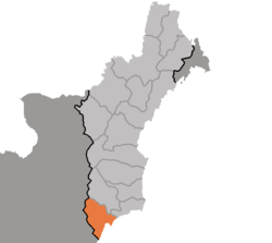 Map of North Hamgyong showing the location of Kimchaek | |

| |
 Kimchaek Location within North Korea | |
| Coordinates: 40°40′2″N 129°12′2″E | |
| Country | North Korea |
| Province | North Hamgyong |
| Administrative divisions | 22 tong, 22 ri |
| Population (2008) | |
| • Total | 207,699 |
| • Dialect | Hamgyŏng |
| Time zone | UTC+9 (Pyongyang Time) |
Etymology
The city received its current name in 1951 during the Korean War, in honor of the Korean People's Army (KPA) general, Kim Chaek.[1] It was known as "Shirotsu" during Japanese rule between 1910 and 1945.
Climate
Kimchaek has a hot-summer humid continental climate (Köppen climate classification: Dfb).[2]
| Climate data for Kimchaek | |||||||||||||
|---|---|---|---|---|---|---|---|---|---|---|---|---|---|
| Month | Jan | Feb | Mar | Apr | May | Jun | Jul | Aug | Sep | Oct | Nov | Dec | Year |
| Record high °C (°F) | 14.0 (57.2) |
16.7 (62.1) |
27.8 (82.0) |
35.2 (95.4) |
34.0 (93.2) |
34.3 (93.7) |
37.0 (98.6) |
36.6 (97.9) |
32.9 (91.2) |
30.2 (86.4) |
23.7 (74.7) |
17.8 (64.0) |
37.0 (98.6) |
| Average high °C (°F) | −0.3 (31.5) |
1.0 (33.8) |
5.5 (41.9) |
12.1 (53.8) |
16.3 (61.3) |
19.6 (67.3) |
23.9 (75.0) |
25.9 (78.6) |
22.7 (72.9) |
17.2 (63.0) |
9.2 (48.6) |
2.3 (36.1) |
13.0 (55.4) |
| Daily mean °C (°F) | −5.3 (22.5) |
−3.8 (25.2) |
0.9 (33.6) |
7.0 (44.6) |
11.8 (53.2) |
15.5 (59.9) |
20.1 (68.2) |
22.1 (71.8) |
17.8 (64.0) |
11.8 (53.2) |
4.6 (40.3) |
−2.2 (28.0) |
8.4 (47.1) |
| Average low °C (°F) | −10.4 (13.3) |
−8.7 (16.3) |
−3.3 (26.1) |
2.6 (36.7) |
7.4 (45.3) |
12.4 (54.3) |
17.5 (63.5) |
19.2 (66.6) |
13.7 (56.7) |
7.1 (44.8) |
−0.3 (31.5) |
−7.3 (18.9) |
4.2 (39.6) |
| Record low °C (°F) | −26.0 (−14.8) |
−20.0 (−4.0) |
−15.0 (5.0) |
−7.1 (19.2) |
−0.5 (31.1) |
1.0 (33.8) |
9.0 (48.2) |
10.6 (51.1) |
2.8 (37.0) |
−4.0 (24.8) |
−16.6 (2.1) |
−25.1 (−13.2) |
−26.0 (−14.8) |
| Average precipitation mm (inches) | 19.4 (0.76) |
16.8 (0.66) |
23.8 (0.94) |
37.4 (1.47) |
51.5 (2.03) |
72.5 (2.85) |
120.2 (4.73) |
166.6 (6.56) |
83.6 (3.29) |
42.1 (1.66) |
34.0 (1.34) |
29.7 (1.17) |
697.6 (27.46) |
| Average precipitation days (≥ 1.0 mm) | 5 | 3 | 3 | 4 | 7 | 7 | 8 | 9 | 6 | 4 | 5 | 5 | 65 |
| Average relative humidity (%) | 63 | 64 | 65 | 70 | 78 | 86 | 88 | 85 | 77 | 70 | 64 | 60 | 72 |
| Mean monthly sunshine hours | 173 | 197 | 231 | 225 | 222 | 141 | 141 | 173 | 207 | 218 | 172 | 161 | 2,261 |
| Source 1: Deutscher Wetterdienst (sun, 1961–1990)[3][4][lower-alpha 1] | |||||||||||||
| Source 2: Meteo Climat (extremes, 1906–present)[5] | |||||||||||||
Administrative divisions
Kimch'aek-si is divided into 22 tong (neighbourhoods) and 22 ri (villages):
|
|
Economy
Kimchaek is an important port on the Sea of Japan (East Sea of Korea), and is home to an ironworks and the Kimch’aek Polytechnic Institute.[1]
Transport
Kimchaek is on the Pyongra Line railway.
See also
- List of cities in North Korea
- List of Korea-related topics
- Geography of North Korea
Notes
- Station ID for Kimchaek is 47025 Use this station ID to locate the sunshine duration
References
- "Kimch'aek". Encyclopaeida Britannica’. Retrieved 8 December 2012.
- "Kimchaek climate: Average Temperature, weather by month, Kimchaek weather averages". Climate-Data.org. Retrieved 6 November 2019.
- "Klimatafel von Kimchaek / Korea (Nordkorea)" (PDF). Baseline climate means (1961-1990) from stations all over the world (in German). Deutscher Wetterdienst. Retrieved 6 November 2016.
- "Station 47025 Kimchaek". Global station data 1961–1990—Sunshine Duration. Deutscher Wetterdienst. Archived from the original on 17 October 2017. Retrieved 6 November 2016.
- "Station Songjin (Kimchaek)" (in French). Meteo Climat. Retrieved 6 November 2016.
Further reading
- Dormels, Rainer. North Korea's Cities: Industrial facilities, internal structures and typification. Jimoondang, 2014. ISBN 978-89-6297-167-5
| Wikimedia Commons has media related to Kimchaek. |
External links

| 2,000,000 and more |
|
|---|---|
| 1,000,000–1,999,999 |
|
| 500,000–999,999 | |
| 200,000–499,999 | |