Haeju
Haeju[lower-alpha 1] (Korean pronunciation: [hɛ.dzu]) is a city located in South Hwanghae Province near Haeju Bay in North Korea. It is the administrative centre of South Hwanghae Province. As of 2008, the population of the city is estimated to be 273,300. At the beginning of the 20th century, it became a strategic port in Sino-Korean trade. Haeju has chemical-related enterprises and a cement factory.
Haeju 해주시 | |
|---|---|
| Korean transcription(s) | |
| • Chosŏn'gŭl | 해주시 |
| • Hancha | 海州市 |
| • McCune-Reischauer | Haeju-si |
| • Revised Romanization | Haeju-si |
 Views of Haeju | |
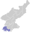
 Map of South Hwanghae showing the location of Haeju | |

| |
 Haeju Location within North Korea | |
| Coordinates: 38°3′N 125°43′E | |
| Country | |
| Province | South Hwanghae Province |
| Administrative divisions | 25 tong, 4 ri |
| Area | |
| • Total | 206.9 km2 (79.9 sq mi) |
| Population (2008) | |
| • Total | 273,300 |
| • Dialect | Hwanghae |
| Time zone | UTC+9 (Pyongyang Time) |
History
The area around Haeju is known to have been inhabited since the Neolithic period, as shellmounds, pottery, and stone tools have been found at Ryongdangp'o. During the early Three kingdoms period, it was briefly governed by a small chieftain, when it was known as "Naemihol" (內米忽郡). In 757, however, it was conquered by the Goguryeo kingdom, who later lost it to Silla. It was under the Goryeo dynasty's King T'aejo that it received its current name.
Sohyon Academy (소현서원) was a Confucian academy founded near Haeju by the famous scholar Yi I (1536–84) after his retirement. It is situated in Unbyong Valley, a part of Soktamgugok (Nine valleys of pools and rocks.
According to the North Korean government, the North Korean attack on South Korea on 25 June 1950 was a response to a two-day long bombing by the South Koreans and their surprise attacks on Haeju and other places. Early in the morning of 25 June, before the dawn counterattack in the North Korean account, the South Korean Office of Public Information announced that the Southern forces had captured Haeju. The South Korean government later denied capturing the town and blamed the report on an exaggerating officer. Yugoslavia and the Soviet Union proposed that North Korea would be invited to the UN Security Council to present its side of the story. Both proposals were voted down.[2]
Geography
Haeju City is located on the westernmost edge of the Korean Peninsula, 60 km north of the Military Demarcation Line and 100 km south of Pyongyang. The city, being not very mountainous, is composed mostly of plains. All the mountains located within the city are under 1,000 m in elevation.
Mountains
- Mountain Suyang, 946 m.
- Mountain Jangdae, 686 m.
- Nam Hill, 122 m.
Climate
Haeju has a humid continental climate (Köppen climate classification: Dwa), with cold, dry winters and hot, humid summers.
| Climate data for Haeju | |||||||||||||
|---|---|---|---|---|---|---|---|---|---|---|---|---|---|
| Month | Jan | Feb | Mar | Apr | May | Jun | Jul | Aug | Sep | Oct | Nov | Dec | Year |
| Record high °C (°F) | 12.0 (53.6) |
14.7 (58.5) |
22.9 (73.2) |
27.7 (81.9) |
34.5 (94.1) |
36.0 (96.8) |
36.0 (96.8) |
37.2 (99.0) |
34.0 (93.2) |
29.6 (85.3) |
25.0 (77.0) |
17.2 (63.0) |
37.2 (99.0) |
| Average high °C (°F) | −0.4 (31.3) |
1.8 (35.2) |
7.8 (46.0) |
15.3 (59.5) |
20.5 (68.9) |
24.8 (76.6) |
27.7 (81.9) |
28.8 (83.8) |
24.8 (76.6) |
18.7 (65.7) |
11.2 (52.2) |
2.2 (36.0) |
15.2 (59.4) |
| Daily mean °C (°F) | −4.8 (23.4) |
−2.6 (27.3) |
2.8 (37.0) |
9.9 (49.8) |
15.6 (60.1) |
20.0 (68.0) |
23.6 (74.5) |
24.7 (76.5) |
19.7 (67.5) |
13.1 (55.6) |
5.7 (42.3) |
−1.6 (29.1) |
10.5 (50.9) |
| Average low °C (°F) | −8.7 (16.3) |
−6.8 (19.8) |
−1.0 (30.2) |
5.6 (42.1) |
11.0 (51.8) |
16.1 (61.0) |
21.2 (70.2) |
21.8 (71.2) |
16.1 (61.0) |
8.9 (48.0) |
2.3 (36.1) |
−5.6 (21.9) |
6.7 (44.1) |
| Record low °C (°F) | −18.9 (−2.0) |
−19.0 (−2.2) |
−12.0 (10.4) |
−6.1 (21.0) |
0.0 (32.0) |
2.0 (35.6) |
10.9 (51.6) |
9.8 (49.6) |
2.3 (36.1) |
−4.7 (23.5) |
−11.1 (12.0) |
−18.0 (−0.4) |
−19.0 (−2.2) |
| Average precipitation mm (inches) | 15.5 (0.61) |
14.9 (0.59) |
32.6 (1.28) |
67.2 (2.65) |
81.4 (3.20) |
119.7 (4.71) |
344.7 (13.57) |
259.7 (10.22) |
113.0 (4.45) |
38.2 (1.50) |
36.2 (1.43) |
24.4 (0.96) |
1,147.5 (45.18) |
| Average precipitation days (≥ 1.0 mm) | 3 | 2 | 5 | 5 | 6 | 7 | 14 | 10 | 6 | 4 | 6 | 5 | 73 |
| Average relative humidity (%) | 67 | 64 | 63 | 64 | 68 | 76 | 85 | 79 | 71 | 66 | 68 | 70 | 70 |
| Mean monthly sunshine hours | 188 | 184 | 213 | 224 | 235 | 197 | 133 | 188 | 210 | 215 | 164 | 169 | 2,320 |
| Source 1: Deutscher Wetterdienst (sun, 1961–1990)[3][4][lower-alpha 2] | |||||||||||||
| Source 2: Meteo Climat (extremes, 1957–present)[5] | |||||||||||||
Administrative divisions
Haeju is divided into several urban neighborhoods ("dong") and several rural villages ("ri").[6]
| Chosŏn'gŭl | Hancha | |
|---|---|---|
| Changch'un-dong | 장춘동 | 長春洞 |
| Haech'ŏng-dong | 해청동 | 海清洞 |
| Haeun-dong | 해운동 | 海運洞 |
| Hakhyŏn-dong | 학현동 | 鶴峴洞 |
| Kuje-dong | 구제동 | 九齊洞 |
| Kwangha-dong | 광하동 | 廣河洞 |
| Kwangsŏk-tong | 광석동 | 廣石洞 |
| Kyŏlsŏng-dong | 결성동 | 結城洞 |
| Namsan-dong | 남산동 | 南山洞 |
| Okkye-dong | 옥계동 | 玉溪洞 |
| Puyong-dong | 부용동 | 芙蓉洞 |
| Ryongdang-dong | 룡당동 | 龍塘洞 |
| Saegŏri-dong | 새거리동 | 새거리洞 |
| Sami-dong | 사미동 | 四美洞 |
| Sansŏng-dong | 산성동 | 山城洞 |
| Sŏae-dong | 서애동 | 西艾洞 |
| Sŏkch'ŏn-dong | 석천동 | 石川洞 |
| Sŏkmi-dong | 석미동 | 石美洞 |
| Sŏnsan-dong | 선산동 | 仙山洞 |
| Sŭngma-dong | 승마동 | 乘馬洞 |
| Taegok-tong | 대곡동 | 大谷洞 |
| Ŭpp'a-dong | 읍파동 | 邑波洞 |
| Yangsa-dong | 양사동 | 養社洞 |
| Yŏnggwang-dong | 영광동 | 榮光洞 |
| Yŏnha-dong | 연하동 | 煙下洞 |
| Chakch'ŏl-li | 작천리 | 鵲川里 |
| Changbang-ri | 장방리 | 長芳里 |
| Singwang-ri | 신광리 | 神光里 |
| Yŏngyang-ri | 영양리 | 迎陽里 |
Culture and travel
Famous tourist attractions in the city center include Puyong Pavilion, the Haeju Dharani Monument, the Haeju Sokbinggo, and several trees classified as living monuments. Farther out, scenic spots include Suyangsan Falls, the Sokdamgugok scenic area, Suyangsan Fortress and the Sohyon Academy.
Economy
Haeju Special Economic Zone was announced in the Second Inter-Korean summit meeting between the South Korean president Roh Moo-Hyun and the North Korean leader Kim Jong-Il. It was to be a Special Economic Zone centered on the Haeju port. The zone would have consisted of 16.5 km2 of development, and also the expansion of the Haeju port. This project was estimated to cost over US$4.5 billion.
This economic agreement between South Korea and North Korea would have allowed trading across the Northern Limit Line[7] between the ports of Incheon and Haeju, only 110 km apart. Recent military skirmishes make any revival of this deal unlikely for the time being.
Transportation
Haeju has a military and civilian dual purposes air station (HAE), with a 12/30 runway (Haeju Airport). Haeju also has one of the major economic and military ports in North Korea. It is connected to Sariwŏn via the Hwanghae Ch'ŏngnyŏn Line of the Korean State Railway.
Education
Haeju is home to Haeju University of Education, Haeju College of Art, and Kim Je Won Haeju University of Agriculture. Sohyon Academy (소현서원) was a Confucian academy founded by the famous scholar Yi Yulgok (1536–84). It is situated in the Unbyong Valley west of Haeju.
Media
The Korean Central Broadcasting Station airs on AM 1080 kHz using a 1.5-megawatt mediumwave transmitter.
People born in Haeju
- Choe Chung (984–1068), Confucian scholar and poet
- Choe Yun-ui (1102–1162), Confucian scholar
- Choe Manri (d. 1445), minister of Hall of Worthies
- Syngman Rhee, the first president of South Korea
- Kim Koo (1876–1949), last president of the Provisional Government of the Republic of Korea
- An Jung-geun (1879–1910), independence activist who assassinated Itō Hirobumi
- Mirok Li (1899–1950), writer
- Kang Joon-ho (1928–1990), bronze-medalist Olympic boxer (1952)
- Jong Song-ok (1974), marathon gold-medalist & Olympic runner
Haeju is the home of the Haeju Choi and the Haeju Oh clan.
See also
Notes
- In the 19th century, Haeju was sometimes spelled Hai-tsiou.[1]
- Station ID for Haeju is 47069 Use this station ID to locate the sunshine duration
Citations
- EB (1878), p. 390.
- William Blum (2004). Killing Hope: US Military and CIA Interventions Since World War II. Zed Books Ltd. pp. 46–48.
- "Klimatafel von Haeju / Korea (Nordkorea)" (PDF). Baseline climate means (1961-1990) from stations all over the world (in German). Deutscher Wetterdienst. Retrieved 24 January 2016.
- "Station 47069 Haeju". Global station data 1961–1990—Sunshine Duration. Deutscher Wetterdienst. Archived from the original on 17 October 2017. Retrieved 6 November 2016.
- "Station Haeju" (in French). Meteo Climat. Retrieved 6 November 2016.
- "중앙일보 - 아시아 첫 인터넷 신문".
- Rodger Baker (24 November 2010). "Importance of the Koreas' Northern Limit Line". STRATFOR. Retrieved 4 December 2010.
- "Agreements Signed between DPRK and Ecuador". KCNA. 27 April 2008. Archived from the original on 8 September 2017.
- "Sister Relations Established between Cities in DPRK and Russia". KCNA. 30 September 2012. Archived from the original on 8 September 2017. Retrieved 3 December 2017.
Bibliography
- , Encyclopædia Britannica, 9th ed., Vol. VI, New York: Charles Scribner's Sons, 1878, pp. 390–394.
Further reading
- Dormels, Rainer. North Korea's Cities: Industrial facilities, internal structures and typification. Jimoondang, 2014. ISBN 978-89-6297-167-5
External links
| Wikimedia Commons has media related to Haeju. |
| Wikivoyage has a travel guide for Haeju. |
- Haeju at Curlie
- North Korea Uncovered
- Haeju photos. Traveller's blog with pictures from North Korea
- City profile of Haeju
| 2,000,000 and more |
|
|---|---|
| 1,000,000–1,999,999 |
|
| 500,000–999,999 | |
| 200,000–499,999 | |