Kyongwon County
Kyŏngwŏn County is a kun, or county, in North Hamgyong province, North Korea, located at 42°48′41″N 130°11′58″E, formerly known as Saebyŏl. It is bordered by the People's Republic of China to the north and east, Kyonghung to the southeast, Hoeryong to the southwest, and Onsong to the west.
Kyongwon County 경원군 | |
|---|---|
| Korean transcription(s) | |
| • Hanja | 慶源郡 |
| • McCune–Reischauer | Kyŏngwŏn-gun |
| • Revised Romanization | Gyeongwon-gun |
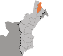 Map of North Hamgyong showing the location of Kyongwon | |
| Country | North Korea |
| Region | Kwanbuk |
| Province | North Hamgyong |
| Administrative divisions | 1 ŭp, 3 rodongjagu, 21 ri |
| Area | |
| • Total | 888 km2 (343 sq mi) |
| Population (2008)[1] | |
| • Total | 107,327 |
The western region of Kyongwon is mountainous, while the east is relatively flat. The highest point is Chungsan. The largest river is the Tumen, which flows along the eastern border. Numerous tributaries of the Tumen also flow through the county. Approximately 75% of the county is forested.
Aside from agriculture, livestock raising and sericulture are widespread. The chief local crops are rice, corn, and soybeans. Bituminous coal is also mined.
Railroads passing through Kyongwon include the Hambuk and Kogonwon Lines. It is also connected by rail to the Chinese city of Hunchun in the Yanbian autonomous prefecture.
History
Under Joseon period Kyongwon was invaded by Jurchens tribes in 1409. Therefore, to safeguard his people from the hostile Chinese and Jurchen people (later known as Manchus) living in Manchuria, King Sejong the Great of Joseon ordered to establish there one of the six post/garrisons (hangul :육진 hanja :六鎭) in 1433. In 1977 the county's name was changed to Saebyol, but it was later reverted.[2]
Administrative divisions
Kyongwon County is divided into 1 town ("ŭp") 21 villages ("ri") and 3 worker's districts ("rodongjagu", abbreviated as "gu").[2][3]
|
|
Note: The Korean syllabe "som" (섬) in Ryudasom-ri, is converted into hanja "do" 島 because both of them means island in that case.
See also
- North Hamgyong
- Geography of North Korea
- Administrative divisions of North Korea
External links
References
- DPR Korean Central Bureau of Statistics: 2008 Population Census Archived 2010-03-31 at the Wayback Machine (Population 2008, published in 2009)
- "함경북도 경원군 개요 - 북한지역정보넷". North Korean Human geography. The Institute for Peace Affairs. Retrieved 21 February 2013.
- "새별군 - 북한지명사전". North Korea Net. JoongAng Ilbo. Retrieved 26 February 2013.
