Singhanakhon District
Singhanakhon District (Thai: สิงหนคร, pronounced [sǐŋ.hàʔ.náʔ.kʰɔ̄ːn]) is a district (amphoe) in the northern part of Songkhla Province, southern Thailand.
Singhanakhon สิงหนคร | |
|---|---|
.jpg) Beach near Hat Kaeo Resort, Songkhla | |
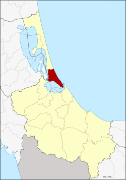 District location in Songkhla Province | |
| Coordinates: 7°14′18″N 100°33′10″E | |
| Country | Thailand |
| Province | Songkhla |
| Seat | Sathing Mo |
| Area | |
| • Total | 228.0 km2 (88.0 sq mi) |
| Population (2005) | |
| • Total | 79,281 |
| • Density | 347.7/km2 (901/sq mi) |
| Time zone | UTC+7 (ICT) |
| Postal code | 90330 |
| Geocode | 9015 |
Geography
Neighboring districts are (from the south clockwise): Mueang Songkhla, Hat Yai, Khuan Niang of Songkhla Province; Pak Phayun of Phatthalung Province; and Sathing Phra of Songkhla Province. To the east is the Gulf of Thailand.
The district is between Thale Luang and Songkhla Lake.
History
The minor district (king amphoe) was created on 15 February 1988, when 11 tambons were split off from Mueang Songkhla District.[1] It was upgraded to a full district on 19 July 1991.[2]
Administration

The district is divided into 11 sub-districts (tambons), which are further subdivided into 77 villages (mubans). Singhanakhon is a township (thesaban tambon) which covers parts of tambons Ching Kho and Thamnop and tambon Hua Khao and Sathing Mo. There are a further nine tambon administrative organizations (TAO).
| No. | Name | Thai name | Villages | Pop. | |
|---|---|---|---|---|---|
| 1. | Ching Kho | ชิงโค | 10 | 10,920 | |
| 2. | Sathing Mo | สทิงหม้อ | 6 | 15,361 | |
| 3. | Thamnop | ทำนบ | 7 | 4,458 | |
| 4. | Ram Daeng | รำแดง | 7 | 2,734 | |
| 5. | Wat Khanun | วัดขนุน | 8 | 7,937 | |
| 6. | Chalae | ชะแล้ | 5 | 2,868 | |
| 7. | Pak Ro | ปากรอ | 6 | 2,571 | |
| 8. | Pa Khat | ป่าขาด | 5 | 2,846 | |
| 9. | Hua Khao | หัวเขา | 8 | 14,567 | |
| 10. | Bang Khiat | บางเขียด | 5 | 3,500 | |
| 11. | Muang Ngam | ม่วงงาม | 10 | 11,519 |
References
- ประกาศกระทรวงมหาดไทย เรื่อง แบ่งเขตท้องที่อำเภอเมืองสงขลา จังหวัดสงขลา ตั้งเป็นกิ่งอำเภอสิงหนคร (PDF). Royal Gazette (in Thai). 105 (21 ง Special): 73. February 5, 1988.
- พระราชกฤษฎีกาตั้งอำเภอทุ่งตะโก อำเภอพะโต๊ะ อำเภอเขาค้อ อำเภอน้ำหนาว อำเภอวังจันทร์ อำเภอนาด้วง อำเภอเต่างอย อำเภอสิงหนคร อำเภอพระสมุทรเจดีย์ และอำเภอลำดวน พ.ศ. ๒๕๓๔ (PDF). Royal Gazette (in Thai). 108 (107 ก Special): 29–33. June 19, 1991.