Sinegorye
Sinegorye (Russian: Синего́рье; lit. region of blue mountains) is an urban locality (an urban-type settlement) in Yagodninsky District of Magadan Oblast, Russia, located on the Kolyma River, 8 kilometers (5.0 mi) from Kolyma Hydroelectric Station. Population: 2,821 (2010 Census);[1] 4,071 (2002 Census);[5] 11,645 (1989 Census).[6]
Sinegorye Синегорье | |
|---|---|
Urban-type settlement | |
Location of Sinegorye 
| |
 Sinegorye Location of Sinegorye 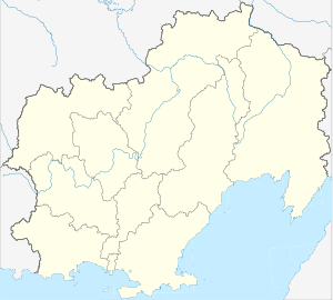 Sinegorye Sinegorye (Magadan Oblast) | |
| Coordinates: 62°05′N 150°31′E | |
| Country | Russia |
| Federal subject | Magadan Oblast |
| Administrative district | Yagodninsky District |
| Founded | 1971 |
| Population | |
| • Total | 2,821 |
| • Estimate (2018)[2] | 2,198 (-22.1%) |
| Time zone | UTC+11 (MSK+8 |
| Postal code(s)[4] | 686222 |
| OKTMO ID | 44722000066 |
Geography
Sinegorye lies around 280 km north-west of the oblast capital of Magadan, on the left bank of the Kolyma near its confluence with the Bakhapcha. The settlement is located in Yagodninsky District, just over 70 km south-east of the administrative centre Yagodnoye.
History
The youngest town in the Kolyma region, Sinegorye was built in the period 1971 to 1981 to house workers for the construction of the nearby dam and hydroelectric power station on the Kolyma River. Sinegorye received status as an urban-type settlement in 1972. The settlement was planned to house up to 10,000 inhabitants, however after the eventual completion of the dam and power plant construction project, the majority of the town's inhabitants moved away, leaving around two thirds of the town's buildings abandoned in the present day.
The remaining population mainly consists of hydro plant employees and their families.
Infrastructure
Sinegorye is connected to the outside world via a 30 km road to Debin, where it connects to the Kolyma Highway to Magadan. Sinegorye Airport was previously located around 20 km north-east of the settlement, operating between the years 1978 and 2000.
Sports
There is a well-equipped slalom track on the nearby mountain slope.
References
- Russian Federal State Statistics Service (2011). "Всероссийская перепись населения 2010 года. Том 1" [2010 All-Russian Population Census, vol. 1]. Всероссийская перепись населения 2010 года [2010 All-Russia Population Census] (in Russian). Federal State Statistics Service.
- "26. Численность постоянного населения Российской Федерации по муниципальным образованиям на 1 января 2018 года". Federal State Statistics Service. Retrieved January 23, 2019.
- "Об исчислении времени". Официальный интернет-портал правовой информации (in Russian). June 3, 2011. Retrieved January 19, 2019.
- Почта России. Информационно-вычислительный центр ОАСУ РПО. (Russian Post). Поиск объектов почтовой связи (Postal Objects Search) (in Russian)
- Russian Federal State Statistics Service (May 21, 2004). "Численность населения России, субъектов Российской Федерации в составе федеральных округов, районов, городских поселений, сельских населённых пунктов – районных центров и сельских населённых пунктов с населением 3 тысячи и более человек" [Population of Russia, Its Federal Districts, Federal Subjects, Districts, Urban Localities, Rural Localities—Administrative Centers, and Rural Localities with Population of Over 3,000] (XLS). Всероссийская перепись населения 2002 года [All-Russia Population Census of 2002] (in Russian).
- "Всесоюзная перепись населения 1989 г. Численность наличного населения союзных и автономных республик, автономных областей и округов, краёв, областей, районов, городских поселений и сёл-райцентров" [All Union Population Census of 1989: Present Population of Union and Autonomous Republics, Autonomous Oblasts and Okrugs, Krais, Oblasts, Districts, Urban Settlements, and Villages Serving as District Administrative Centers]. Всесоюзная перепись населения 1989 года [All-Union Population Census of 1989] (in Russian). Институт демографии Национального исследовательского университета: Высшая школа экономики [Institute of Demography at the National Research University: Higher School of Economics]. 1989 – via Demoscope Weekly.
External links
- Sinegorye photos on the website of Yelena Ilyushenko (in Russian)
- Sinegorye on the website of A. O. Kogodovsky (in Russian)
- Sinegorye on the website of Maxim Khorev (in Russian)
- Sinegorye (Bokhapcha) Weather Station Information
Administrative center: Magadan • Rural localities | |||
| Districts | |||
| Cities and towns | |||
| Urban-type settlements | |||