Sidhi district
Sidhi District is one of the tribal districts of Madhya Pradesh state of India. The town of Sidhi is the district headquarters. The district is part of Rewa Division.
Sidhi district | |
|---|---|
District of Madhya Pradesh | |
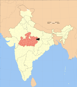 Location of Sidhi district in Madhya Pradesh | |
| Country | India |
| State | Madhya Pradesh |
| Division | Rewa |
| Headquarters | Sidhi |
| Tehsils | 7 |
| Government | |
| • Lok Sabha constituencies | Sidhi |
| Area | |
| • Total | 10,536 km2 (4,068 sq mi) |
| Population (2011) | |
| • Total | 1,127,033 |
| • Density | 110/km2 (280/sq mi) |
| • Urban | 93,121 |
| Demographics | |
| • Literacy | 66.09per cent |
| • Sex ratio | 952 |
| Time zone | UTC+05:30 (IST) |
| Major highways | NH-75 |
| Average annual precipitation | normal mm |
| Website | http://sidhi.nic.in |
History
Sidhi is a part of Madhya Pradesh. It forms the northeastern boundary of the state. Sidhi is known for its natural environment, historical importance and cultural roots. Sidhi has a number of natural resources with the river Son draining the district, and with coal deposits which feed major industries across the country.
This is the birthplace of Birbal. Located in the area is the Sanjay Tiger Reserve or Sanjay National Park which tells the magnificence of the Lions here. There is also a park - Parasli.
Divisions
Sidhi district comprises seven tehsils: Bahari, Churhat, Gopad Banas, Rampur Naikin, Majhauli, Kusmi and Sihawal. There are four Madhya Pradesh Vidhan Sabha constituencies in this district, namely, Churhat, Sidhi, Sihawal and Dhauhani. All of these are part of Sidhi Lok Sabha constituency.
Economy
The Vindhyachal Super Thermal Power Station supplies electricity over a wide area. On one side the spectrum of its floristic socio-cultural diversity and ethnic history of tribal, the district has a panoramic view of the Kaimur, Kehejua and Ranimunda hills blazing with flowers of flame of forest and intoxicated by the sweet smell of mahua flowers. The whole of Sidhi district was part of Rewa state.
In 2006 the Ministry of Panchayati Raj named Chamba one of the country's 250 most backward districts (out of a total of 640).[1] It is one of the 24 districts in Madhya Pradesh currently receiving funds from the Backward Regions Grant Fund Programme (BRGF).[1]
Rulers of Sidhi
In the 1800s, there were three separate rulers of Sidhi, ruling three parts of the territory:
- The Chandela rulers from Bardi (Khatai).
- Second one is Rajasahab of Singrauli.
After these came the Rajput Baghelas came from Kasauta, Rewa. They immigrated to Sidhi in early 19th century. They ruled the western Sidhi territory (Churhat/Rampur) from then on till India gained independence. The last ruler of Churhat was Rao RanBahadur Singhji- elder brother of Arjun Singh.
Raja Kant Deo Singh of Bardi Khatai continues to live in the ancestral Haveli located on the banks of the river Sone. He is an active member of the Bharatiya Janata Party.
Raja Baba of singrauli riyasat who is son in law of arjun singh and was president of MP Mining Department is Current King of His Dynasty.who is an active member of Indian National Congress.
Geography
Sidhi district is located on the Northeastern Boundary of the state between 22,475 and 24.4210 North Latitude and 81:1840 and 824830 East longitude. The district has Singrauli district in the north-east,and Uttar Pradesh Koriya district of Chhattisgarh on the east, and Rewa district on the west.
Sidhi District has a total population of 18,31,152 sharing almost 3.03%of the total population of erstwhile state of Madhya Pradesh in 2001.
Transportation
Air
Closest airport to Sidhi is in Allahabad which is 147 kilometers (91 miles).
Demographics
| Historical population | ||
|---|---|---|
| Year | Pop. | ±% p.a. |
| 1901 | 180,233 | — |
| 1911 | 209,968 | +1.54% |
| 1921 | 180,804 | −1.48% |
| 1931 | 207,401 | +1.38% |
| 1941 | 243,103 | +1.60% |
| 1951 | 266,111 | +0.91% |
| 1961 | 332,774 | +2.26% |
| 1971 | 440,669 | +2.85% |
| 1981 | 532,098 | +1.90% |
| 1991 | 709,436 | +2.92% |
| 2001 | 910,983 | +2.53% |
| 2011 | 1,127,033 | +2.15% |
| source:[2] | ||
According to the 2011 census, Sidhi District has a population of 1,127,033,[3] roughly equal to the nation of Cyprus[4] or the US state of Rhode Island.[5] This gives it a ranking of 411th in India (out of a total of 640).[3] The district has a population density of 232 inhabitants per square kilometre (600/sq mi) .[3] Its population growth rate over the decade 2001-2011 was 23.66%.[3] Sidhi has a sex ratio of 952 females for every 1000 males,[3] and a literacy rate of 66.09%.[3]
Languages
At the time of the 2011 Census of India, 99.08% of the population in the district spoke Hindi and 0.79% Gondi as their first language.[6]
Among the languages spoken in Sidhi are Bagheli, which has a lexical similarity of 72-91% with Hindi[7] (compared to 60% for German and English)[8] and is spoken by about 7,800,000 people in Bagelkhand;[7] and Gondi, a Dravidian language spoken by at least 200,000 members of the Gond tribe and written in the Devanagari script.[9]
Education
In 1980, at the time when Arjun Singh was the chief minister of Madhya Pradesh, a committee was formed to find out more about the educational system in Sidhi district. It was tasked to find out which was the first school in Sidhi district, and also, who was the first graduate.
It was popularly thought that Rajasahab Madhwas was the first graduate from Sidhi. The survey further revealed that Shri Divakar Bahadur Singh, village Jhalwar (Churhat), was the first graduate from Allahabad University. He had done his BA in 1924 and had proceeded to do his LLB also from Allahabd University in 1926. Thereafter he had come back to practice and settle in Jhalwar (Churaht) in Sidhi district. His successors are still present in Jhalwar. Among them, Batuk Pratap Singh (Jhalwar) is the source of information regarding the history events in the district.
It was also found that the first school in Sidhi was in Bardi. This school had started around 100 years before the survey, i.e., around the year 1880
Notable people
- Ajay Pratap Singh, Member of Parliament, Rajya Sabha
- Birbal (Born as Mahesh Das in village Ghoghara in Block Sihawal, Sidhi) was a courtier in Raja Ramchandra Singh Darbar(1555-1592)of Baghela Dynasty, Rewa Rajya (presently in Madhya Pradesh) before moving to Akbar's court.
- Arjun Singh former CM of Madhya Pradesh
- Riti Pathak, Member of Parliament, Parliamentary Constituency No. 11 Sidhi
- Kunwar Singh Tekam, Member of Legislative Assembly, Assembly Constituency No. 82 Dhauhani, Former Chairman Of National Commission for Scheduled Tribes, Govt. Of India, New Delhi
- Arunoday Singh,an Indian film actor. His debut movie was Sikandar. Singh has appeared in Sudhir Mishra's Yeh Saali Zindagi, Pooja Bhatt's Jism 2, David Dhawan's Main Tera Hero, and Ashutosh Gowariker's Mohenjo Daro.
Tourist Places
- Sanjay National Park, which is a part of Sanjay-Dubri Tiger Reserve,[10] is the most popular place to visit.
- The Son River near Bagdara Abhyaranya.
- Parsili Rest House, which is 60.0 km (37.3 miles) from the Sidhi headquarter, near Majhauli Tehsil.
- For viewing the surroundings: Varchar Aashram at Rampur Village, Block Kusami, and Tikari Rest House, which is 40.0 km (24.9 miles) south from Sidhi.
- ghoghra devi mandir and also the birthplace of birbal (navratna of akbar)
- Jogdaha Ghadiyal Abhyaranya near sihawal tehsil
- Ram mandir, which is 5 km away from dist. headquarter
- Chandreh temple
References
- Ministry of Panchayati Raj (September 8, 2009). "A Note on the Backward Regions Grant Fund Programme" (PDF). National Institute of Rural Development. Archived from the original (PDF) on April 5, 2012. Retrieved September 27, 2011.
- Decadal Variation In Population Since 1901
- "District Census 2011". Census2011.co.in. 2011. Retrieved 2011-09-30.
- US Directorate of Intelligence. "Country Comparison:Population". Retrieved 2011-10-01.
Cyprus 1,120,489 July 2011 est.
- "2010 Resident Population Data". U. S. Census Bureau. Retrieved 2011-09-30.
Rhode Island 1,052,567
- 2011 Census of India, Population By Mother Tongue
- M. Paul Lewis, ed. (2009). "Bagheli: A language of India". Ethnologue: Languages of the World (16th ed.). Dallas, Texas: SIL International. Retrieved 2011-09-28.
- M. Paul Lewis, ed. (2009). "English". Ethnologue: Languages of the World (16th ed.). Dallas, Texas: SIL International. Retrieved 2011-09-28.
- M. Paul Lewis, ed. (2009). "Bharia: A language of India". Ethnologue: Languages of the World (16th ed.). Dallas, Texas: SIL International. Retrieved 2011-09-28.
- "No-tiger-in-Sanjay-Tiger-Reserve-also-says-official", NEWS-Environment-Flora-Fauna, Times of India, retrieved 2011-01-19
External links
Places adjacent to Sidhi district | |
|---|---|
| State symbols | |
|---|---|
| Topics |
|
| Governance |
|
| Divisions | |
| Districts |
|
| Major cities | |