Shire of Mckinlay
The Shire of Mckinlay is a local government area in north-western Queensland, Australia.
| Shire of Mckinlay Queensland | |||||||||||||||
|---|---|---|---|---|---|---|---|---|---|---|---|---|---|---|---|
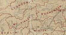
 Location within Queensland | |||||||||||||||
| Population | 814 (2018)[1] | ||||||||||||||
| • Density | 0.019982/km2 (0.05175/sq mi) | ||||||||||||||
| Established | 1891 | ||||||||||||||
| Area | 40,737 km2 (15,728.6 sq mi)[1] | ||||||||||||||
| Mayor | Philip Roland Curr | ||||||||||||||
| Council seat | Julia Creek | ||||||||||||||
| Region | North West Queensland | ||||||||||||||
| State electorate(s) | Traeger | ||||||||||||||
| Federal Division(s) | Kennedy | ||||||||||||||
| Website | Shire of Mckinlay | ||||||||||||||
| |||||||||||||||
It covers an area of 40,737 square kilometres (15,728.6 sq mi), and has existed as a local government entity since 1891. The shire economy is based on beef production and mining. BHP Billiton operate the Cannington mine in the shire, extracting silver, lead and zinc.
History
Wanamarra (also known as Maykulan and Wunumura is an Australian Aboriginal language in North West Queensland. The language region includes areas within the Shire of McKinlay, Shire of Cloncurry and Shire of Richmond, including the Flinders River area, and the towns of Kynuna and Richmond.[2]
The Mackinlay Division was created on 9 December 1891 out of parts of Boulia and Cloncurry under the Divisional Boards Act 1887.
With the passage of the Local Authorities Act 1902, Mackinlay Division became the Shire of Mackinlay on 31 March 1903.
In 1932, the spelling of the shire's name was altered to be Shire of Mckinlay, as the shire was named after the explorer John McKinlay.[3]
On 24 July 1930, it was abolished and a new Shire of Mckinlay was formed from parts of the Shires of Cloncurry, Mckinlay, Winton and Wyangarie (Richmond).
Towns and localities
The Shire of McKinlay includes the following settlements:
- Julia Creek
- Cannington
- Kynuna
- McKinlay
- Nelia
Amenities
The Mckinlay Shire Council operates public libraries at Julia Creek and McKinlay.[4]
Chairmen and mayors
- 1927: W. M. Allison
Population
| Year | Population |
|---|---|
| 1933 | 1,899 |
| 1947 | 1,633 |
| 1954 | 1,647 |
| 1961 | 2,132 |
| 1966 | 1,701 |
| 1971 | 1,582 |
| 1976 | 1,468 |
| 1981 | 1,477 |
| 1986 | 1,446 |
| 1991 | 1,306 |
| 1996 | 1,423 |
| 2001 | 1,358 |
| 2006 | 1,351 |
| 2011 | 1,050 |
| 2016 | 796 |
References
- "3218.0 – Regional Population Growth, Australia, 2017-18: Population Estimates by Local Government Area (ASGS 2018), 2017 to 2018". Australian Bureau of Statistics. Australian Bureau of Statistics. 27 March 2019. Retrieved 25 October 2019. Estimated resident population, 30 June 2018.
-

- "McKinlay Shire". Queensland Places. Centre for the Government of Queensland, University of Queensland. Retrieved 18 September 2013.
- "McKinlay Shire Council". Public Libraries Connect. State Library of Queensland. 20 September 2017. Archived from the original on 6 February 2018. Retrieved 6 February 2018.
- "2008 McKinlay Shire - Mayoral Election - Election Summary". results.ecq.qld.gov.au. Retrieved 4 December 2017.
- "2012 McKinlay Shire - Mayoral Election - Election Summary". results.ecq.qld.gov.au. Retrieved 4 December 2017.
- "2016 McKinlay Shire Council - Mayoral Election - Election Summary". results.ecq.qld.gov.au. Retrieved 4 December 2017.
- "2020 Local Government Elections: Saturday, 28 March 2020". Electoral Commission of Queensland. 2020. Archived from the original on 16 June 2020. Retrieved 16 June 2020.