Sheshma
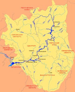
The Sheshma (Russian: Шешма; Tatar: Cyrillic Чишмә, Latin Çişmä) is a river in Tatarstan and Samara Oblast, Russian Federation, a left tributary of the Kama, falling into the Kama near Starosheshminsk. It is 259 kilometres (161 mi) long, of which 227 kilometres (141 mi) are in Tatarstan, and its drainage basin covers 6,040 square kilometres (2,330 sq mi).[1]
| Sheshma | |
|---|---|
 | |
| Location | |
| Country | Tatarstan and Samara Oblast, Russia |
| Physical characteristics | |
| Source | |
| ⁃ location | Samara Oblast |
| ⁃ coordinates | 54°18′46″N 52°24′24″E |
| Mouth | Kama |
⁃ coordinates | 55.4614°N 51.0674°E |
| Length | 259 km (161 mi) |
| Basin size | 6,040 km2 (2,330 sq mi) |
| Basin features | |
| Progression | Kama→ Volga→ Caspian Sea |
The river begins in Samara Oblast, 28 kilometres (17 mi) south of Leninogorsk, Tatarstan. Major tributaries are the Forest Sheshma, Kuvak, Sekines, Kichuy, and Talkysh rivers. The maximal mineralization is 600–700 mg/l. The average sediment deposition at the river mouth per year is 112 millimetres (4.4 in). The river generally is fed by underground water in the dry season. Drainage is regulated. There are major flood-plains in the middle and lower reaches of the Sheshma. Since 1978 it has been protected as a natural monument of Tatarstan.[2] Shugurovo, Novosheshminsk and Starosheshminsk stay on the river.
References
- «Река Шешма», Russian State Water Registry
- "Чишмә". Tatar Encyclopaedia (in Tatar). Kazan: The Republic of Tatarstan Academy of Sciences. Institution of the Tatar Encyclopaedia. 2002.
The river Kama | ||
|---|---|---|
Left tributary of the Volga | ||
| Tributaries | 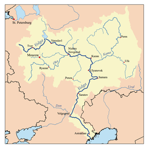 | |
| Reservoirs | ||
| Hydroelectric stations |
| |