Seelyville, Indiana
Seelyville is a town in Lost Creek Township, Vigo County, in the U.S. state of Indiana.[6] The population was 1,029 at the 2010 census. It is part of the Terre Haute Metropolitan Statistical Area.
Seelyville, Indiana | |
|---|---|
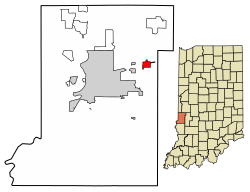 Location of Seelyville in Vigo County, Indiana. | |
| Coordinates: 39°29′32″N 87°15′59″W | |
| Country | United States |
| State | Indiana |
| County | Vigo |
| Township | Lost Creek |
| Area | |
| • Total | 0.91 sq mi (2.35 km2) |
| • Land | 0.89 sq mi (2.30 km2) |
| • Water | 0.02 sq mi (0.05 km2) |
| Elevation | 584 ft (178 m) |
| Population | |
| • Total | 1,029 |
| • Estimate (2018)[4] | 1,020 |
| • Density | 1,150.90/sq mi (444.48/km2) |
| Time zone | UTC−5 (Eastern (EST)) |
| • Summer (DST) | UTC−4 (EDT) |
| ZIP code | 47878 |
| Area code | 812 |
| FIPS code | 18-68652[5] |
| GNIS feature ID | 443203 |
History
Seelyville was originally called the village of Woodsmills. The town was laid out by Moddisett the owner of the land north of the Jonas Seely property, When the Terre Haute and Eastern rail road was built along the south side of town the small whistle stop station hired Jonas Seely as station master. The name was originally the Seely Station but soon expanded to the Seelyville Station.[7] The place came into existence by the opening of the McKeen coal shaft, one of the earliest operated in the county. After passing through several hands, the mine closed operations in 1879. Others operated into the early 1900s. East of Terre Haute by nine miles, the early town had a post office established in 1878 and was a station on the Vandalia Railroad.[8]
Geography
Seelyville is located at 39°29′32″N 87°15′59″W (39.492188, -87.266466).[9]
According to the 2010 census, Seelyville has a total area of 0.91 square miles (2.36 km2), of which 0.89 square miles (2.31 km2) (or 97.8%) is land and 0.02 square miles (0.05 km2) (or 2.2%) is water.[10]
Climate
The climate in this area is characterized by hot, humid summers and generally mild to cool winters. According to the Köppen climate classification system, Seelyville has a humid subtropical climate, abbreviated "Cfa" on climate maps.[11]
Demographics
| Historical population | |||
|---|---|---|---|
| Census | Pop. | %± | |
| 1910 | 1,188 | — | |
| 1920 | 915 | −23.0% | |
| 1930 | 825 | −9.8% | |
| 1940 | 807 | −2.2% | |
| 1950 | 898 | 11.3% | |
| 1960 | 1,114 | 24.1% | |
| 1970 | 1,195 | 7.3% | |
| 1980 | 1,374 | 15.0% | |
| 1990 | 1,090 | −20.7% | |
| 2000 | 1,182 | 8.4% | |
| 2010 | 1,029 | −12.9% | |
| Est. 2018 | 1,020 | [4] | −0.9% |
| U.S. Decennial Census[12] | |||
2010 census
As of the census[3] of 2010, there were 1,029 people, 424 households, and 263 families living in the town. The population density was 1,156.2 inhabitants per square mile (446.4/km2). There were 481 housing units at an average density of 540.4 per square mile (208.6/km2). The racial makeup of the town was 97.8% White, 0.4% African American, 0.2% Native American, 0.2% Asian, 0.2% from other races, and 1.3% from two or more races. Hispanic or Latino of any race were 0.9% of the population.
There were 424 households of which 31.4% had children under the age of 18 living with them, 44.8% were married couples living together, 12.7% had a female householder with no husband present, 4.5% had a male householder with no wife present, and 38.0% were non-families. 29.2% of all households were made up of individuals and 10.6% had someone living alone who was 65 years of age or older. The average household size was 2.40 and the average family size was 2.99.
The median age in the town was 36.2 years. 23.2% of residents were under the age of 18; 10.4% were between the ages of 18 and 24; 27.5% were from 25 to 44; 27.5% were from 45 to 64; and 11.4% were 65 years of age or older. The gender makeup of the town was 50.0% male and 50.0% female.
2000 census
As of the census[5] of 2000, there were 1,182 people, 491 households, and 326 families living in the town. The population density was 1,371.4 people per square mile (530.7/km²). There were 526 housing units at an average density of 610.3 per square mile (236.2/km²). The racial makeup of the town was 98.39% White, 0.68% African American, 0.17% Asian, 0.42% from other races, and 0.34% from two or more races. Hispanic or Latino of any race were 0.85% of the population.
There were 491 households out of which 32.2% had children under the age of 18 living with them, 53.0% were married couples living together, 9.2% had a female householder with no husband present, and 33.6% were non-families. 27.1% of all households were made up of individuals and 10.6% had someone living alone who was 65 years of age or older. The average household size was 2.38 and the average family size was 2.90.
In the town, the age distribution of the population shows 24.1% under the age of 18, 8.3% from 18 to 24, 29.5% from 25 to 44, 24.5% from 45 to 64, and 13.6% who were 65 years of age or older. The median age was 37 years. For every 100 females, there were 96.0 males. For every 100 females age 18 and over, there were 95.9 males.
The median income for a household in the town was $35,114, and the median income for a family was $45,167. Males had a median income of $31,000 versus $21,326 for females. The per capita income for the town was $17,588. About 3.5% of families and 7.4% of the population were below the poverty line, including 5.3% of those under age 18 and 14.3% of those age 65 or over.
Notable natives
One of Seelyville's most famous residents was New York Giants outfielder Josh Devore, sometimes referred to as the "Seelyville Speed Demon."
References
- "2016 U.S. Gazetteer Files". United States Census Bureau. Retrieved Jul 28, 2017.
- "US Board on Geographic Names". United States Geological Survey. 2007-10-25. Retrieved 2008-01-31.
- "U.S. Census website". United States Census Bureau. Retrieved 2012-12-11.
- "Population and Housing Unit Estimates". Retrieved February 18, 2020.
- "U.S. Census website". United States Census Bureau. Retrieved 2008-01-31.
- "Seelyville, Indiana". Geographic Names Information System. United States Geological Survey. Retrieved 2016-07-13.
- "Profile for Seelyville, IN". ePodunk. Retrieved July 13, 2016.
- Bradsby, H.C. (1891). History of Vigo County, Indiana, with Biographical Selections. Chicago: S. B. Nelson & Co. pp. 479.
- "US Gazetteer files: 2010, 2000, and 1990". United States Census Bureau. 2011-02-12. Retrieved 2011-04-23.
- "G001 – Geographic Identifiers – 2010 Census Summary File 1". United States Census Bureau. Archived from the original on 2020-02-13. Retrieved 2015-07-25.
- Climate Summary for Seelyville, Indiana
- "Census of Population and Housing". Census.gov. Retrieved June 4, 2015.
Municipalities and communities of Vigo County, Indiana, United States | ||
|---|---|---|
| City | Map of Indiana highlighting Vigo County | |
| Towns | ||
| Townships | ||
| CDPs | ||
| Other unincorporated communities |
| |
| Footnotes | ‡This populated place also has portions in an adjacent county or counties | |