Atherton, Indiana
Atherton is an unincorporated community in northern Otter Creek Township, Vigo County, in the U.S. state of Indiana.[2] It is part of the Terre Haute metropolitan area.
Atherton, Indiana | |
|---|---|
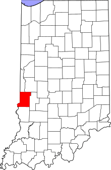 Vigo County's location in Indiana | |
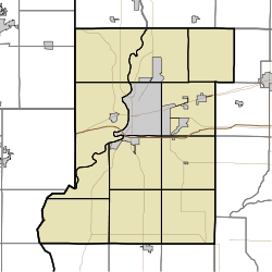 Atherton location in Vigo County, Indiana | |
| Coordinates: 39°36′29″N 87°21′43″W | |
| Country | United States |
| State | Indiana |
| County | Vigo County |
| Township | Otter Creek |
| Elevation | 528 ft (161 m) |
| Time zone | UTC-5 (Eastern (EST)) |
| • Summer (DST) | UTC-4 (EDT) |
| ZIP code | 47874 |
| Area code(s) | 765 |
| GNIS feature ID | 430321 |
History
Atherton was laid out and platted October 7, 1871. The original plat was signed by Newton Rogers, Sarah A. Denny and Mary J. Rogers. The line of the north part of the plat marked the dividing line between Vigo County and Parke County. The early town was laid out around Atherton's railroad station.[3]
A post office was established at Atherton in 1881, and remained in operation until it was discontinued in 1934.[4]
Geography
Atherton is located at 39°36′29″N 87°21′43″W at an elevation of 528 feet.
References
- "US Board on Geographic Names". United States Geological Survey. October 25, 2007. Retrieved 2016-07-13.
- "Atherton, Indiana". Geographic Names Information System. United States Geological Survey. Retrieved August 6, 2017.
- Bradsby, H.C. (1891). History of Vigo County, Indiana, with Biographical Selections. Chicago: S. B. Nelson & Co. pp. 475–476.
- "Vigo County". Jim Forte Postal History. Retrieved July 13, 2016.
Municipalities and communities of Vigo County, Indiana, United States | ||
|---|---|---|
| City | Map of Indiana highlighting Vigo County | |
| Towns | ||
| Townships | ||
| CDPs | ||
| Other unincorporated communities |
| |
| Footnotes | ‡This populated place also has portions in an adjacent county or counties | |
This article is issued from Wikipedia. The text is licensed under Creative Commons - Attribution - Sharealike. Additional terms may apply for the media files.