Libertyville, Indiana
Libertyville is an unincorporated community in Vermillion and Vigo counties, in the U.S. state of Indiana.[3]
Libertyville, Indiana | |
|---|---|
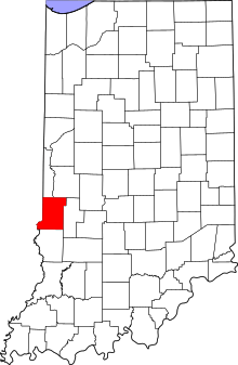 Vigo County's location in Indiana | |
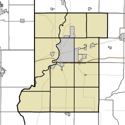 Libertyville Location in Vigo County, Indiana | |
| Coordinates: 39°36′10″N 87°31′07″W | |
| Country | United States |
| State | Indiana |
| County | Vigo |
| Township | Fayette |
| Elevation | 614 ft (187 m) |
| Time zone | UTC-5 (Eastern (EST)) |
| • Summer (DST) | UTC-4 (EDT) |
| ZIP code | 47885 |
| FIPS code | 18-43632[2] |
| GNIS feature ID | 437848 |
It is part of the Terre Haute Metropolitan Statistical Area.
History
A post office was established at Libertyville in 1871, and remained in operation until it was discontinued in 1904.[4]
Geography
Libertyville is located along U.S. Highway 150, at 39°36′10″N 87°31′07″W.
References
- "US Board on Geographic Names". United States Geological Survey. October 25, 2007. Retrieved 2016-07-14.
- "U.S. Census website". United States Census Bureau. Retrieved 2008-01-31.
- "Libertyville, Indiana". Geographic Names Information System. United States Geological Survey. Retrieved July 31, 2017.
- "Vigo County". Jim Forte Postal History. Retrieved July 14, 2016.
Municipalities and communities of Vermillion County, Indiana, United States | ||
|---|---|---|
| City | Map of Indiana highlighting Vermillion County | |
| Towns | ||
| Townships | ||
| CDPs | ||
| Other unincorporated communities | ||
| Ghost towns | ||
| Footnotes | ‡This populated place also has portions in an adjacent county or counties | |
Municipalities and communities of Vigo County, Indiana, United States | ||
|---|---|---|
| City | Map of Indiana highlighting Vigo County | |
| Towns | ||
| Townships | ||
| CDPs | ||
| Other unincorporated communities |
| |
| Footnotes | ‡This populated place also has portions in an adjacent county or counties | |
This article is issued from Wikipedia. The text is licensed under Creative Commons - Attribution - Sharealike. Additional terms may apply for the media files.