Seboomook Lake, Maine
Seboomook Lake is an unorganized territory in Somerset County, Maine, United States. The population was 45 at the 2000 census.
Geography
According to the United States Census Bureau, the unorganized territory has a total area of 3,715.8 km² (1,434.7 mi²). 3,628.4 km² (1,400.9 mi²) of it is land and 87.4 km² (33.8 mi²) of it (2.35%) is water.
Seboomook Lake
| Seboomook Lake | |
|---|---|
| Location | Somerset County, Maine |
| Coordinates | 45°56′N 69°52′W[1] |
| Primary outflows | West Branch Penobscot River |
| Basin countries | United States |
| Max. length | 13 mi (21 km)[2] |
| Max. width | 1 mi (1.6 km)[2] |
| Surface area | 6,880 acres (2,780 ha)[3] |
| Max. depth | 48 feet (15 m)[4] |
| Water volume | 102,195 acre⋅ft (126,056,000 m3)[3] |
| Surface elevation | 1,073 ft (327 m)[1] |
Seboomook Lake is a reservoir on the West Branch Penobscot River. The reservoir extends upstream from Seboomook Dam in Seboomook Township, through Plymouth Township, to the confluence of the North Branch and South Branch Penobscot River in Pittston Academy Grant.[2]
Townships
The territory consists of 40 townships[5] plus portions of three other townships (shared with Northeast Somerset).
- Tomhegan
- Brassua
- Thorndike
- Sandy Bay
- Bald Mountain (T4R3)
- Alder Brook
- Soldiertown
- West Middlesex Canal Grant
- Big W
- Little W
- Seboomook
- Plymouth
- Pittston Academy Grant
- Hammond
- Prentiss
- Blake Gore
- T4R5 NBKP
- Dole Brook
- Comstock
- T4R17 WELS
- Elm Stream
- Russell Pond
- T5R17 WELS
- T5R18 WELS
- T5R19 WELS
- T5R20 WELS
- Big Six
- T6R18 WELS
- T6R17 WELS
- Saint John
- T7R16 WELS
- T7R17 WELS
- T7R18 WELS
- T7R19 WELS
- T8R16 WELS
- T8R17 WELS
- T8R18 WELS
- T8R19 WELS
- T9R16 WELS
- T9R17 WELS
- T9R18 WELS
- Big Ten
- T10R16 WELS
Demographics
| Historical population | |||
|---|---|---|---|
| Census | Pop. | %± | |
| 1920 | 24 | — | |
| 1940 | 16 | — | |
| 1950 | 18 | 12.5% | |
| 1980 | 37 | — | |
| 1990 | 19 | −48.6% | |
| 2000 | 45 | 136.8% | |
| 2010 | 48 | 6.7% | |
| Est. 2014 | 47 | [6] | −2.1% |
| U.S. Decennial Census[7] | |||
At the 2000 census there were 45 people in 22 households, including 11 families, in the unorganized territory. The population density was 0.0/km² (0.0/mi²). There were 368 housing units at an average density of 0.1/km² (0.3/mi²). The racial makeup of the unorganized territory was 100.00% White.[8] Of the 22 households 18.2% had children under the age of 18 living with them, 50.0% were married couples living together, 4.5% had a female householder with no husband present, and 45.5% were non-families. 40.9% of households were one person and 4.5% were one person aged 65 or older. The average household size was 2.05 and the average family size was 2.75.
The age distribution was 15.6% under the age of 18, 2.2% from 18 to 24, 20.0% from 25 to 44, 57.8% from 45 to 64, and 4.4% 65 or older. The median age was 50 years. For every 100 females, there were 150.0 males. For every 100 females age 18 and over, there were 137.5 males.
The median household income was $49,167 and the median family income was $61,250. Males had a median income of $46,250 versus $0 for females. The per capita income for the unorganized territory was $32,578. There were no families and 11.1% of the population living below the poverty line, including no under eighteens and none of those over 64.
References
- U.S. Geological Survey Geographic Names Information System: Seboomook Lake
- The Maine Atlas and Gazetteer (Thirteenth ed.). Freeport, Maine: DeLorme Mapping Company. 1988. pp. 33, 42&43. ISBN 0-89933-035-5.
- Maine Depts. of Environmental Protection and Inland Fisheries & Wildlife (2005-08-04). "Maine Lakes: Morphometry and Geographic Information". Senator George J. Mitchell Center for Environmental and Watershed Research, The University of Maine. Archived from the original on 2006-09-03. Retrieved 2008-07-31.
- "Seboomook Lake" (PDF). Maine Department of Inland Fisheries and Game. State of Maine. Retrieved 3 May 2016.
- SOMERSET COUNTY COMMUNITY LISTING (106) And 2000 Census Population Figures of 50,888
- "Annual Estimates of the Resident Population for Incorporated Places: April 1, 2010 to July 1, 2014". Archived from the original on May 23, 2015. Retrieved June 4, 2015.
- "Census of Population and Housing". Census.gov. Retrieved June 4, 2015.
- "U.S. Census website". United States Census Bureau. Retrieved 2008-01-31.
Municipalities and communities of Somerset County, Maine, United States | ||
|---|---|---|
| Towns | 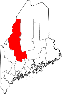 Somerset County map | |
| Plantations | ||
| Unorganized territories | ||
| CDPs | ||
| Other villages | ||