Sam Sung District
Sam Sung (Thai: ซำสูง, pronounced [sām sǔːŋ]) is a district (amphoe) of Khon Kaen Province, northeastern Thailand.
Sam Sung ซำสูง | |
|---|---|
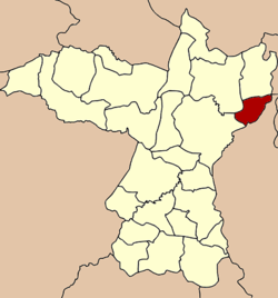 District location in Khon Kaen Province | |
| Coordinates: 16°32′35″N 103°4′47″E | |
| Country | Thailand |
| Province | Khon Kaen |
| Seat | Kranuan |
| Area | |
| • Total | 116.7 km2 (45.1 sq mi) |
| Population (2005) | |
| • Total | 23,672 |
| • Density | 202.8/km2 (525/sq mi) |
| Time zone | UTC+7 (ICT) |
| Postal code | 40170 |
| Geocode | 4021 |
History
The minor district (king amphoe) was established on 31 March 1994 by splitting five tambons from Kranuan District. The establishment of the new district became effective on 30 April.[1][2]
On 15 May 2007, all 81 minor districts were upgraded to full districts.[3] On 24 August the upgrade became official.[4]
Geography
Neighboring districts are (from the southwest clockwise): Mueang Khon Kaen, Nam Phong, and Kranuan of Khon Kaen Province; Chuen Chom and Chiang Yuen of Maha Sarakham Province.
Administration
The district is divided into five subdistricts (tambons), which are further subdivided into 34 villages (mubans). The township (thesaban tambon) Sam Sung (เทศบาลตำบลซำสูง) covers tambon Kranuan. There are a further four tambon administrative organizations (TAO).
| No. | Name | Thai name | Villages | Pop. | |
|---|---|---|---|---|---|
| 1. | Kranuan | กระนวน | 6 | 5,188 | |
| 2. | Kham Maet | คำแมด | 5 | 3,449 | |
| 3. | Ban Non | บ้านโนน | 9 | 5,877 | |
| 4. | Khu Kham | คูคำ | 7 | 4,624 | |
| 5. | Huai Toei | ห้วยเตย | 7 | 4,534 |
References
- khonkaen.doae.go.th Archived 2007-10-16 at the Wayback Machine
- ประกาศกระทรวงมหาดไทย เรื่อง แบ่งเขตท้องที่อำเภอกระนวน จังหวัดขอนแก่น ตั้งเป็นกิ่งอำเภอซำสูง (PDF). Royal Gazette (in Thai). 111 (42 ง): 13. May 26, 1994.
- แถลงผลการประชุม ครม. ประจำวันที่ 15 พ.ค. 2550 (in Thai). Manager Online.
- พระราชกฤษฎีกาตั้งอำเภอฆ้องชัย...และอำเภอเหล่าเสือโก้ก พ.ศ. ๒๕๕๐ (PDF). Royal Gazette (in Thai). 124 (46 ก): 14–21. August 24, 2007.