Sainte-Anne-de-Sorel
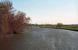
Sainte-Anne-de-Sorel is a municipality in the Pierre-De Saurel Regional County Municipality, in the Montérégie region of Quebec. The community consists of a mainland section along with several islands extending into Lac Saint-Pierre. The population as of the Canada 2011 Census was 2,742, which makes it the largest municipality and the second largest urban division of the RCM.
Sainte-Anne-de-Sorel | |
|---|---|
Municipality | |
 | |
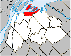 Location within Pierre-De Saurel RCM | |
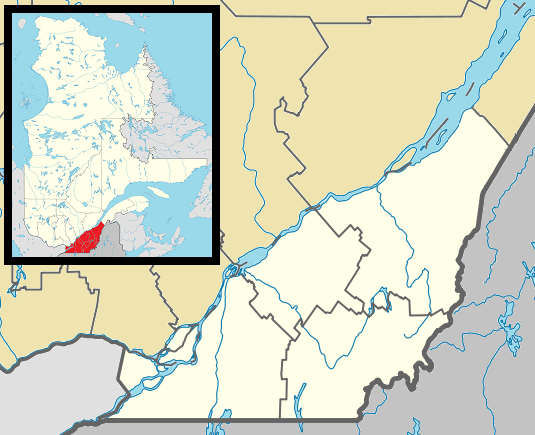 Sainte-Anne-de-Sorel Location in southern Quebec | |
| Coordinates: 46°03′N 73°04′W[1] | |
| Country | |
| Province | |
| Region | Montérégie |
| RCM | Pierre-De Saurel |
| Constituted | May 14, 1877 |
| Government | |
| • Mayor | Michel Péloquin |
| • Federal riding | Bécancour—Nicolet—Saurel |
| • Prov. riding | Richelieu |
| Area | |
| • Total | 59.10 km2 (22.82 sq mi) |
| • Land | 38.39 km2 (14.82 sq mi) |
| Population (2011)[4] | |
| • Total | 2,742 |
| • Density | 71.4/km2 (185/sq mi) |
| • Pop 2006-2011 | |
| • Dwellings | 1,412 |
| Time zone | UTC−5 (EST) |
| • Summer (DST) | UTC−4 (EDT) |
| Postal code(s) | J3P 5N3 |
| Area code(s) | 450 and 579 |
| Highways | No major routes |
| Website | www |
From 2006 throughout 2010 there has been much speculation about Sainte-Anne willing to merge into Sorel-Tracy to become a district (much like the former Saint-Pierre-de-Sorel and Tracy municipalities), however at the present time there has been no future talk about it at both city halls. The RCM planning administration is against the merger though, as it would compromise development potential in Sainte-Anne in favor of Sorel, since property evaluation services would be unified.
Demographics
PopulationPopulation trend:[5]
|
LanguageMother tongue language (2006)[6]
|
See also
References
- Reference number 402571 of the Commission de toponymie du Québec (in French)
- Ministère des Affaires municipales, des Régions et de l'Occupation du territoire: Sainte-Anne-de-Sorel
- Parliament of Canada Federal Riding History: BAS-RICHELIEU--NICOLET--BÉCANCOUR (Quebec)
- 2011 Statistics Canada Census Profile: Sainte-Anne-de-Sorel, Quebec
- Statistics Canada: 1996, 2001, 2006, 2011 census
- 2006 Statistics Canada Community Profile: Sainte-Anne-de-Sorel, Quebec
| Wikimedia Commons has media related to Sainte-Anne-de-Sorel. |
Adjacent Municipal Subdivisions | ||||||||||
|---|---|---|---|---|---|---|---|---|---|---|
| ||||||||||
| Cities |
|
|---|---|
| Municipalities |
|
| Parishes | |
| Villages | |
| |